Maps of Thornwood
9 Atlas rural country district north of New York City.
1 : 18000 Hyde, E. Belcher
6 Ossining, Mt. Pleasant.
1 : 18000 Hyde & Company
Ossining, Sparta.
1 : 25344 Beers, F. W. (Frederick W.)
Plan of Sing Sing and part of Town of Ossining.
from Atlas of the Hudson River Valley from New York city to Troy, including a section of about 8 miles in width. Published by Watson & co. Compiled from official records and careful surveys, under the supervision of F. W. Beers.
188-189 Ossining, Briar Cliff Manor.
1 : 18000 G.W. Bromley & Co.
Plate 52: Sinsing, Town of Ossining, Westchester Co.N.Y.
from Atlas of New York and vicinity : from actual surveys / by and under the direction of F. W. Beers, assisted by A. B. Prindle & others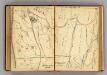
156-157 Mt. Pleasant.
1 : 9600 G.W. Bromley & Co.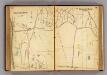
154-155 Briarcliff Manor.
1 : 9600 G.W. Bromley & Co.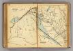
186-187 Ossining.
1 : 5400 G.W. Bromley & Co.
Plates 45 & 46: Singsing, Town of Ossining, Westchester Co. N.Y.
from County atlas of Westchester, New York. Published by J.B. Beers & Co., assisted by S.W. Wilson and others.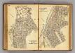
166-167 Sherman Park.
1 : 7200 G.W. Bromley & Co.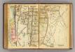
176-177 Ossining.
1 : 5400 G.W. Bromley & Co.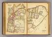
184-185 Ossining.
1 : 5400 G.W. Bromley & Co.
Plates 45 & 46: Singsing, Town of Ossining, Westchester Co. N.Y.
from County atlas of Westchester, New York. Published by J.B. Beers & Co., assisted by S.W. Wilson and others.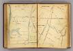
146-147 N. Tarrytown, Mt. Pleasant.
1 : 7200 G.W. Bromley & Co.
148-149 Mt. Pleasant.
1 : 7200 G.W. Bromley & Co.
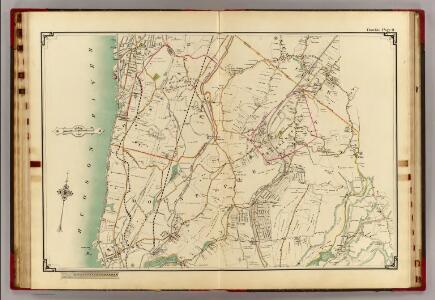
Mt. Pleasant, Town.
1 : 38016 Beers, F. W. (Frederick W.)
Mt. Pleasant, Ossining towns.
1 : 25700 Bien, Joseph Rudolf
North part of Town of Mount Pleasant - Pleasantville.
from County atlas of Westchester, New York. Published by J.B. Beers & Co., assisted by S.W. Wilson and others.
Croton Landing - Sparta.
from County atlas of Westchester, New York. Published by J.B. Beers & Co., assisted by S.W. Wilson and others.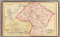
Mt. Pleasant, Ossining.
1 : 24000 Bromley, George Washington; Bromley, Walter Scott; G.W. Bromley & Co.
North part of Town of Mount Pleasant - Pleasantville.
from County atlas of Westchester, New York. Published by J.B. Beers & Co., assisted by S.W. Wilson and others.
Town of Newcastle, Westchester County, New York. (insets) Newcastle. Chappaqua.
1 : 39680 Beers, Frederick W.
Ossining
1 : 24000
Ossining
1 : 24000
Ossining
1 : 24000
Ossining
1 : 24000
Ossining
1 : 24000
Ossining
1 : 24000
Ossining
1 : 31680
Ossining
1 : 25000
Ossining
1 : 31680
Ossining
1 : 31680