Maps of Iran

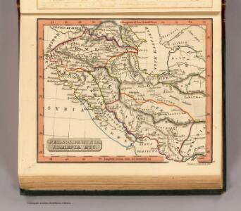
Persis, Parthia, Armenia, etc.
1 : 14700000 Fenner, Rest.
Persis, Parthia, Armenia.
1 : 14600000 Fenner, Rest.
Indoscythicum atque Parthicum Regna.
1 : 10020000 Menke, Th.
Assyrie, Babylonie a Persie

Afbeeldinge der Oostersche landen waar in, zoo de X stammen Israëls, als de II overige van Juda; gedurende den tyd hunner ballingschap verkeert hebben : tot opheldering van dit gedeelte der gewyde geschiedenis
1 : 6000000 ontworpen door W.A. Bachiene J. van Jagen mapp. sculpsit, et figur. apposit. sculpturam curavit ; S. Fokke fec. Uitgegeven te Gorinchem : by Nicolaas Goetzee
Kaerte van de waerschijnlijkste plaets van den Hof van Eden, de vlakte van Sinear, en den berg, waer op d'Ark gerust heeft, volgens deeze histori
Annotatie: Afkomstig uit dl. I van: Algemeene histori van het begin der wereld af tot den tegenwoordigen tijd toe / ... door Kornelis Westerbaen Wz. - Utrecht : Hermanus Besseling, 1735-1755; Rechtsboven: I Deel tusschen bl. 460 en 461 [Utrecht : H. Besseling excudit]
Countries Situated between Shiraz and Constantinople.
1 : 6000000 Melish, John
Regna Lydium, Medicum, Babylonium etc.
Mesopotamien Antike
Paradis Terestre.
1 : 8500000 Houze, Antoine Philippe
Persian Empire, eastern.
1 : 5900000 Society for the Diffusion of Useful Knowledge (Great Britain)
Persia, Ottoman Empire.
1 : 5900000 Society for the Diffusion of Useful Knowledge (Great Britain)
Tercia Asiae Tabula [Karte], in: Claudii Ptolemei viri Alexandrini mathematice discipline philosophi doctissimi geographie opus [...], S. 199.
1 Karte aus Atlas Waldseemüller, Martin [und Ptolemaeus, Claudius] Übelin, Georg
Carte de l'Asie Mineure, de l'Armenie et du Kourdistan
1 : 4000000 Arménie Kinneir, John Makdonald Aubert
[Quinta Asie tabula] [Karte], in: Clavdii Ptholomei Viri Alexandrini Cosmographie, S. 173.
1 Karte aus Atlas Nicolaus Germanus [und Ptolemaeus, Claudius]
Asie Anterieure.
1 : 5000000 Vivien St Martin, L.
Tabula Asiae IIII. [Karte], in: Geographia universalis vetus et nova complectens Claudii Ptolemaei Alexandrini enarrationis libros VIII, S. 275.
1 Karte aus Atlas Münster, Sebastian [und Ptolemaeus, Claudius]
The eastern part of the ancient Persian empire
1 : 5800000 perská říše Long, G. Walker, C. Baldwin & Gradock
Tabula Asiae III. [Karte], in: Geographia universalis vetus et nova complectens Claudii Ptolemaei Alexandrini enarrationis libros VIII, S. 272.
1 Karte aus Atlas Münster, Sebastian [und Ptolemaeus, Claudius]
Charte des Osmanischen Reichs in Asien / nach den neuesten astronomischen Ortsbestim[m]ungen und bes
1 : 3700000 1 Karte : Kupferdruck ; 46 x 61 cm Reichard, Christian Gottlieb Theophil im Verlage des geograph. Instituts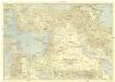
Bible Lands and the cradle of western civilization
1 : 3000000 Jeruzalém National Geographic Society
Persien.
1 : 4430000 Grassl, J. (Joseph)
Neueste Specialkarte von Persien
Grosser Hand-Atlas über alle Theile der Erde in 170 Karten Meyer, J. Verlag des Bibliographischen Instituts
L'Euphrate et le Tigre
1 : 2400000 Anville, Jean Baptiste Bourguignon d', 1697-1782 [s.n.]
Iran.
1 : 5000000 Vivien St Martin, L.
Schul-Atlas für die alte Erdbeschreibung : zur allgemeinen Schul-encyclopädie gehörig
J. H. Campe Zusammensetzung und Zeichnung von [...] Dufour, unter Leitung von Heusinger ; gestochen von Frentzel. Braunschweig : Schulbuchhandlung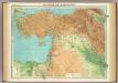
Asia Minor, Syria & Mesopotamia.
1 : 4000000 John Bartholomew and Son
Klein Asien.
1 : 5670000 Radefeld, Carl Christian Franz, 1788-1874
Verkehrsstraßen in Persien
1 : 10000000 Turkmenistán
Composite: Carte General de la Turquie d'Asie.
1 : 4200000 Vivien de St Martin, L.