Maps of Balkan Pen.
Turquie Europeenne.
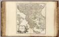
1 : 2800000 Robert de Vaugondy, Gilles, 1688-1766
Der europäische Theil des Türkischen Reichs
1 : 1680000 Evropa jihovýchodní Reichard, C. G. Campe, Friedrich Friedrich Campe
Země jihoslovanské
balkánské země Fáborský, Jan B. Nipočić, Vasilij
Das osmanische Europa oder die europaeische Türkey
1 : 3000000 Evropa jihovýchodní Weiland, Karl Ferdinand Jungmann, Carl Geograph. Institut
Carte de la Péninsule des Balkans
1 : 3000000 Balkanhalbinsel Südosteuropa L. Wuhrer Lith.
Types et variétés psychiques des Yougoslaves
1 : 3000000 Balkanhalbinsel Südosteuropa Ethnische Gruppe L. Wuhrer Lith.
Carte ethnographique de la péninsule des Balkans
1 : 3000000 Balkanhalbinsel Südosteuropa Ethnische Gruppe L. Wuhrer Lith.
Courants métanastasiques dans le peuplement des pays Serbes du XVe siècle à nos jours
1 : 3000000 Balkanhalbinsel Südosteuropa Migration L. Wuhrer Lith.
Das osmanische Europa oder die europaeische Türkey
1 : 3000000 Balkánský poloostrov Weiland, Karl Ferdinand Boué Geographisches Institut
Das osmanische Europa oder die europaeische Türkey
1 : 3000000 Bospor (Turecko : průliv) Weiland, Karl Ferdinand Boué Geographisches Institut
Das osmanische Europa oder die europaeische Türkey
1 : 3000000 Bospor (Turecko : průliv) Weiland, Karl Ferdinand im Verlage des Geograph. Instituts
Das osmanische Europa oder die europaeische Türkey
1 : 3000000 Dardanely (Turecko : průliv) Weiland, Karl Ferdinand im Verlage des Geograph. Instituts
Das osmanische Europa oder die europaeische Türkey
1 : 3000000 Dardanely (Turecko : průliv) Weiland, Karl Ferdinand Geograph. Institut
Das osmanische Europa oder die europaeische Türkey
1 : 3000000 Dardanely (Turecko : průliv) Weiland, Karl Ferdinand Ciliax, L. Geograph. Institut
Türkei und Griechenland
1 : 5400000 Osmanisches Reich, Griechenland
Balkan-Halbinsel
1 : 12000000 Balkanhalbinsel
Siebenbürgen die Türkey und Griechenland
1 : 4930000 Sedmihradsko (Rumunsko) Grimm, I. L. Siebert, Selmar Simon Schropp
Siebenbürgen die Türkey und Griechenland
Sedmihradsko (Rumunsko) Grimm, I. L. Siebert, Selmar Simon Schropp
Ethnographische Übersicht des europäischen Orients
Bospor (Turecko : průliv) Kiepert, Heinrich D. Reimer
[Karte der Balkan-Halbinsel]
Balkánský poloostrov
Charte von der europaeischen Tuerkey von Griechenland und den Ionischen Inseln
Balkanhalbinsel, Osmanisches Reich
Die Europaeische Türkei, Griechenland und die Ionischen Inseln
1 : 6000000 Balkanhalbinsel
La Turquie d'Europe, La Hongrie, La Transilvanie, La Croatie, La Morlaquie, La Sclavonie et La Dalmatie avec La Rép.que des Sept Iles
1 : 3700000 par J. B. Poirson gravé par Tardieu l'ainé [Paris] : [Mentelle etc.]
[Neuer Atlas der ganzen Erde nach den neuesten Bestimmungen ... : XXIII.] Griechenland, die Jonischen Inseln und das Osmanische Reich in Europa
Entworfen und gezeichnet von Dr. F.W. Streit H. Leutemann sc. Leipzig : J.C. Hinrichs'sche Buchhandlung
Verkehrspolitische Karte der Balkanstaaten
1 : 2500000 balkánské země
Balkanländer von 1878-1915
1 : 15000000 Balkanhalbinsel
Die Europaeische Türkey und das Königreich Griechenland
Osmanisches Reich / Europäischer Teil, Griechenland
Karte der Balkan Halbinsel
1 : 3000000 Balkánský poloostrov Schlachter, J. J. Schlachter
H. Kiepert's Generalkarte der südost-europäischen Halbinsel
1 : 1500000 Balkánský poloostrov Bischoff, C. Kiepert, Heinrich Dietrich Reimer


