Maps of Alagoas

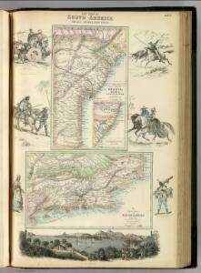
East Coast of South America. Brazil, Middle Provinces.
Fullarton, A. & Co.
Partie du Bresil. Amer. Merid. 19.
1 : 1641836 Vandermaelen, Philippe, 1795-1869
Capitaniae De Cirii et Parnambuco. [Karte], in: Novus atlas absolutissimus, Bd. 9, S. 85.
1 Karte aus Atlas Janssonius Offizin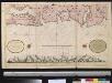
Een gedeelte van de kust van Brazilia tussen Rio Coroipo en Rio Ponica
Brazil Gerard van Keulen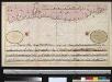
Een gedeelte van den kust van Brazilia tussen Cabo St. Augostino en Rio Coroipo int groodt
Brazil Gerard van Keulen
PRÆFECTURA | DE CIRÎIÎ, | vel SEREGIPPE DEL REY cum | Itàpuáma.
[Amsterdam : Joan Blaeu]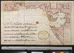
Een gedeelte van de kust van Brazilia tussen Rio Ponica en Rio das Contas
Brazil Gerard van Keulen
PRÆFECTURÆ | PARANAMBUCÆ | PARS | MERIDIONALIS
[Amsterdam : Joan Blaeu]
[Map of the All Saints' Bay, in the map:] BAHIA DE | TODOS OS SANC- | TOS
[Amsterdam : Joan Blaeu]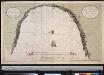
Afteekening van de Baij de Todelos Sanctos geleegen aen de cust van Brazilia met alle desselfs geleegentheden int groodt
Brazil Gerard van Keulen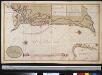
De Bahia de Todos los Santos met de stad St. Salvador in Brazilia neffens alle geleegentheeden van belegering der selver gedaan door sijn Ex.ti Johan Mourits van Nassau den 16 April 1639
Brazil Gerard van Keulen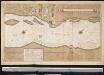
Rio St. Francisco in Brazilia tusse 10 en 11 gr. Z. br.
Brazil Gerard van Keulen
Afteeckeninge vande Cap S. Augustyn
1 : 3500 Annotatie: Facs. van de uitg: Amsterdam : Iacob Kyns, [ca. 1635]. - Naar origineel Kaartenverzameling UBVU; Annotatie geografische gegevens: Legenda: Verclaringe der cyfer getallen, A-K, 1-6 [S.l. : s.n.]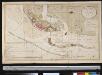
Caerte van de haven van Pharnambocque met de stad Mauritia geleegen aen de kust van Brazilia op 8 graaden 8 min. Zuijder Breeten
Brazil Gerard van Keulen
Afteeckeninge vande Cap S. Augustyn
1 : 3500 Annotatie geografische gegevens: Legenda: Verclaringe der cyfer getallen, A-K, 1-6 Amsterdam : Jacob Kyns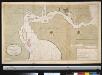
Ilho de Antonij Vaaz geleegen in Brazilia op 8 graden 8 min. Zuijder Breeten
Brazil Gerard van Keulen
PRÆFECTURÆ | PARANAMBUCÆ | PARS | BOREALIS, | una cum | PRÆFECTURA | de | ITÂMARACÂ.
[Amsterdam : Joan Blaeu]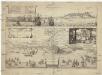
Olinda de Phernambuco
Olinda (Brazílie) Hollar, Václav
Partie du Bresil. Amer. Merid. 24.
1 : 1641836 Vandermaelen, Philippe, 1795-1869
Eygentlicher abris und gelegenheit der vornemen hauptstadt des Königreichs Brasilien Phernambuco auch Olinda genandt inn America gelegen ...
1 : 1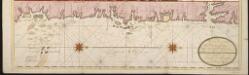
Een gedeelte van de kust van Brazilia tussen Rio das Contas en Cabo St. Thome [north part]
Brazil Gerard van Keulen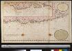
Een gedeelte van de cust van Brazilia tussen Punto de Lucena en Cabo St. Augustino int groot
Brazil Gerard van Keulen
Maritima Brasiliae Universae
Blaeu, Joan [Blaeu]
Roteiro em Brazil no 1817-1821 do Dr. Pohl
1 : 16480000 Brazílie
South America 4.
1 : 2800000 Arrowsmith, Aaron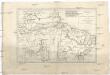
Brésil et pays des Amazones
1 : 10700000 Amazonka-oblast Bonne, Rigobert André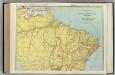
Brazil, Paraguay, and Uruguay (northern half).
1 : 5020000 Rand McNally and Company
Accuratissima Brasiliae tabula
1 : 4000000 Henricus Hondius excudit Amstelodami : Henricus Hondius
Nova et accurata Brasiliae totius tabula
1 : 6000000 Blaeu, Joan, 1596-1673 Nunc apud Petrum Schenk Junior