Maps of Dawson County

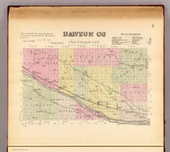
Dawson Co.
1 : 190080 Everts & Kirk
Lexington
1 : 125000
Lexington
1 : 125000
Lexington
1 : 125000
Lexington
1 : 125000
Lexington
1 : 125000
Lexington
1 : 125000
Lexington
1 : 125000
Lexington
1 : 125000
Lexington West
1 : 24000
Cozad
1 : 24000
Gothenburg SE
1 : 24000
Lexington SE
1 : 24000
Lexington East
1 : 24000
Lexington East
1 : 24000
Cozad NW
1 : 24000
Willow Island
1 : 24000
Buffalo
1 : 24000
Lexington NW
1 : 24000
Sumner
1 : 24000
Miller SW
1 : 24000
Miller SW
1 : 24000
Miller
1 : 24000
Gothenburg SW
1 : 24000
Gothenburg
1 : 24000
Gothenburg
1 : 24000
Johnson Lake
1 : 24000
Elwood NW
1 : 24000
Elwood NW
1 : 24000
Eustis
1 : 24000
Bertrand NW
1 : 24000
Overton
1 : 24000
Overton
1 : 24000