Maps of Europe
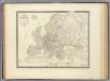
L'Europe.
1 : 12800000 Andriveau-Goujon, J.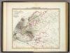
Karte von Europa.
1 : 13500000 Berghaus, Heinrich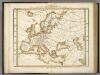
Karte Von Europa.
1 : 14500000 Berghaus, Heinrich
Charte von Europa
1 Karte : Kupferdruck ; 46 x 56 cm im Verlage des Industrie-Comptoirs
General Karte von Europa
1 Karte : Kupferdruck ; 50 x 58 cm von der K. K. privileg: Schneider und Weigelschen Kunst= und Buchhandlung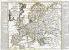
L'Europe
1 Karte : Kupferdruck ; 46 x 51 cm Nolin; Longchamps; Basset; Basset chez Basset rue Jacques au coin de celle des Mathurins
Charte von Europa
1 Karte : Kupferdruck ; 38 x 47 cm Güssefeld zu finden bey C. Weigel u. Schneider
Charte von Europa
1 Karte : Kupferdruck ; 38 x 48 cm Güssefeld zu finden bey C. Weigel u. Schneider
Charte von Europa
1 Karte : Kupferdruck ; 38 x 47 cm Güssefeld zu finden bey C. Weigel u. Schneider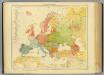
15-16. Europa etnografica.
1 : 12000000 Touring club italiano
Charte von Europa
1 Karte : Kupferdruck ; 38 x 47 cm Güssefeld zu finden bey C. Weigel u. Schneider
Europe Antiqua.
1 : 47000000 Fenner, Rest.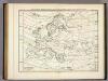
Verbreitung Der Wichtigsten Kultur, - Baum - Und Strauchgewachse In Europa.
1 : 15000000 Berghaus, Heinrich
L'Europe 800, 1500.
1 : 16500000 Lapie, M. (Pierre), 1779-1850
L'Europe avant l'invasion des Barbares.
1 : 17000000 Lapie, M. (Pierre), 1779-1850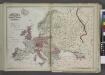
Europe
from New topographical atlas and gazetteer of New York, comprising a topographical view of the several counties of the state, ... including ... map of the United States and territories ... Compiled from the latest astronomical observations, official surveys and records of the United States and territories ...
L'Asie 1.
1 : 9500000 Brue, Adrien Hubert, 1786-1832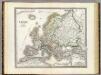
Europa.
1 : 10000000 Weiland, C. F. (Carl Ferdinand), d. 1847
Europa mit politischer Begränzung der einzelnen Staaten
Hand-Atlas über alle Theile der Erde nach dem neuesten Zustande und über das Weltgebäude Stieler, Adolf bei Justus Perthes
Europa
1 Karte : Kupferdruck ; 47 x 55 cm Walch Johann Walch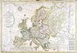
Carte générale de l'Europe
1 Karte : Kupferdruck ; 52 x 75 cm Hérisson; Basset; Basset chez Basset rue Jacques au coin de celle des Mathurins no. 670
Karte von Europa
1 Karte : Kupferdruck ; 25 x 29 cm Sotzmann; Schmidt s.n.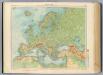
11-12. Europa fisica.
1 : 12000000 Touring club italiano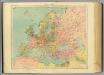
13-14. Europa politica.
1 : 12000000 Touring club italiano
Elementary Map.
1 : 26611200 Melish, John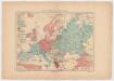
Carta etnográfica dell' Europa / dir. G.Marinelli ; Francesco Vallardi
1 : 20000000 G. Marinelli Francesco Vallardi
Europa zur Uebersicht der Flussgebiete und Höhenzüge
Stieler's Hand-Atlas Stieler, Adolf bei Justus Perthes
Europe.
1 : 24000000 Darton, William
[Verbreitung der Mammalia oder Säugethiere in Europa]
Zweiter Band, enthaltend in vier Abtheilungen die Vertheilung der Organismen: 5. Pflanzen-Geographie, 6. Thier-Geographie, 7. Anthropographie, 8. Ethnographie Humboldt, Alexander von Verlag von Justus Perthes


