Maps of Malay Archipelago
East India Islands.
1 : 12773000 Hammond, C.S.
Atlas für Handel und Industrie: Für Kaufleute, Fabrikante u. Gewerbetreibende, Handlungs- u. Gewerbe-Schulen
Grand Archipel d'Asie.
1 : 10200000 Picquet, C.
Malaisie.
1 : 1200000 Levasseur, E.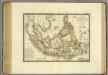
Grand Archipel d'Asie.
1 : 10200000 Brue, Adrien Hubert, 1786-1832
Iles de la Sonde, Philippines.
1 : 11700000 Garnier, F. A., 1803-1863
Kaert van de Molocques : zeer correckt afgheteyckent met allen zijn eylanden ende sterckten, met een afbeeldinghe van de Straat van Botton / [Jan Cornelisz. Moy?]
[S.l. : s.n.]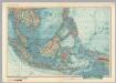
South-East Asia. Pergamon World Atlas.
1 : 10000000 Polish Army Topography Service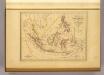
Malaisie.
1 : 18500000 Malte-Brun, Conrad, 1775-1826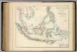
Indian Archipelago.
1 : 9187200 Fullarton, A. & Co.
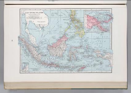
East India Islands.
1 : 16500000 Darton, William
Die Ostindischen Inseln
Stieler's Hand-Atlas Stieler, Adolf bei Justus Perthes
East India Islands.
1 : 10000000 Hall, S. (Sidney)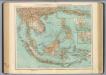
95-96. Indocina, Siam, Arcipelago Malese.
1 : 10000000 Touring club italiano
Die Ostindischen Inseln
Hand-Atlas über alle Theile der Erde nach dem neuesten Zustande und über das Weltgebäude Stieler, Adolf bei Justus Perthes
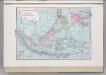
East Indies.
1 : 12672000 Colton, G.W.

East India Islands.
1 : 21500000 Arrowsmith, Aaron
East India Islands.
1 : 21500000 Arrowsmith, Aaron
Neueste Karte der Ostindischen Inseln
Grosser Hand-Atlas über alle Theile der Erde in 170 Karten Meyer, J. Verlag des Bibliographischen Instituts
Ostindische Inseln
1 : 12500000 Filipíny Berghaus, Herm. Eberhardt, H. Justus Perthes
East Indies.
1 : 12000000 Colton, G.W.
East Indies.
1 : 11000000 Colton, G.W.
East India Isles.
1 : 11404800 Burr, David H., 1803-1875
East Indies.
1 : 11000000 Colton, G.W.
Die Ostindischen Inseln
Hand-Atlas über alle Theile der Erde nach dem neuesten Zustande und über das Weltgebäude Stieler, Adolf bei Justus Perthes
Insulae Indiae Orientalis Praecipuae, In quibus Moluccae celeberrimae sunt. [Karte], in: Gerardi Mercatoris Atlas, sive, Cosmographicae meditationes de fabrica mundi et fabricati figura, S. 538.
1 Karte aus Atlas Mercator, Gerhard Montanus, Petrus
Die Ostindischen Inseln
Handatlas über alle Theile der Erde und über das Weltgebäude Stieler, Adolf Justus Perthes
East India Isles.
1 : 15200000 Greenleaf, Jeremiah