Maps of Farmington

Monterey, Tenn.-Corinth, Miss.
United States. War Department
Map of the country between Monterey, Tenn. & Corinth, Miss. : showing the lines of entrenchments made & the routes followed by the U.S. forces under the command of Maj. Genl. Halleck, U.S. Army, in their advance upon Corinth in May 1862
1 : 31680 Matz, Otto H., 1830-1919 Geo. H. Walker, lith.
Corinth
1 : 24000
Corinth
1 : 24000
Kendrick
1 : 24000
Kendrick
1 : 24000
Corinth
1 : 62500
Corinth
1 : 62500
Corinth
1 : 62500
Rienzi
1 : 24000
Glens
1 : 24000
Glens
1 : 24000
Glens
1 : 24000
Michie
1 : 24000
Guys
1 : 24000
Guys
1 : 24000
Guys
1 : 24000
Michie
1 : 24000
Michie
1 : 24000
Michie
1 : 24000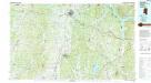
Corinth
1 : 100000
Corinth
1 : 100000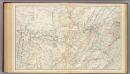
Gen. map XIV.
1 : 633600 United States. War Department
Lloyd's Military Campaign Charts: Map of Mississippi River
Lloyd's Military Campaign Charts, showing the principal places of interest, compiled from official data by Gen. E.L. Viele and C. Haskins. Published under the auspices of the American Geographical and Statistical Society. Mississippi River.
Western Battle-Ground. Western Naval Expedition Map
Western Battle-Ground. Western Naval Expedition Map. Published by Prang, Western Naval Expansion Map, Showing Tennessee & Mississippi Rivers details the middle states of the Confederacy and the Border State of Kentucky and highlights forts, railroads and cities in the region. The portrait at the corner of the map is Commander Andrew Hull Foot who commanded navy gunboats in the region and aided General Ulysses S. Grant in Union victory at For Henry in February 1862. The fort is labelled on the top right of the map. L. Prang & Co.
Map of the Seat of War among the Creek Indians.
1 : 1013760 Melish, John
(Mississippi, Louisiana, Arkansas)
1 : 4400000 Moore, M. B. (Marinda Branson), 1829-1864
Mississippi.
Rand McNally and Company
Tennessee.
1 : 2500000 Tanner, Henry S.


