Maps of Germany
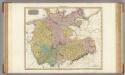
Germany N. of Mayne.
1 : 1200000 Thomson, John
Allemagne du N.O.
1 : 1500000 Vivien St Martin, L.
Germany. Deutschland I.
1 : 1760000 Society for the Diffusion of Useful Knowledge (Great Britain)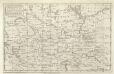
A Map of the Seat of War in Germany &c.
Mollova mapová sbírka Bennett Dilly, Charles
Northern and Central Germany.
1 : 2154240 Fullarton, A. & Co.
Germany north.
1 : 2800000 Arrowsmith, Aaron; Lewis, Samuel
Germany north.
1 : 2800000 Arrowsmith, Aaron; Lewis, Samuel
Sewerní Německo
1 : 3600000 Německo severní Merklas, Václav
Germany (Deutschland)
1 : 1776000 Hannover (Německo) Walker, C. Baldwin & Cradock
German Empire 1.
1 : 1774080 Letts, Son & Co.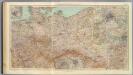
53-55. Germania nord.
1 : 1500000 Touring club italiano
Germany.
1 : 3300000 Tanner, Henry S.
Germany.
1 : 3294720 Tanner, Henry S.
Nord-Deutschland
E. von Sydow's Schul-Atlas in sechs und dreissig Karten Sydow, Emil von bei Justus Perthes
Germany.
1 : 3250000 Mitchell, Samuel Augustus
Reisekarte von Nord - Deutschland
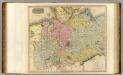
Germany north of the Mayn.
1 : 1180000 Pinkerton, John, 1758-1826
Etats Secondaires de L'Allemagne.
Andriveau-Goujon, J.
Germany.
1 : 1788000 Hammond, C.S.
Post-Reise-Karte von Deutschland mit spezieller Angabe der Eisenbahn- und Dampschiffahrt- Verbindungen
1 : 1820000 Německo Hagendorn, von Piloty & Loehle
Post-Reise-Karte von Deutschland mit spezielle Angabe der Eisenbahn- und Dampschiffahrt- Verbindungen
Německo Hagedorn, von Fhr. von Hagedorn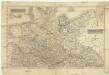
Nordwestliche deutsche Bundesstaaten, Nordoestliche deutsche Bundesstaaten
Německo severní
Die Beiden Deutschen Staaten

Germany.
1 : 3168000 Tallis, J. & F.
Länder 1947
Deutschland Kunz, Andreas ; Moeschl, Joachim Robert
Länder der Bundesrepublik 1957
Deutschland, Bundesrepublik Kunz, Andreas ; Moeschl, Joachim Robert
Germany.
1 : 1870000 Hughes, William
Schiffahrtsstraßen in Deutschland Stand 1989
Deutschland Wasserstraße, Binnenschifffahrt Kunz, Andreas ; Moeschl, Joachim Robert
Besatzungszonen und Länder 1947
Deutschland Besatzungszone Kunz, Andreas ; Moeschl, Joachim Robert


