Maps of Northwest

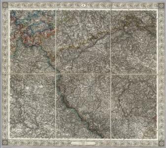
Sheet II: Karte Des Oesterreichischen Kaiserstaates.
1 : 576000 Scheda, Josef
II, uit: General-Karte des oesterreichischen Kaiserstaates mit einem grossen Theile der angrenzenden Länder / durch Josef Scheda ... bearb. und hrsg
1 : 576000 Annotatie geografische gegevens: Maatstokken: oesterreichische Meilen, geografische oder deutsche Meilen, preussische Meilen, türkische Berri, französische Lieues, russische Werste; Maatstok per blad: wiener Klafter, öster. Meilen; Blad XIX: statistische en taalkundige informatie; Blad XIX: legenda [Wien : K.K. Militärisch-Geografisches Institut]
Bohemia

Mittelbach ́s Neueste Specialkarte von Böhmen

Bohemia

Bohemia

Grossdeutsches Reich Sudetenländer

Die Fahrposten in Prag
Praha (Česko)
Hydrologická mapa země České pro vodní knihy

Das Königreich Böhmen
1 : 700000 Karlovy Vary-oblast (Česko) Weiland, Karl Ferdinand Verlag des Geograph. Instituts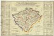
Orientirungs- Karte in der neuen gerichtlichen und politischen Eintheilung des Königreichs Böhmen
1 : 1500000 Čechy (Česko) Schmidt, Eduard Hennig, C. J. G. Calve
Karte des Koenigreichs Boehmen
1 : 440000 Praha (Česko) Loth, Johann Anděl, Bedřich Friedrich Kretzschmar
Das Königreich Boehmen
1 : 1000000 Česko Weiland, Karl Ferdinand im Verlage des Geograph. Instituts
Das Königreich Boehmen
1 : 1000000 Čechy (Česko) Weiland, Karl Ferdinand Verlag des Geograph. Instituts
Historisch-geographisch-statistisch-gefaellsaemtliche Karte von Königreiche Böhmen
1 : 1500000 Čechy (Česko) Bastien, Joseph Cajetan von Mayregg.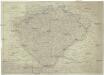
Koenigreich Böhmen nach Müller und den neuesten Beobachtungen verfasst
1 : 1000000 Čechy (Česko) bey Tranquillo Mollo
Special-Karte des Königreiches Boehmen
1 : 888000 Česko Medau, Karel Vilém C.W. Medau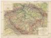
Karte des Königreiches Böhmen
1 : 1000000 Česko Rothaug, Johann Georg Freytag & Berndt
Neüeste Post Charte von Königreich Böhmen
Česko Balzer, Jan Jiří zu finden in Johann Balzerischen Kupferstich verlag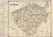
Charte des Königreiches Böhmen
Česko Berra, Marco Marco Berra
Strassen-Karte des Koenigreiches Boehmen
1 : 430000 Česko
Strassen-Karte des Koenigreiches Boehmen
1 : 430000 Česko

Nejstarší hroby v Čechách
Čechy (Česko)
Bouřkové stanice v Čechách v Čechách 1905-1915
1 : 750000 Česko
Strassenkarte des Koenigreiches Boehmen

Železniční mapa Čech
1 : 1600000 Čechy (Česko) Zdeněk, Jaroslav nákladem Františka Řivnáče
Evanjelická cirkev [sic] česká
Čechy (Česko) Gräf, K. Müller, A.
Böhmen
1 : 930000 Čechy (Česko) v. C. Flemming