Maps of Kinshasa

Africa - South. Pergamon World Atlas.
1 : 10000000 Polish Army Topography Service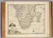
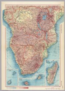
Southern Africa.
1 : 13600000 Bowen, Emanuel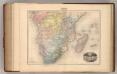
Afrique (Partie Sud).
1 : 14400000 Migeon, J.
Afrique Meridionale.
1 : 15000000 Garnier, F. A., 1803-1863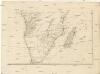
[Karte von Africa]
Afrika Robert de Vaugondy, Didier Alberti, Ignaz F.A. Schraembl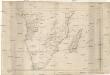
[Karte von Africa]
Afrika Robert de Vaugondy, Didier Benedicti, Hieronymus F.A. Schraembl
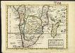
Africa meridional y Madagascar
1 mapa. Datat al s. XIX. Gras y compañia, editores. Madrid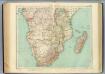
118-19. Africa sud.
1 : 10000000 Touring club italiano
Afrique méridionale
1 : 16323000 A. B[rué] Paris : chez l'auteur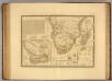
Afrique, meridionale.
1 : 16000000 Picquet, C.
Carte du Congo et du pays des Cafres
1 : 9100000 Afrika subsaharská Delisle, Guillaume Guillame del'Isle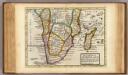
South part of Africa and Magadascar.
1 : 21000000 Moll, Herman, d. 1732
Afrique du Sud.
1 : 10000000 Vivien St Martin, L.
Africa North Western Sheet.
1 : 14256000 Colton, G.W.
Süd Africa

Southern Africa.
1 : 15000000 Colton, G.W.
Sud-Afrika & Madagaskar.
1 : 12500000 Petermann, A.
Süd-Afrika & Madagaskar
Hand-Atlas über alle Theile der Erde und über das Weltgebäude Stieler, Adolf Justus Perthes
Central & Southern Africa.
1 : 12000000 John Bartholomew and Son
Carte du Congo et du Pays des Cafres
1 : 9000000
Southern Africa.
1 : 15000000 Colton, G.W.
Southern Africa.
1 : 15000000 Colton, G.W.
L'Afrique 4.
1 : 10000000 Brue, Adrien Hubert, 1786-1832
Southern Africa.
1 : 15000000 Colton, G.W.
Forschungsreisen in Afrika von Dr. Oskar Lenz
1 : 8500000 Afrika jižní Schwarz, Wilfried
Southern Africa.
1 : 15000000 Colton, G.W.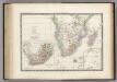
Afrique partie Sud.
1 : 16000000 Levasseur, E.
South Africa.
1 : 16600000 Sharpe, J.
Costa oriental de Africa
1 : 25000000 1 mapa, col. Full d'un atles en llengua castellana no identificat, que conté mapes físics, polítics i sobre el servei de correus. Datat al 1890 aproximadament.