Maps of Germany

German Federal Republic. Pergamon World Atlas.
Polish Army Topography Service
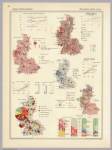
German Federal Republic. Pergamon World Atlas.
Polish Army Topography Service
Western Germany 22
1 : 1700000 Appleton, D. & Co.
Germany.
1 : 1870000 Hughes, William
German Empire W.
1 : 1330560 Stanford, Edward
Allemagne.
1 : 1850000 Brue, Adrien Hubert, 1786-1832
W. Germany.
1 : 1300000 Arrowsmith, John
Die Beiden Deutschen Staaten

German States.
1 : 2050000 Teesdale, Henry
L'Allemagne Occidentale.
1 : 1800000 Levasseur, E.
Schiffahrtsstraßen in Deutschland Stand 1989
Deutschland Wasserstraße, Binnenschifffahrt Kunz, Andreas ; Moeschl, Joachim Robert
82-83. West Germany. The World Atlas.
1 : 1250000 USSR (Union of Soviet Socialist Republics).
Länder der Bundesrepublik 2003
Deutschland Kunz, Andreas ; Moeschl, Joachim Robert
Länder der Bundesrepublik 1949
Deutschland, Bundesrepublik Kunz, Andreas ; Moeschl, Joachim Robert
Länder der Bundesrepublik 1952
Deutschland, Bundesrepublik Kunz, Andreas ; Moeschl, Joachim Robert
Länder der Bundesrepublik 31.12.1990
Deutschland Kunz, Andreas ; Moeschl, Joachim Robert
Länder der Bundesrepublik 1993
Deutschland Kunz, Andreas ; Moeschl, Joachim Robert
Länder der Bundesrepublik 1955
Deutschland, Bundesrepublik Kunz, Andreas ; Moeschl, Joachim Robert
Besatzungszonen und Länder 1947
Deutschland Besatzungszone Kunz, Andreas ; Moeschl, Joachim Robert
Germany-Czechoslovakia-Poland
Germany-Czechoslovakia-Poland [Aerodromes, Landing grounds, Seaplane bases], ADI (Maps) AM 8058A. [S.l.] : Air Ministry, United Kingdom
Länder der Bundesrepublik 1957
Deutschland, Bundesrepublik Kunz, Andreas ; Moeschl, Joachim Robert
Länder 1947
Deutschland Kunz, Andreas ; Moeschl, Joachim Robert
Germany.
1 : 3250000 Mitchell, Samuel Augustus
Geschichtl. Entwicklung des Königr. Preussen bis zum Frieden von Tilsit (1807)
Deutschland, Preußen, Tilsit / Friede
Länder der Bundesrepublik 1989
Deutschland, Bundesrepublik Kunz, Andreas ; Moeschl, Joachim Robert
Allemagne occidentale.
1 : 1850000 Picquet, C.
Western Germany.
1 : 1340000 Arrowsmith, John
Germany.
1 : 3168000 Tallis, J. & F.
Germany.
1 : 3300000 Tanner, Henry S.