Maps of Germany
l'Allemagne par Cercles in 1789.
1 : 6300000 Malte-Brun, Conrad, 1775-1826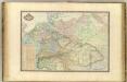
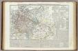
Europe Centrale.
1 : 3000000 Garnier, F. A., 1803-1863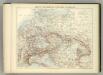
Carte Politique de L'Europe Centrale.
1 : 3600000 Jouvet et Cie.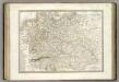
Allemagne.
1 : 3300000 Lapie, M. (Pierre), 1779-1850
Karte des Deutschen Reichs
Schmidt, Johann Marius Friedrich; Jäck Schropp
Allemagne.
1 : 5000000 Monin, C.V.
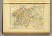
Germany.
1 : 6000000 Finley, Anthony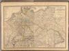
Composite: Allemagne.
1 : 2000000 Andriveau-Goujon, J.
Autriche, Prusse, Confed. Germanique, Pologne 1788 a 1841.
1 : 6300000 Houze, Antoine Philippe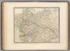
L'Allemagne, l'Europe centrale.
1 : 3460000 Andriveau-Goujon, J.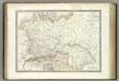
Germanie Ancienne.
1 : 3300000 Lapie, M. (Pierre), 1779-1850
Germany, Austria.
1 : 4118400 Letts, Son & Co.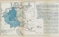
Nr. 8a. Die Germanisierung des Ostens
Ostmitteleuropa Deutsche, Siedlung
Mitteleuropa während des 30 jährigen Krieges.
Evropa střední Benecke Bormann, E. F. Tempsky
Der Deutsche Bund samt der Helvetischen Eidgenossenschaft aft. 1828
Historisch-genealogisch-geographischer Atlas von Le Sage Las Cases, Emmanuel Auguste Dieudonné Marius Joseph de Johann Velten, Kunsthändler
Map of the Empire of Germany.
1 : 1250000 Delarochette, Louis Stanislas d'Arcy
Rozsah moci význačných českých panovníků do XIV. stol.

Mitteleuropa am Ende des 30 jährigen Krieges
Evropa střední F. Tempsky
Übersichtskarte der Eisenbahnen und Eisen-Bahn-Abstoss-Stationen von Mitteleuropa 1883
Evropa střední W. Koch
L'Allemagne 911 a 1024.
1 : 6300000 Houze, Antoine Philippe
Sbírka map a diagramů použitých na mírových konferencích v Paříži v letech 1919 - 1920
Carta generale della Germania ossia Confederazione Germanica.
1 : 3500000 Marzolla, Benedetto
Central states Europe.
1 : 9000000 Fenner, Rest.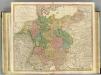
German Empire.
1 : 2150000 Faden, William, 1750?-1836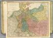
German Empire.
1 : 2150000 Faden, William, 1750?-1836
R.A. Schulz's neue praktische Reise-Karte mit Angabe der Distanzen
Evropa střední Schulz, R. A. Biller, Dominik Artaria & Co.
R.A. Schulz's neue praktische Reise-Karte mit Angabe der Distanzen
Evropa střední Schulz, R. A. Artaria & Co.
Empire d'Allemagne, Hongrie, Gallicie, Prusse, Provinces-Unies de Pays-Bas en 1789.
1 : 3500000 Picquet, C.
L'Allemagne 1437 a 1612.
1 : 6300000 Houze, Antoine Philippe


