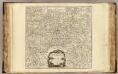
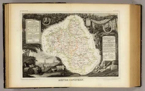
Maps of Aveyron
Dept. De L'Aveyron.
1 : 585000 Levasseur, Victor.


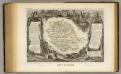
Département du Tarn
1 Karte : Kupferdruck ; 49 x 48 cm Houdan; Dumez chez Dumez directeur de l'Atlas national rue de la Harpe no. 26, et au dépôt de cet atlas placé au cabinet bibliographique rue de la Monnoye no. 5
Archevesché d'Alby
1 Karte : Kupferdruck ; 33 x 44 cm Sanson; Robert de Vaugondy ches le Sr. Robert g. du r. quai de lHorloge du Palais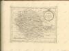
Dept. Du Tarn.
1 : 563000 Levasseur, Victor.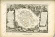
16 Rodez.
1 : 86400 Cassini family; Cassini, Cesar-Francois, 1714-1784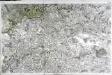
[Rodez]
1 Blatt : 56 x 89 cm s.n.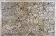
[Albi]
1 Blatt : 56 x 89 cm s.n.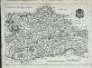
Carte dv diocese d'Alby
1 Karte : Kupferdruck ; 26 x 36 cm Merian Caspar Merian
EPISCOPATVS | ALBIENSIS, | EVESCHÉ D'ALBY
Amstelædami exc. Joannes Blaeu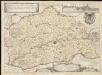
Carte du diocese d'Alby
1 : 110000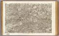
17 Albi.
1 : 86400 Cassini family; Cassini, Cesar-Francois, 1714-1784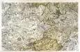
[Nant - Millaud]
1 Blatt : 56 x 89 cm s.n.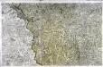
[Mende]
1 Blatt : 56 x 89 cm s.n.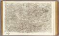
18 Castres.
1 : 86400 Cassini family; Cassini, Cesar-Francois, 1714-1784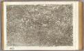
15 Aurillac.
1 : 86400 Cassini family; Cassini, Cesar-Francois, 1714-1784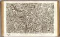
55 Mende.
1 : 86400 Cassini family; Cassini, Cesar-Francois, 1714-1784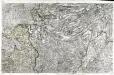
[Aurillac]
1 Blatt : 56 x 89 cm s.n.
Govverneme[n]t de Milhau
1 Karte : Kupferdruck ; 11 x 15 cm Sebastian Cramoisy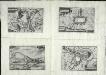
Roqvecovrbe
1 Plan : Kupferdruck ; 11 x 15 cm Sebastian Cramoisy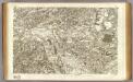
37 Montauban.
1 : 86400 Cassini family; Cassini, Cesar-Francois, 1714-1784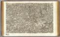
36 Cahors.
1 : 86400 Cassini family; Cassini, Cesar-Francois, 1714-1784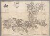
Carte topographique du Canton de St. Antonin, Arrond.t de Montauban, Département de Tarn-et-Garonne / par Aubry
1 : 30000 Aubry, ... [S.l. : s.n.]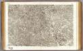
35 Sarlat.
1 : 86400 Cassini family; Cassini, Cesar-Francois, 1714-1784
Gowerneme[n]t de Roquecourbe
1 Karte : Kupferdruck ; 11 x 15 cm Sebastian Cramoisy
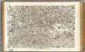
Partie orientale du gouvernement général de la Guienne
1 Karte : Kupferdruck ; 47 x 50 cm Robert de Vaugondy G. et D. Robert de Vaugondy