Maps of Weehawken
[Map of that part of New York City Between 34th St. and 46th St., and the East and Hudson Rivers, showing] encroachment of nuisances upon populous up-town districts.
From Manhattan
Outline and Index Map of Atlas of New York City.
from Atlas of the borough of Manhattan, city of New York.
Topographical Atlas Of The City Of New York
1 : 12000 Viele, Egbert L.
Height District Map Section No. 8
from Height district map / City of New York, Board of Estimate and Apportionment.
Outline & Index Map of Volume Two, Atlas of New York City, 14th Street to 59th Street.
from Atlas of the city of New York, borough of Manhattan. From actual surveys and official plans / by George W. and Walter S. Bromley.
Use District Map Section No. 8
from Use district map / City of New York, Board of Estimate and Apportionment.
Area District Map Section No. 8
from Area district map / City of New York, Board of Estimate and Apportionment.
Outline and Index Map of Volume Two, Atlas of New York City, Borough of Manhattan. 14th Street to 59th Street.
from Atlas of the city of New York, borough of Manhattan. From actual surveys and official plans / by George W. and Walter S. Bromley.
M-T-10-100: Index Map of Central Park, Boro. of Manhattan.
from Topographical survey of portion of Central Park, Boro. of Manhattan ... / City of New York, Department of Parks, Topographical Division.
[Maps of the 14, 15, 16, 17, 20, 21 assembly districts and 23 & 24 Wards of New York City.]
From Manhattan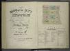
[Volume 6 Index Map.]
from Maps of the city of New York / surveyed under directions of insurance companies of said city.
64 Central Park Lots, New York City.
From Manhattan
Data for population from census of 1910, Borough of Manhattan
From Manhattan
Key
From Atlas 42.55. Vol. 5, 1890.
City of New York.
1 : 17000 Tanner, Henry S.
Map of the city of New-York extending northward to Fiftieth St. / surveyed and drawn by John F. Harrison, C.E.
from Manhattan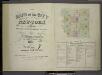
[Volume 7 Index Map.]
from Maps of the city of New York / surveyed under directions of insurance companies of said city.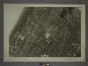
8B - N.Y. City (Aerial Set).
from Sectional aerial maps of the City of New York / [photographed and assembled under the direction of the chief engineer, July 1st, 1924].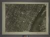
8D - N.Y. City (Aerial Set).
from Sectional aerial maps of the City of New York / [photographed and assembled under the direction of the chief engineer, July 1st, 1924].
Part of the 23rd Ward, New York City.
from Atlas of the city of New York : from official records, private plans & actual surveys / compiled under the supervision of E. Robinson & R. H. Pidgeon.
TheWest End Plateau of the city of New York, 1879.
From Manhattan
Plan of Weehawken township.
from Combined atlas of the State of New Jersey and the County of Hudson : from actual survey, official records & private plans / by and under the direction of G. M. Hopkins ...
Block distribution of children of 4 to 18 years of age for Chelsea and Greenwich for 1910.
From Manhattan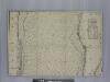
New map of that part of the city of New York south from 20th Street on the Hudson & 35th Street on the East River : showing the position of Greenwich, Washington and West Streets on the Hudson River, and Pearl, Water, Front, Cherry & Tompkins Sts. on the
from Manhattan
Sheet 14: [Bounded by E. Ninety Second Street, Avenue A, E. Nintieth Street, Avenue B, E. Seventy Second Street, Avenue A, [E. Fifty Ninth Street] and 5th Avenue.]
from Plan of New York City, from the Battery to Spuyten Duyvil Creek. Showing every lot and building thereon; old farm lines, strreet numbers at the corners of blocks, railroads, steamboat landings, bulkhead and pier lines, etc. Based on the surveys made by Messrs. Randall & Blackwell, and on the special survey by J. F. Harrison.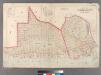
Part of Long Island City, Ward No. 1 & 3.
from Atlas of Queens Co., Long Island, New York / compiled from official records, private plans & actual surveys by and under the direction of Chester Wolverton.
The city of New York / Will L. Taylor, chief draughtsman.
from Whole
Sheet 13: [Bounded by W. Ninty First Street, (New Reservoir) 5th Avenue, Fifty Ninth Street and 12th Avenue.]
from Plan of New York City, from the Battery to Spuyten Duyvil Creek. Showing every lot and building thereon; old farm lines, strreet numbers at the corners of blocks, railroads, steamboat landings, bulkhead and pier lines, etc. Based on the surveys made by Messrs. Randall & Blackwell, and on the special survey by J. F. Harrison.
Map of the city of New-York extending northward to Fiftieth St. / surveyed and drawn by John F. Harrison, C.E.
from Manhattan
![[Map of that part of New York City Between 34th St. and 46th St., and the East and Hudson Rivers, showing] encroachment of nuisances upon populous up-town districts.](https://images-3.georeferencer.com/images/iiif/356214404514/full/,300/0/native.jpg)

