Maps of New Jersey

A chart of Delaware Bay and River : containing a full and exact description of the shores, creeks, harbours, soundings, shoals, sands, and bearings of the most considerable land marks &c. &c. / faithfully coppied [sic] from that published at Philadelphia
from Parts
A map of New Jersey, from the best authorities.
from The American geography; or, A view of the present situation of the United States of America: containing astronomical geography; geographical definitions, discovery, and general description ... By Jedidiah Morse, A.M.
A map of the most inhabited part of Virginia containing the whole province of Maryland with part of Pensilvania, New Jersey and North Carolina / drawn by Joshua Fry & Peter Jefferson in 1751.
From Parts
Map of the state of Maryland : laid down from an actual survey of all the principal waters, public roads, and divisions of the counties therein : describing the situation of the cities, towns, villages, houses of worship and other public buildings, fu...
From Maryland
Delaware.
from Delaware
Delaware and Mary-Land / By David H. Burr, New-York; engd. & printed by Illman & Pilbrow.
from Parts David H. Burr; Illman & Pilbrow,
Routes between New-York & Washington / drawn by I. Smith, geographer.
from Parts
New Jersey
1 : 505000 Sotzmann, D. F Bey Carl Ernst Bohn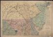
Bacon's topographical war map showing the battle fields of Pennsylvania, Maryland, and Virginia
1 : 540000 G.W. Bacon & Co. G.W. Bacon & Co.
Virginia & Maryland.
1 : 1150000 Bowen, Emanuel
The Province of New Jersey, divided into East and West, commonly called the Jerseys / engraved & published by Wm. Faden.
from Charts and maps
The Province of New Jersey, divided into East and West, commonly called the Jerseys / engraved & published by Wm. Faden, Charing Cross, December 1st, 1777 ; Croisey, sculpt.
from Whole
A chart of Delaware Bay and River / from the original by Mr. Fisher of Philadelphia, 1776.
from Charts and maps
A Map of the country round Philadelphia: including part of New Jersey, New York, Staten Island, & Long Island.; The Gentleman's magazine.
from The Gentleman's magazine. The Gentleman's magazine,
The legacy of New Sweden: Swedish and Finnish sites in America, 1638-1787 / compiled by Richard Hulan.
Richard Hulan,
Seat of war in the environs of Philadelphia / by Thos. Kitchin Senr., hydrographer to His Majesty.
from Revolutionary War, 1775-1783
Delaware / drawn by F. Lucas, Jr. ; engraved by G.W. Boynton.
from Delaware
The State of New Jersey / compiled from the most accurate surveys / Martin sculpt.
from Whole
Virginia and Maryland.
1 : 1340000 Moll, Herman, d. 1732
The province of New Jersey, divided into east and west, commonly called the Jerseys
1 : 420000 Faden, William Faden, William
Composite: New Map Of The Peninsula Embracing Delaware And The Eastern Shores Of Maryland And Virginia
1 : 346480 MacCormac, Walter S.
New Jersey.
1 : 860000 Schonberg & Co.
A chart of Delaware Bay and River : containing a full and exact description of the shores, creeks, harbours, soundings, shoals, sands, and bearings of the most considerable land marks &c. &c. / faithfully coppied [sic] from that published at Philadelphia
from A new edition, much enlarged, of the second part of the North American pilot, for New England, New York, Pennsylvania, New Jersey, Maryland, Virginia, North and South Carolina, Georgia, Florida, and the Havanna : including general charts of the British Ch
Map of the State of New Jersey
from Atlas of Hunterdon County, New Jersey : from recent and actual surveys and records / under the superintendence of F.W. Beers.
New Jersey.
1 : 778000 Tanner, Henry S.
New Jersey.
1 : 980000 Lucas, Fielding Jr.
New Jersey / engraved by J.H. Young.
from Whole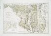
Maryland und Delaware / entworfen von D.F. Sotzmann ; W. Sander, sculp.
from Charts and maps
Map of The State of New Jersey
from Atlas of Monmouth co., New Jersey. From recent and actual surveys and records, under the superintendence of F.W. Beers.
![A chart of Delaware Bay and River : containing a full and exact description of the shores, creeks, harbours, soundings, shoals, sands, and bearings of the most considerable land marks &c. &c. / faithfully coppied [sic] from that published at Philadelphia](https://images-0.georeferencer.com/images/iiif/141265400306/full/,300/0/native.jpg)

