Maps of Soproni járás

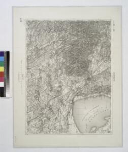
Oedenburg.
from Spezialkarte der osterreichisch-ungarischen Monarchie.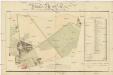
Plan des Thiergartens der k.k. Militair Accademie Wiener Neustadt
1 : 3000 Wiener Neustadt (Rakousko) Zesner Müller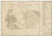
Grundriss des Thiergartens in dem k.k. Militaire Kadeten Haus
1 : 4000 Wiener Neustadt (Rakousko) Szczepanowski, K. Schönerer, Mathias
Sopron vármegye
1 : 340000 Neziderské jezero (Maďarsko a Rakousko : oblast) Hegedüs, Johann Nepomuk Görög, Demeter Görög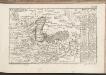
C. Soproniensis
Ungarn Komitat Ödenburg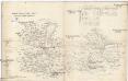
Oedenburger und Raaber Comitat
1 : 280000 Györ (Maďarsko : oblast)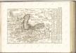
[Die Ost-Gränz-Gegend vom Vierter U.W.W. bis über Oedenburg und uber Güns]

Guns.
from Spezialkarte der osterreichisch-ungarischen Monarchie.
Eisenstadt.
from Spezialkarte der osterreichisch-ungarischen Monarchie.
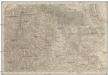
Neunkirchen und Aspang.
from Spezialkarte der osterreichisch-ungarischen Monarchie.
Kapuvar.
from Spezialkarte der osterreichisch-ungarischen Monarchie.
Wien 147, uit: Special-Karte von Mittel-Europa / nach amtlichen Quellen bearbeitet von W. Liebenow
1 : 300000 titelvariant: W. Liebenow's Mittel-Europa; Annotatie: Titel boven de bladen: W. Liebenow's Mittel-Europa Johannes Wilhelm Liebenow 1822-1897 Frankfurt a. M. : Ludwig Ravenstein

Comitatus Castri Ferrei
1 : 110000 Maďarsko Kenedics, Joseph Mansfeld, Johann Ernst
Unter Wienner Wald
1 : 640000 Mollova mapová sbírka Insprugger, Sebastianus Märtin, Johann Heinrich Voigt, Maria Theresia
Sbírka map a diagramů použitých na mírových konferencích v Paříži v letech 1919 - 1920
Siedlungsgebiet der Deutschen nach dem Nachbarschaftsindex für Westungarn 1941
Ungarn, Transdanubien, Deutsche, Siedlung Bottlik, Zsolt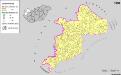
Siedlungsgebiet der Deutschen nach dem Nachbarschaftsindex für Westungarn 1980
Ungarn, Transdanubien, Deutsche, Siedlung Bottlik, Zsolt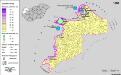
Siedlungsgebiet der Deutschen nach dem Nachbarschaftsindex für Westungarn 1880
Ungarn, Transdanubien, Deutsche, Siedlung Bottlik, Zsolt
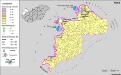
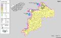
Kroaten in West-Ungarn 1941
Transdanubien Kroaten, Siedlung Bottlik, Zsolt
Kroaten in West-Ungarn 1880
Transdanubien Kroaten, Siedlung Bottlik, Zsolt
A horvátok aránya és száma Nyugat-Magyarországon 1980-ban
Transdanubien Kroaten, Siedlung Bottlik, Zsolt
Kroaten in West-Ungarn 1980
Transdanubien Kroaten, Siedlung Bottlik, Zsolt
A horvátok aránya és száma Nyugat-Magyarországon 1941-ben
Transdanubien Kroaten, Siedlung Bottlik, Zsolt
A horvátok aránya és száma Nyugat-Magyarországon 1880-ban
Transdanubien Kroaten, Siedlung Bottlik, Zsolt
Generalkarte vom Burgenland
1 : 200000 Burgenland (Rakousko) R. Lechner
Die Alpengegend Nieder-OEsterreichs und Ober-Steyermarks
1 : 290000 Alpy (pohoří) Becker, Moritz Alois Steinhauser, Anton Josef Bermann
Mappa Comitatvs Soproniensis 1758
1 : 1250000 Mollova mapová sbírka Zeller, Sebastian