Maps of Sahel

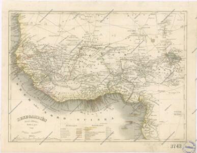
Senegambien
West. Mittel-Africa.
1 : 6000000 Weiland, C. F. (Carl Ferdinand), d. 1847
Westliches Mittel-Africa, Senegambien, Sudan, Ober-Guinea und einen Theil der Sahara umfassend oder die Stufenländer des mittlern Africa's und Nordrand von Hochafrica
1 : 6000000 entworfen und gezeichnet von C.F. Weiland gestochen von K.J. Mädel sen. Weimar : Geographisches Institut
Westliches Mittel-Africa
1 : 6000000 Guinea Weiland, Karl Ferdinand Geograph. Instituts
Senegambie, Soudan, Guinee Septentrionale.
1 : 8250000 Picquet, C.
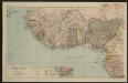
Afrique Occidentale
Vidal de La Blache, Paul
Gvinea propria nec non Nigritiæ vel terræ Nigrorvm maxima pars
1 Karte : Kupferdruck ; 44 x 54 cm Anville; Haas; Desmarchais Homännische Erben
Gvinea propria nec non Nigritiæ vel terræ Nigrorvm maxima pars
1 Karte : Kupferdruck ; 44 x 54 cm Anville; Haas; Desmarchais Homännische Erben
Africa Southern.
1 : 8000000 Hall, S. (Sidney)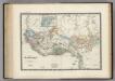
Senegambie, Soudan, Guinee.
1 : 8600000 Levasseur, E.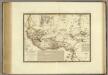
Senegambie, Soudan, Guinee Septentrionale.
1 : 8250000 Brue, Adrien Hubert, 1786-1832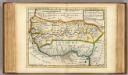
Negroland and Guinea.
1 : 15000000 Moll, Herman, d. 1732
Afrique occidentale et centrale.
1 : 9500000 Garnier, F. A., 1803-1863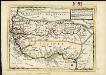
Negroland and Guinea, with the European settlements explaining what belongs to England, Holland, Denmark &c.
1 : 12500000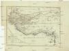
Charte von Senegambien und Ober-Guinea nebst dem innern Nigritien
1 : 8500000 Afrika severozápadní
CHARTE von SENEGAMBIEN UND OBER-GUINEA nebst dem innern Nigritien
1 : 8540000 Gambie
Charte von Senegambien und Ober-Guinea nebst dem innern Nigritien
1 : 8540000 Gambie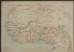
Afrique occidentale française
1 : 8000000
Nordwestliches Afrika
Afrique centrale. Sénégal-Niger
1 : 8000000 Niox, Gustave-Léon 1840-1921 Paris : Ch. Delagrave
[136][139] Tractus Littorales Guineae ..., uit: Atlas sive Descriptio terrarum orbis
Annotatie: Gedigitaliseerde versie. Amsterdam. Heiloo : Picturae (vervaardiger), 2015. tiff-bestand. Gedigitaliseerd: 07-01-2015; Origineel: Universiteitsbibliotheek Vrije Universiteit (XL.05127.-) ; Netherlands; Titelpagina ontbreekt Wit, Frederik de Amsterdam : Frederick de Wit
Carte des fuseaux horaires de l'Afrique occidentale française
1 : 6000000 Afrika západní Service géographique des colonies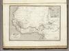
Afrique Occidentale.
1 : 2700000 Montemont, A.
Africa NW.
1 : 10000000 Andree, Richard; Times (London, England)
[Afrika, Blatt 3]
Adolf Stieler's Handatlas über alle Theile der Erde und über das Weltgebäude Stieler, Adolf Justus Perthes
Carte des fuseaux horaires de l'Afrique occidentale française
1 : 6000000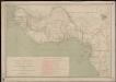
Carte des missions catholiques du Soudan français et de la côte occidentale d'Afrique
1 : 4000000 Vuillot, Paul 18..-19.. [Lyon : Oeuvre de la propagation de la foi]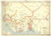
Afrique occidentale française
1 : 2500000 Francouzská západní Afrika Service géographique de l'Afrique occid[enta]le franç[ai]se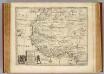
Negroland, adjacent countries.
1 : 10000000 Bowen, Emanuel