Maps of powiat opatowski

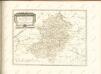
Karte des westlichen Russlands

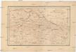
Sandomierz 80, uit: Special-Karte von Mittel-Europa / nach amtlichen Quellen bearbeitet von W. Liebenow
1 : 300000 titelvariant: W. Liebenow's Mittel-Europa; Annotatie: Titel boven de bladen: W. Liebenow's Mittel-Europa Johannes Wilhelm Liebenow 1822-1897 Frankfurt a. M. : Ludwig Ravenstein
Mapa hypsometryczna Gór Świętokrzyskich
1 : 225000 Świętokrzyskie Góry (Polsko) Lencewicz, Stanisław
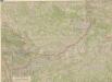
Tarnobrzeg
1 : 75000 Polsko Link, J. K. u. k. Militärgeographisches Institut
Opatow
1 : 75000 Opatów (Polsko) K. u. k. Militärgeographisches Institut
Łagów
1 : 75000 K. u. k. Militärgeographisches Institut
Tarnobrzec.; Spezialkarte der osterreichisch-ungarischen Monarchie.
from Spezialkarte der osterreichisch-ungarischen Monarchie. Austro-Hungarian Monarchy. Militärgeographisches Institut.,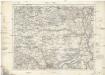
Solec
1 : 75000 Solec-oblast (Polsko) K. u. k. Militärgeographisches Institut
Staszów
1 : 75000 Staszów (Polsko) K. u. k. Militärgeographisches Institut
Nisko und Rozwadów
1 : 75000 Nisko (Polsko) Baumgarten K. u. k. Militärgeographisches Institut
Kraśnik
1 : 75000 K. u. k. Militärgeographisches Institut
Opole
1 : 75000 K. u. k. Militärgeographisches Institut
Opole
1 : 75000 Wagner, W. K. u. k. Militärgeographisches Institut
Nisko und Rozwadow
1 : 75000 Polsko Baumgarten K. u. k. Militärgeographisches Institut
Nisko und Rozwadow.
from Spezialkarte der osterreichisch-ungarischen Monarchie.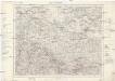
Szydłowiec
1 : 75000 Szydłowiec (Polsko) K. u. k. Militärgeographisches Institut
Warszawa, Brest-Litowsk, Radom, Lublin, Kielze, Tomaszów


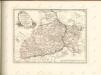
West-Galizien
Halič (Polsko a Ukrajina) Metzburg, Georg Ignaz von im Verlage des Kunst und Industrie Comptoirs
Ost Galizien
Halič (Polsko a Ukrajina) Liesganig, Joseph m Verlage des Kunst- und Industrie- Comptoirs
Warschau, Lublin, Modlin (Nowogeorgiewsk)
1 : 750000 Lublin (Polsko : oblast) Karl, E. K. u. k. Militärgeographisches Institut
Warschau, Lublin, Nowo-Georgiewsk
1 : 750000 Lublin (Polsko : oblast) K. k. militär-geographisches Institut
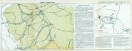
Strategische Übersichts-Karte des polnisch-litaurischen Armee-Bewegungraumes
Galizien, Karpathen, Bukowina nebst anschließendem Ungarn, Russland u. s. w.
Ravenstein, Hans
General-Carte von Westgallizien
1 : 291000 Polsko jihovýchodní Benedicti, Lucas
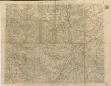
Strassen- und Eisenbahnkarte des oesterreichischen Kaiserthumes
1 : 864000 Blatt 3 Schaller, G. K.K. Militärisch-Geografisches Institut, Karten-Evidenthaltungs-Abteilung