Maps of Powys

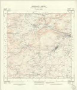
SO25 - OS 1:25,000 Provisional Series Map
1 : 25000 Topographic maps Ordnance Survey Ordnance Survey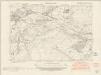
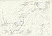
Herefordshire XVII.NW - OS Six-Inch Map
1 : 10560 Topographic maps Ordnance Survey Ordnance Survey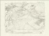
Herefordshire XVII.NW - OS Six-Inch Map
1 : 10560 Topographic maps Ordnance Survey Ordnance Survey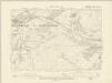
Herefordshire XVII.NW - OS Six-Inch Map
1 : 10560 Topographic maps Ordnance Survey Ordnance Survey
Herefordshire XVII.NW - OS Six-Inch Map
1 : 10560 Topographic maps Ordnance Survey Ordnance Survey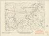
Herefordshire XVII.SW - OS Six-Inch Map
1 : 10560 Topographic maps Ordnance Survey Ordnance Survey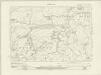
Herefordshire XVII.SW - OS Six-Inch Map
1 : 10560 Topographic maps Ordnance Survey Ordnance Survey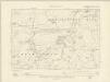
Herefordshire XVII.SW - OS Six-Inch Map
1 : 10560 Topographic maps Ordnance Survey Ordnance Survey
Herefordshire XVII.SW - OS Six-Inch Map
1 : 10560 Topographic maps Ordnance Survey Ordnance Survey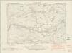
Radnorshire XXIX.NE - OS Six-Inch Map
1 : 10560 Topographic maps Ordnance Survey Ordnance Survey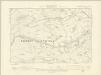
Radnorshire XXIX.NE - OS Six-Inch Map
1 : 10560 Topographic maps Ordnance Survey Ordnance Survey
Radnorshire XXIX.NE - OS Six-Inch Map
1 : 10560 Topographic maps Ordnance Survey Ordnance Survey
Herefordshire XVI.SE - OS Six-Inch Map
1 : 10560 Topographic maps Ordnance Survey Ordnance Survey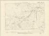
Herefordshire XVI.SE - OS Six-Inch Map
1 : 10560 Topographic maps Ordnance Survey Ordnance Survey
Herefordshire XVI.SE - OS Six-Inch Map
1 : 10560 Topographic maps Ordnance Survey Ordnance Survey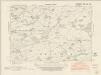
Herefordshire XXIV.NW - OS Six-Inch Map
1 : 10560 Topographic maps Ordnance Survey Ordnance Survey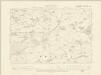
Herefordshire XXIV.NW - OS Six-Inch Map
1 : 10560 Topographic maps Ordnance Survey Ordnance Survey
Herefordshire XXIV.NW - OS Six-Inch Map
1 : 10560 Topographic maps Ordnance Survey Ordnance Survey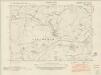
Herefordshire XXIII.NE - OS Six-Inch Map
1 : 10560 Topographic maps Ordnance Survey Ordnance Survey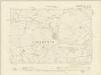
Herefordshire XXIII.NE - OS Six-Inch Map
1 : 10560 Topographic maps Ordnance Survey Ordnance Survey
Herefordshire XXIII.NE - OS Six-Inch Map
1 : 10560 Topographic maps Ordnance Survey Ordnance Survey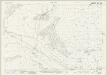
Herefordshire XVII.2 (includes: Burlingjobb And Old Radnor; Kington Rural; Kington Urban; Lower Harpton) - 25 Inch Map
1 : 2500 Topographic maps Ordnance Survey Ordnance Survey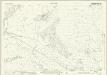
Radnorshire XXX.2 (includes: Burlingjobb and Old Radnor; Kington Rural; Kington Urban; Lower Harpton) - 25 Inch Map
1 : 2500 Topographic maps Ordnance Survey Ordnance Survey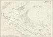
Herefordshire XVII.2 (includes: Burlingjobb And Old Radnor; Kington Rural; Kington Urban; Lower Harpton) - 25 Inch Map
1 : 2500 Topographic maps Ordnance Survey Ordnance Survey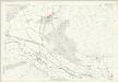
Herefordshire XVII.2 (includes: Burlingjobb And Old Radnor; Kington Rural; Kington Urban; Lower Harpton) - 25 Inch Map
1 : 2500 Topographic maps Ordnance Survey Ordnance Survey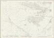
Herefordshire XVII.6 (includes: Kington Rural; Kington Urban) - 25 Inch Map
1 : 2500 Topographic maps Ordnance Survey Ordnance Survey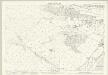
Herefordshire XVII.6 (includes: Kington Rural; Kington Urban) - 25 Inch Map
1 : 2500 Topographic maps Ordnance Survey Ordnance Survey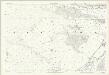
Herefordshire XVII.6 (includes: Kington Rural; Kington Urban) - 25 Inch Map
1 : 2500 Topographic maps Ordnance Survey Ordnance Survey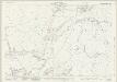
Herefordshire XVII.10 (includes: Huntington; Kington Rural) - 25 Inch Map
1 : 2500 Topographic maps Ordnance Survey Ordnance Survey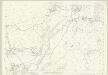
Herefordshire XVII.10 (includes: Huntington; Kington Rural) - 25 Inch Map
1 : 2500 Topographic maps Ordnance Survey Ordnance Survey