Maps of Babergh

Colchester - OS One-Inch Map
1 : 63360 Topographic maps Ordnance Survey Ordnance Survey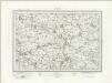
Sudbury (Outline) - OS One-Inch Revised New Series
1 : 63360 Topographic maps Ordnance Survey Ordnance Survey
Sudbury (Hills) - OS One-Inch Revised New Series
1 : 63360 Topographic maps Ordnance Survey Ordnance Survey
Braintree (Hills) - OS One-Inch Revised New Series
1 : 63360 Topographic maps Ordnance Survey Ordnance Survey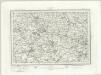
Braintree (Outline) - OS One-Inch Revised New Series
1 : 63360 Topographic maps Ordnance Survey Ordnance Survey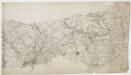
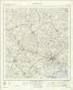
Witham
Colchester is the largest settlement featured on this drawing. The draughtsman has recorded the layout of the streets in red ink. On nearby Lexden Heath, an 'Ancient Intrenchment' is depicted. These lines of entrenchment date back to the Roman occupation. The drawing extends to cover Mersey Island and the River Colne. The salt marshes are distinguished by irregular patterning and the individual channels of the Colne are named. A military battery is marked at the mouth of the river, reflecting the military focus of these drawings. A blue line indicates the level of the low water mark.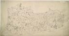
Halstead
1 : 31680 Oval gaps have been left in the forested areas of this unfinished plan to allow place names to be inserted later. The road network is complete, indicating that communication routes were the first aspect of the area to be recorded, a reflection of the military imperative of the Survey. Yeakell, Thomas
Sudbury
1 : 31680 This plan traces the border between Essex and Suffolk along the course of the River Stour and the River Brett valley, running through Hadleigh. Verron, Charles
Bury St. Edmunds
1 : 31680 .Built in 1795 to display the paintings and silverware of the fourth Earl of Bristol, Ickworth House is depicted near the top left of the map along the road leading south-west to Haverhill. The abbey of Bury St Edmunds is indicated by a cross. The abbey, built shortly after the Norman Conquest of 1066, housed a thriving monastic community until its dissolution in 1539. A prison and windmills are noted outside Bury St Edmunds. Metcalf, Edward B.
Chelmsford (Hills) - OS One-Inch Revised New Series
1 : 63360 Topographic maps Ordnance Survey Ordnance Survey
Chelmsford (Outline) - OS One-Inch Revised New Series
1 : 63360 Topographic maps Ordnance Survey Ordnance Survey
Maldon
This drawing covers the area surrounding the Blackwater River. Pencil lines radiate from trigonometrical stations: notable fixed locations from which angular measurements were taken. Rays emanating from Iltney near the centre of the map, on the south bank of the river, have been used to plot the relative position of the Chigborough Road on the opposite bank. The marshes around Tollesbury Fleet are indicated by irregular intersecting lines.
Boxstead
1 : 31680 The draughtsman used Balsham Steeple and West Wickham Steeple at the top left of this plan as triangulation points. From these positions, he made angular observations with a theodolite to measure the height of the land and to plot individual topographical features. Pencil rays radiating from these two points,record the measurement process. Verron Charles
Colchester (Outline) - OS One-Inch Revised New Series
1 : 63360 Topographic maps Ordnance Survey Ordnance Survey
Colchester (Hills) - OS One-Inch Revised New Series
1 : 63360 Topographic maps Ordnance Survey Ordnance Survey
Stow Market
1 : 31680 This is a plan of the Gipping Valley in Suffolk. The circular hole in the top left-hand margin indicates that an 'Ordnance Office Copy' blind stamp has been removed from the manuscript. The die has cut through the paper causing the stamp to fall out. Pencil rays intersect across the map, evidence of measurements taken by the surveyor between fixed triangulation points. Stanley, William
TM05 - OS 1:25,000 Provisional Series Map
1 : 25000 Topographic maps Ordnance Survey Ordnance Survey
TM04 - OS 1:25,000 Provisional Series Map
1 : 25000 Topographic maps Ordnance Survey Ordnance Survey
TL95 - OS 1:25,000 Provisional Series Map
1 : 25000 Topographic maps Ordnance Survey Ordnance Survey
TM03 - OS 1:25,000 Provisional Series Map
1 : 25000 Topographic maps Ordnance Survey Ordnance Survey
TL94 - OS 1:25,000 Provisional Series Map
1 : 25000 Topographic maps Ordnance Survey Ordnance Survey
TM02 - OS 1:25,000 Provisional Series Map
1 : 25000 Topographic maps Ordnance Survey Ordnance Survey
TL85 - OS 1:25,000 Provisional Series Map
1 : 25000 Topographic maps Ordnance Survey Ordnance Survey
TL93 - OS 1:25,000 Provisional Series Map
1 : 25000 Topographic maps Ordnance Survey Ordnance Survey
TM01 - OS 1:25,000 Provisional Series Map
1 : 25000 Topographic maps Ordnance Survey Ordnance Survey
TL84 - OS 1:25,000 Provisional Series Map
1 : 25000 Topographic maps Ordnance Survey Ordnance Survey
TL92 - OS 1:25,000 Provisional Series Map
1 : 25000 Topographic maps Ordnance Survey Ordnance Survey
TL75 - OS 1:25,000 Provisional Series Map
1 : 25000 Topographic maps Ordnance Survey Ordnance Survey
TL83 - OS 1:25,000 Provisional Series Map
1 : 25000 Topographic maps Ordnance Survey Ordnance Survey