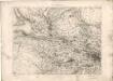
Maps of Glasgow
Lanarkshire, Sheet 001.14 - 25 Inch Map
1 : 2500 Topographic maps Ordnance Survey Ordnance Survey
Lanarkshire, Sheet 001.14 - 25 Inch Map
1 : 2500 Topographic maps Ordnance Survey Ordnance Survey
Lanarkshire, Sheet 001.14 - 25 Inch Map
1 : 2500 Topographic maps Ordnance Survey Ordnance Survey
Lanark, Sheet I.14 (Cadder) - OS 25 Inch map
1 : 2500 Topographic maps Ordnance Survey Ordnance Survey
Lanark, Sheet I.14 (Maryhill) - OS 25 Inch map
1 : 2500 Topographic maps Ordnance Survey Ordnance Survey
Dumbarton, Sheet XXVIII.8 (With inset XXIX.1) (New Kilpatrick) - OS 25 Inch map
1 : 2500 Topographic maps Ordnance Survey Ordnance Survey
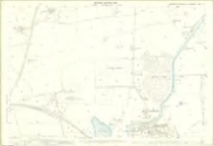
Lanarkshire Sheet I.SW - OS 6 Inch map
1 : 10560 Topographic maps Ordnance Survey Ordnance Survey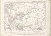
Lanarkshire Sheet I.SW - OS 6 Inch map
1 : 10560 Topographic maps Ordnance Survey Ordnance Survey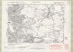
Dunbartonshire Sheet n XXIV.SW - OS 6 Inch map
1 : 10560 Topographic maps Ordnance Survey Ordnance Survey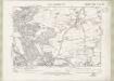
Dunbartonshire Sheet n XXIV.SW - OS 6 Inch map
1 : 10560 Topographic maps Ordnance Survey Ordnance Survey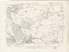
Dunbartonshire Sheet n XXIV.SW - OS 6 Inch map
1 : 10560 Topographic maps Ordnance Survey Ordnance Survey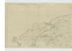
Lanarkshire, Sheet I - OS 6 Inch map
1 : 10560 Topographic maps Ordnance Survey Ordnance Survey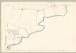
Dumbarton, Sheet XXIV.13 (New Kilpatrick) - OS 25 Inch map
1 : 2500 Topographic maps Ordnance Survey Ordnance Survey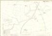
Dumbartonshire, Sheet 024.13 - 25 Inch Map
1 : 2500 Topographic maps Ordnance Survey Ordnance Survey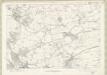
Dunbartonshire Sheet n XXIV - OS 6 Inch map
1 : 10560 Topographic maps Ordnance Survey Ordnance Survey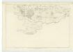
Stirlingshire, Sheet XXXII - OS 6 Inch map
1 : 10560 Topographic maps Ordnance Survey Ordnance Survey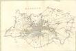
Glasgow
Great Britain. Parliament. House of Commons.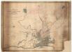
Map shewing...estate of Milton.
Kyle, Thomas, 1827?-1864
Map of the ten parishes within the Royalty... of Glasgow.
Cleland, James, 1770-1840 Smith, David, ca. 1803/4-1854
This map of the ten parishes within the Royalty and the parishes of Gorbals Barony of Glasgow.
Smith, David, fl. 1803-1854 Cleland, James, 1770-1840 Wood, John, ca. 1780-1847
Map of the City of Glasgow and suburbs.
Fleming, Peter, 1783-ca.1851
Map of the City of Glasgow and suburbs.
Fleming, Peter, 1783-ca.1851
Map of the City of Glasgow and suburbs.
Fleming, Peter, 1783-ca.1851
Map of the City of Glasgow and suburbs.
Fleming, Peter, 1783-ca.1851
Map of the City of Glasgow and suburbs.
Fleming, Peter, 1783-ca.1851
Map of the City of Glasgow and suburbs.
Fleming, Peter, 1783-ca.1851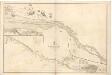
River Clyde from Dumbarton to Glasgow.
Great Britain. Hydrographic Office
Map of the town of Glasgow & country seven miles around.
Richardson, Thomas, fl. 1772-1829
Glasgow - OS One-Inch map
1 : 63360 Topographic maps Ordnance Survey Ordnance Survey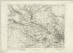
Glasgow - OS One-Inch map
1 : 63360 Topographic maps Ordnance Survey Ordnance Survey