Maps of Argyll and Bute

Sound of Iona
Great Britain. Hydrographic Office
Argyllshire, Sheet CIV - OS 6 Inch map
1 : 10560 Topographic maps Ordnance Survey Ordnance Survey
Argyllshire, Sheet CXVI - OS 6 Inch map
1 : 10560 Topographic maps Ordnance Survey Ordnance Survey
Argyll and Bute Sheet CIV - OS 6 Inch map
1 : 10560 Topographic maps Ordnance Survey Ordnance Survey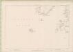
Argyll and Bute Sheet CXVI - OS 6 Inch map
1 : 10560 Topographic maps Ordnance Survey Ordnance Survey
Argyll and Bute Sheet CXVIa & CXVIb - OS 6 Inch map
1 : 10560 Topographic maps Ordnance Survey Ordnance Survey
Argyllshire, Sheet CXVIa & CXVIb - OS 6 Inch map
1 : 10560 Topographic maps Ordnance Survey Ordnance Survey
Argyll and Bute, Sheet CIV.15 (Kilfinichen) - OS 25 Inch map
1 : 2500 Topographic maps Ordnance Survey Ordnance Survey
Argyll, Sheet 104.15 - 25 Inch Map
1 : 2500 Topographic maps Ordnance Survey Ordnance Survey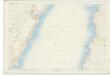
Argyll and Bute, Sheet CIV.16 (Kilfinichen) - OS 25 Inch map
1 : 2500 Topographic maps Ordnance Survey Ordnance Survey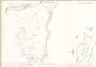
Argyll, Sheet 104.12 - 25 Inch Map
1 : 2500 Topographic maps Ordnance Survey Ordnance Survey
Argyll and Bute, Sheet CIV.12 (Kilfinichen) - OS 25 Inch map
1 : 2500 Topographic maps Ordnance Survey Ordnance Survey
Argyll, Sheet 104.16 - 25 Inch Map
1 : 2500 Topographic maps Ordnance Survey Ordnance Survey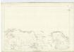
Argyllshire, Sheet CV - OS 6 Inch map
1 : 10560 Topographic maps Ordnance Survey Ordnance Survey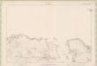
Argyll and Bute Sheet CV - OS 6 Inch map
1 : 10560 Topographic maps Ordnance Survey Ordnance Survey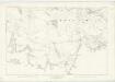
Argyllshire, Sheet CXVII - OS 6 Inch map
1 : 10560 Topographic maps Ordnance Survey Ordnance Survey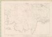
Argyll and Bute Sheet CXVII - OS 6 Inch map
1 : 10560 Topographic maps Ordnance Survey Ordnance Survey
Argyll, Sheet 105.14 - 25 Inch Map
1 : 2500 Topographic maps Ordnance Survey Ordnance Survey
Argyll and Bute, Sheet CV.14 (Kilfinichen) - OS 25 Inch map
1 : 2500 Topographic maps Ordnance Survey Ordnance Survey
Colonsay - Bartholomew's 'Survey Atlas of Scotland'
1 : 126720 Topographic maps John Bartholomew & Son, Ltd John Bartholomew & Son, Ltd
MVLA INSVLA, | quæ ex Æbudarum numero una est, | et Lochabriæ ad occasum prætenditur. | THE YLE OF MVL | whiche is one of the westerne Yles, | and lyeth ovir [!] against Lochabyr
Auct. Timoth. Pont. [Amsterdam : Joan Blaeu]
Iona and Colonsay - OS One-Inch Map
1 : 63360 Topographic maps Ordnance Survey Ordnance Survey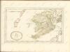

Ivra insvla
1 Karte : Kupferdruck ; 40 x 51 cm Blaeu; Pont Joan Blaeu
Iona - OS One-Inch map
1 : 63360 Topographic maps Ordnance Survey Ordnance Survey
Iona - OS One-Inch map
1 : 63360 Topographic maps Ordnance Survey Ordnance Survey
Iona - OS One-Inch map
1 : 63360 Topographic maps Ordnance Survey Ordnance Survey
Volume 1: Sheet 35 - Colonsay
1 : 63360 Farquharson, J.
Iona & Colonsay (59) - OS One-Inch map
1 : 63360 Topographic maps Ordnance Survey Ordnance Survey


