Maps of Bradford

Yorkshire CCXIV.16 (includes: Blackshaw; Heptonstall; Wadsworth) - 25 Inch Map
1 : 2500 Topographic maps Ordnance Survey Ordnance Survey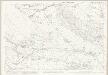
Yorkshire CCXIV.16 (includes: Blackshaw; Heptonstall; Wadsworth) - 25 Inch Map
1 : 2500 Topographic maps Ordnance Survey Ordnance Survey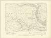
Yorkshire CCXIV.SE - OS Six-Inch Map
1 : 10560 Topographic maps Ordnance Survey Ordnance Survey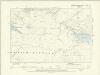
Yorkshire CCXIV.SE - OS Six-Inch Map
1 : 10560 Topographic maps Ordnance Survey Ordnance Survey
Lancashire LXV - OS Six-Inch Map
1 : 10560 Topographic maps Ordnance Survey Ordnance Survey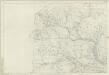
Yorkshire 214 - OS Six-Inch Map
1 : 10560 Topographic maps Ordnance Survey Ordnance Survey
SD92 - OS 1:25,000 Provisional Series Map
1 : 25000 Topographic maps Ordnance Survey Ordnance Survey
Estates in Yorkshire f. A
This is a survey of estates in Yorkshire by Christopher Saxton. Saxton is well known for his atlas of county maps of England and Wales published in 1579 under the patronage of Elizabeth I's Master of requests, Thomas Seckford. This atlas provided the most accurate and detailed image of Britain to date. Later in his career Saxton became an estate surveyor and by the late 1580's was established in this profession. Employed by land owning families and the courts he produced work for consideration during investigations and disputes over property matters. This map, dating from 1594, records the boundaries of adjacent manors. The depiction of hills in profile with shading on one side is typical of Saxton's work and can be seen in the printed maps of his atlas of England and Wales. The map bears Saxton's signature. A scale of miles and furlongs is included. Saxton, Christopher
The County of York Survey'd in MDCCLXVII, VIII, IX, and MDCCLXX
London : T. Jefferys
Blackburn and Burnley - OS One-Inch Map
1 : 63360 Topographic maps Ordnance Survey Ordnance Survey
A mineralogical and geological map of the coalfield of Lancashire with parts of Yorkshire, Cheshire & Derbyshire
1 : 90000 Hall, Elias Elias Hall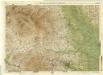
Harrogate, Sheet 6 - Bartholomew's "Half Inch to the Mile Maps" of England & Wales
1 : 126720 Topographic maps Bartholomew, John George John Bartholomew & Co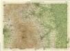
Sheffield, Sheet 9 - Bartholomew's "Half Inch to the Mile Maps" of England & Wales
1 : 126720 Topographic maps Bartholomew, John George John Bartholomew & Co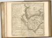
Sheets 49-50. (Cary's England, Wales, and Scotland).
1 : 360000 Cary, John, ca. 1754-1835
An accurate map of the county of Lancaster
1 Karte : Kupferdruck ; 67 x 51 cm Bowen; Hinton sold by I. Hinton at the Kings Arms in Newgate street

Lancashire
This map of Lancashire dates from 1598 and is by the cartographer and antiquarian William Smith. Smith was Rouge Dragon at the College of Heralds/College of Arms, an institution that specialised in genealogical work, increasingly more so during the Elizabethan age as the gentry class rose in importance. The Rouge Dragon is the name of one of the Pursuivants, a heraldic officer attendant on the heralds, often attached to a particular nobleman, named so because of their badges. The prominent coat of arms on this plan reveals Smith's heraldic interests. In 1588, Smith completed "The Particuler Description of England. With the portratures of certaine of the cheiffest citties & townes.1588". This work consisted of drawings of English cities and towns in a traditional birds eye view style, and drawings amalgamating bird's eye view and plan. In the years 1602-03, William Smith anonymously published maps of Chester, Essex, Hertfordshire Lancashire, (for which this may be preparatory work) Leicester, Norfolk, Northamptonshire, Staffordshire, Suffolk, Surrey, Warwickshire and Worcester. These were probably engraved in Amsterdam and were intended to form sheets of a new atlas. After the publication of Saxton’s county maps in the 1570s, cartographers attempted to improve on Saxton’s atlas and replicate its success. Unfortunately for Smith another cartographer, John Speed, was also preparing county maps at this time and competition proved too great, Speed being the victor. Here the ‘Countie stone’ is marked and labelled at the boundary point which separates Lancashire and Westmorland. A panel of text at bottom right provides a description of the County of Lancashire and Duchy of Lancaster. Smith, William
Lancastria palatinatvs anglis Lancaster [et] Lancas Shire
1 Karte : Kupferdruck ; 36 x 49 cm Valck; Schenk apud Gerardum Valk et Petrum Schenk
Lancastria palatinatvs anglis Lancaster et Lancas Shire
1 Karte : Kupferdruck ; 38 x 49 cm Blaeu Joan Blaeu
Dvcatvs Eboracensis pars occidentalis
1 Karte : Kupferdruck ; 39 x 47 cm Valck; Schenk venundantur â Gerardo Valk et Petro Schenk
Dvcatvs Eboracensis pars occidentalis
1 Karte : Kupferdruck ; 37 x 48 cm Blaeu Joan Blaeu
Lancastria Palatinatus anglis Lancaster & Lancas Shire
1 : 290000 Amstelodami : apud Joannem Janssonium
DVCATVS | EBORACENSIS | PARS OCCIDENTALIS; | THE WESTRIDING OF | YORKE SHIRE.
[Amsterdam : Joan Blaeu]
Central and Northern England. Pergamon World Atlas.
1 : 500000 Polish Army Topography Service
LANCASTRIA | PALATINATVS | Anglis | LANCASTER et | Lancas shire.
[Amsterdam : Joan Blaeu]
England and Wales 1:253,440
Ordnance Survey
LANCASTRIAE Comitatus Sheet 28
This map of Lancashire is from the 1583 edition of the Saxton atlas of England and Wales.This atlas was first published as a whole in 1579. It consists of 35 coloured maps depicting the counties of England and Wales. The atlas is of great significance to British cartography as it set a standard of cartographic representation in Britain and the maps remained the basis for English county mapping, with few exceptions, until after 1750. During the reign of Elizabeth I map use became more common, with many government matters referring to increasingly accurate maps with consistent scales and symbols, made possible by advances in surveying techniques. Illustrating the increasing used of maps in government matters, Lord Burghley, Elizabeth I’s Secretary of State, who had been determined to have England and Wales mapped in detail from the 1550s, selected the cartographer Christopher Saxton to produce a detailed and consistent survey of the country. The financier of the project was Thomas Seckford Master of Requests at the Court of Elizabeth I, whose arms appear, along with the royal crest, on each map. Saxton, Christopher Ryther, Augustine
Ordnance Survey of England and Wales (Aeronautical map)
Great Britain. War Office. General Staff. Geographical Section [London] : [Air Ministry],


