Maps of Bromley
Kent XV.4 (includes: Beckenham; Bromley) - 25 Inch Map
1 : 2500 Topographic maps Ordnance Survey Ordnance Survey
Kent XV.4 (includes: Beckenham; Bromley) - 25 Inch Map
1 : 2500 Topographic maps Ordnance Survey Ordnance Survey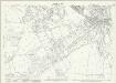
Kent XV.4 (includes: Beckenham; Bromley) - 25 Inch Map
1 : 2500 Topographic maps Ordnance Survey Ordnance Survey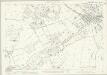
Kent XV.4 (includes: Beckenham; Bromley) - 25 Inch Map
1 : 2500 Topographic maps Ordnance Survey Ordnance Survey
London (Edition of 1894-96) CLII (includes: Beckenham) - 25 Inch Map
1 : 2500 Topographic maps Ordnance Survey Ordnance Survey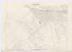
London XVI.63 - OS London Town Plan
1 : 1056 Topographic maps Ordnance Survey Ordnance Survey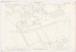
London XVI.62 - OS London Town Plan
1 : 1056 Topographic maps Ordnance Survey Ordnance Survey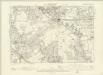
London XVI.SW - OS Six-Inch Map
1 : 10560 Topographic maps Ordnance Survey Ordnance Survey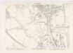
London XVI.53 - OS London Town Plan
1 : 1056 Topographic maps Ordnance Survey Ordnance Survey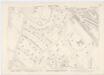
London XVI.52 - OS London Town Plan
1 : 1056 Topographic maps Ordnance Survey Ordnance Survey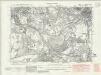
Kent XV.NE - OS Six-Inch Map
1 : 10560 Topographic maps Ordnance Survey Ordnance Survey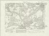
Kent XV.NE - OS Six-Inch Map
1 : 10560 Topographic maps Ordnance Survey Ordnance Survey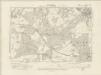
Kent XV.NE - OS Six-Inch Map
1 : 10560 Topographic maps Ordnance Survey Ordnance Survey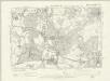
Kent XV.NE - OS Six-Inch Map
1 : 10560 Topographic maps Ordnance Survey Ordnance Survey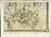
An exact survey of the city's of London Westminster , I
1 Blatt : 53 x 71 cm John Rocque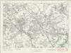
London Sheet T - OS Six-Inch Map
1 : 10560 Topographic maps Ordnance Survey Ordnance Survey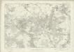
London Sheet T - OS Six-Inch Map
1 : 10560 Topographic maps Ordnance Survey Ordnance Survey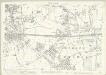
London (Edition of 1894-96) CLIII (includes: Bromley) - 25 Inch Map
1 : 2500 Topographic maps Ordnance Survey Ordnance Survey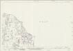
Surrey XIV.8 (includes: Beckenham; Croydon St John The Baptist) - 25 Inch Map
1 : 2500 Topographic maps Ordnance Survey Ordnance Survey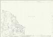
Surrey XIV.8 (includes: Beckenham; Croydon St John The Baptist) - 25 Inch Map
1 : 2500 Topographic maps Ordnance Survey Ordnance Survey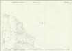
Surrey XIV.8 (includes: Beckenham; Croydon St John The Baptist) - 25 Inch Map
1 : 2500 Topographic maps Ordnance Survey Ordnance Survey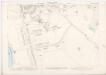
London XVI.51 - OS London Town Plan
1 : 1056 Topographic maps Ordnance Survey Ordnance Survey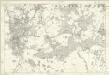
Kent XV - OS Six-Inch Map
1 : 10560 Topographic maps Ordnance Survey Ordnance Survey
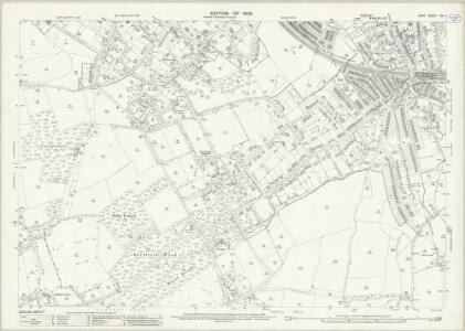
Bromley (Kent)
1 : 21120 Drawing showing the area around Bromley in Kent. Field boundaries enclosing cultivated land dominate this map of what is now south-east London. Such land is depicted by a striped pattern. Ruled dashed red lines also feature strongly. They radiate from trigonometrical stations used for measuring and plotting topographical features. The signalling telegraph station in Plow Garlic Hill at the top left of the plan marks the site of a trigonometrical station.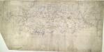
Eynsford (Kent)
This drawing, showing the area around Eynsford in Kent, is covered by a network of red rays, radiating from fixed points marking triangulation stations. These stations, usually sites of relative physical eminence, provided a framework within which to survey the topography of the land. On this plan, red lines radiate from the village church of Ash, marked by a red cross, and from an obelisk in Lullingstone Park. On the far left of the drawing, the word "flag" represents another triangulation point, from which the surveyor took angular measurements. Handwritten annotations at the bottom of the drawing refer to area measurements. There are some corrections in ink Pink, George
A topographical-map, of the county of Kent, 6
1 Blatt : 54 x 69 cm s.n.
A topographical-map, of the county of Kent, No. 1
1 Blatt : 54 x 69 cm A. Dury, W. Herbert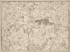
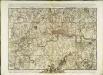
A New and Accurate Survey of the Country about the Cities of LONDON, and WESTMINSTER and the Borough of Southwark for 15 miles in Length & 12 in Depth
In the second half of the18th century, the introduction of turnpike roads and the increased coach-traffic in and out of London contributed to the popularity of the maps of the countryside around the capital. The title of this plan appears in cartouche at bottom centre, with a scale bar near bottom left and its border divided in degrees of latitude and longitude. Bennost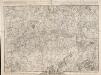
A PLAN of LONDON on the Same Scale as that of PARIS: In Order to ascertain the Difference of the extent of these two Rivals
The title of this plan appears in English and French along the top of the plate, along with the scale bars. The publisher’s imprint and dedication to John, Duke of Montague, feature below the plan. Allegorical figures are depicted at bottom centre holding the Duke's coat of arms. The border of the map is divided in degrees of longitude from the old meridian at St Paul's. Rocque, John