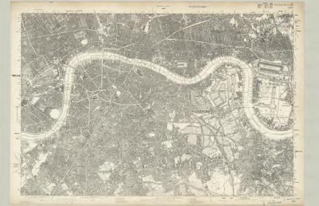
Maps of Southwark
Surrey III - OS Six-Inch Map
1 : 10560 Topographic maps Ordnance Survey Ordnance Survey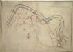
A colored plan, on vellum, of Southwark, and the country on the Surrey side of the Thames from Vauxhall to Deptford, with proposed roads from Westminster Bridge

Londini Angliae regni metropolis delineatio accuratissima / autore F. de Witt
1 : 13000 Wit, Frederik de Amsterdam : F. de Witt
To Martin Folkes esq.r, president of the Royal Society : this plan of the cities of London and Westminster and borough of Southwark, with the contiguous buildings is humbly inscribed
1 : 15000 Rocque, John, d. 1762 John Pine ; John Tinney, print and map sellar
London SE.
1 : 15840 Stanford, Edward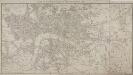
MAP of LONDON and its ENVIRONS 209
This later edition of Sherwood, Neely and Jones's 1813 original. The title appears along the top, with the publisher’s imprint and scale bar below the plan. The map shows Regents Park and the proposed new bridges at Vauxhall and Waterloo, with the Isle of Dogs and the East and West India Docks on an added sheet. Sherwood, Neely & Jones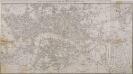
MAP of LONDON and its ENVIRONS 203
The title of this map appears along the top, with scale bar and imprint below the plan. It shows Regents Park and the proposed new bridges at Vauxhall and Waterloo, with the East and West India Docks in the Isle of Dogs added on a separate sheet. Sherwood, Neely & Jones
The London guide, or, a pocket plan of the cities of London & Westminster & borough of Southwak : with the new buildings &c. to the year 1767
Ellis, J. (John), fl. 1750-1800 Printed for Carington Bowles
[Kaart], uit: Payne's illustrated plan of London
1 : 15000 Annotatie: Met een gezicht op Londen en een gezicht op het parlementsgebouw Payne, A. H. Dresden [etc.] : A.H. Payne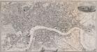
PAYNE'S ILLUSTRATED PLAN OF LONDON
Map of London with title inset in top border, general view of London at top right and view of the House of Parliament at bottom centre. The plan shows Hungerford suspension bridge, with the proposed Waterloo Bridge indicated by a pecked line. Payne, Albert Henry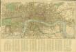
Reynolds’s Map of London with the latest improvements
Reynolds, James
LONDINI ANGLIAE REGNI METROPOLIS 70
The title of this map of London, Westminster and Southwark appears along the top. Figures of cherubs are depicted at top left facing the reference table at top right. The royal and city arms are illustrated at the foot of the plate, with a key to places in Southwark and compass rose at lower left, facing the portraits of King William III and Queen Mary at bottom right. The panorama of the city which features in the panel below the plan is based on Matthaeus Merian’s view published in "Theatrum Europeum" in 1720. Joannes de Ram had already published an identical map of the city. His name was removed from the plan when French mapmaker, engraver and publisher Jacques de la Feuille married de Ram’s widow and took over his publishing business. Feuille, Jacques de la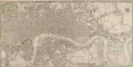
CRUCHLEY'S NEW PLAN OF LONDON IMPROVED TO 1826 INCLUDING THE EAST AND WEST INDIA DOCKS 223
The title of this folding map of London is inset in top border, with the publisher’s imprint and key to symbols in bottom border, scale bar near bottom right, and compass rose at top right. The river and open spaces are highlighted in colour. The map extends eastward on an added sheet to include the East and West India Docks. Cruchley, who first published the map in 1826, added the proposed Collier Docks in the Isle of Dogs to this later edition. The docks were never built and Millwall Docks now occupy part of the site Cruchley, George Frederick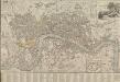
LONDON AND WESTMINSTER 1795
This is the second edition of a map published seven times until 1806. The title is embellished with an engraving of Father Thames, with St Paul's visible in the distance to one side of him. This edition includes an inset plan of the proposed Wet Docks. In 1796, the year this map was published, a Parliamentary Committee attempted to resolve the docking problems such as congestion, delays, lack of warehouse space and theft. The result was a number of project proposals for the building of new docks. However, none of these proposals were carried out, and the problem was not solved until private companies began building enclosed docks in 1802. Fairburn, John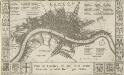
Plan de Londres tel quil Etoit avant l' incendre de 1666 Grave par Hollar
This is a later edition of a 1666map surveyed by Blome and engraved by Hollar. The title appears in French in a panel below the plan, with the key to streets and public buildings appearing in tables at top right, top left and bottom right. A compass star and scale bar are drawn at bottom right. Down both sides of the map are the coats of arms of the 12 Great City Companies (trade guilds), many of which have existed from the middle ages to the present day. Richard Blome was a heraldic writer and cartographer. His maps were often derivative, based on existing sources rather than original surveys. Blome, Richard
LONDINI ANGLIAE REGNI METROPOLIS 71
This map of London, Westminster and Southwark was issued in Peter Van der Aa's "La Galerie Agreable du Monde: Grande Bretagne et Irlande" (Vol. I, Plate 8). It is a later edition of a map first published in Amsterdam byJoannes de Ram at the end of the 17th Century. This edition features title along the top, a key to places in Southwark in cartouche at top left, a reference table at top right, and a bird's-eye view of Westwood Park in Worcestershire at the foot of the plate. The city arms, publisher's imprint, and a monument bearing the title in French appear towards the bottom of the sheet. Aa, Peter van der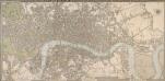
CRUCHLEY'S NEW PLAN OF LONDON IMPROVED TO 1826 INCLUDING THE EAST AND WEST INDIA DOCKS 226
The title of this folding map of London appears inset in the top border, with the publisher’s imprint and key to symbols in the bottom border, the scale bar near the bottom right, and a compass rose at the top right. The river and open spaces are distinguished in colour. The map extends eastward on an added sheet to include the Isle of Dogs and the East and West India Docks. Cruchley, George Frederick
Maps of Old London-J. Rocque
Mitton, Geraldine Edith
London surveyed or a new map of the cities of London and Westminster and the borough of Southwark. ...
from The world described, or, A new and correct sett of maps : shewing the kingdoms and states in all the known parts of the earth, with the principal cities, and most considerable towns in the world ... / ... by Herman Moll, geographer ...
PLAN of the Cities of LONDON and WESTMINSTER the Borough of SOUTHWARK and PARTS adjoining Shewing every HOUSE. By R. Horwood
Map of London printed in 32 sheets and published sheet by sheet between 1792 and 1799, the work of several engravers working to the direction of the cartographer Richard Horwood. Horwood dedicated this map to the Trustees and Directors of the Phoenix Fire Office, reflecting that the protection of London from fire was at this time the reserve of numerous independent company brigades. This edition features a Phoenix at top left with the word "protection" emblazoned beneath it and is uncoloured in its entirety. The Tower of London is shown only by outline, as Horwood records that "The Internal Parts not distinguished being refused permission to take the Survey", testimony that a surveyor was not always welcome. Industries such as brewing and tanning, unwelcome in the city, are located south of the river in Southwark. Barclay Perkins & Co., the largest brewery in the world during the 1800s, is marked on the map, as is Guy's Hospital (for incurables). At the time of this map, the hospital had recently been extended to include a new ward for "lunatics". This map was re-issued, with additions and alterations, at least four times until 1819. Horwood, Richard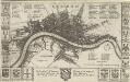
LONDON 45
This map is surveyed by Richard Blome, a heraldic writer and cartographer. Although prolific, he was something of a magpie, borrowing from many sources in the creation of his maps. Engraved by Hollar, this map is dedicated to Sir Robert Vyner, whose coat of arms is depicted at the bottom. The arms of the 12 Great City companies are drawn in the side margins. These companies were the trade guilds of London, many of which have existed from the middle ages to the present day. Hollar, Wenceslaus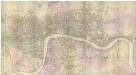
PLAN of the Cities of LONDON and WESTMINSTER the Borough of SOUTHWARK and PARTS adjoining Shewing every HOUSE. By R. Horwood.
This magnificent map covers 32 sheets, each measuring 21" 5/8 x 19" 3/4. It was published sheet by sheet between 1792 and99 and was the work of several engravers under the direction of cartographer Richard Horwood. It is generally considered to be the most important London map of the 18th century. Horwood intended originally to show every house and its number but this was to prove impossible. Although every house is included the numbering was never completed. Horwood dedicated this map to the Trustees and Directors of the Phoenix Fire Office, reflecting that the protection of London from fire was at this time the reserve of numerous independent company brigades. The map is coloured, describing parks in green and the London Wall in red. The Tower of London is shown only by outline; Horwood records that: 'The Internal Parts not distinguished being refused permission to take the Survey’, evidence that a surveyor was not always welcome. Southwark was traditionally a district where the industries of brewing and tanning, unwelcome in the main city, were located. Barclay Perkins & Cos., which in the coming century was to become the largest brewery in the world, is marked on the map, as is Guy's Hospital ("for incurables") which at had recently been extended to include a new hospital for the psychiatrically disturbed. This map was reissued at least four times, with relevant additions and alterations, up until 1819. Horwood, Richard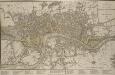
A NEW PLAN OF LONDON, WESTMINSTER AND SOUTHWARK 185
The title of this map appears at top right, with a compass rose and scale bar at bottom right. Below the plan is a list of public offices, with a special section dedicated to those at Somerset House. Designed by William Chambers, Somerset House was built in stages between 1771 and 1835, the first large block ever built to accommodate government offices. Over the years it has housed the Royal Navy, the Stamp Office, Hackney Coaches and Barge Master, the General Register of Births, Deaths and Marriages and the Inland Revenue. Laurie, Robert and Whittle, James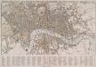
TEGG'S NEW PLAN OF LONDON, &c. WITH 360 REFERENCES TO THE PRINCIPAL STREETS &c.
The title of this folding map of London appears along the top. The city boundaries, open spaces, roads and watercourses are depicted in colour in colour. This is a later edition of a map first issued by Tegg in 1823. It is divided into rectangles for reference, with a street index in panel below the plan. Tegg, Thomas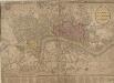
STRANGER'S GUIDE THROUGH the Streets of LONDON and WESTMINSTER
The title of this folding map appears along the top, with the sub-title in an oval at top right. A scale bar and compass star feature at the bottom right. An inset plan of Fleet Prison is included at top left. Squares, open spaces and built-up areas are all delineated in colour. Intended for visitors to the city, the map is divided into squares, with a quick-reference key in the panel below the main plan. Darton, William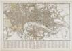
Tegg's new plan of London, &c.
T. Tegg
Charles Booth's descriptive map of London poverty 1889
Charles Booth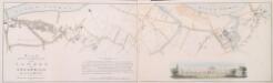
PLAN SHEWING THE PROPOSED LINE of the LONDON AND GREENWICH RAILWAY
1 : 7200 The title of this plan appears at bottom left, with an explanatory note and scale bar at bottom centre. An illustration of the general construction of the railway features at bottom right. The Greenwich line reached Bermondsey in 1836. A year later, it reached London Bridege, which became the first railway terminus in the capital. Wyld, James
PLAN DE LA VILLE DE LONDRES
This small map of London appeared in a book entitled "Memoires et Observations faites par un Voyageur en Angleterre", published in France by Henry Van Bulderen in 1698. The map is a much-reduced derivative of Joannes de Ram's plan of 1690. This edition features title at top left, city arms at top right and a panorama of London, based on Matthaeus Merian’s view of the city, in a panel below the plan. Ram, Joannes de