Maps of Northumberland
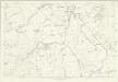
Northumberland XXV - OS Six-Inch Map
1 : 10560 Topographic maps Ordnance Survey Ordnance Survey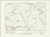
Northumberland nXXI.SE - OS Six-Inch Map
1 : 10560 Topographic maps Ordnance Survey Ordnance Survey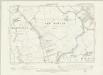
Northumberland XXV.SE - OS Six-Inch Map
1 : 10560 Topographic maps Ordnance Survey Ordnance Survey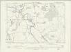
Northumberland XXV.NE - OS Six-Inch Map
1 : 10560 Topographic maps Ordnance Survey Ordnance Survey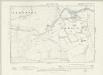
Northumberland XXV.SW - OS Six-Inch Map
1 : 10560 Topographic maps Ordnance Survey Ordnance Survey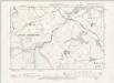
Northumberland XXV.NW - OS Six-Inch Map
1 : 10560 Topographic maps Ordnance Survey Ordnance Survey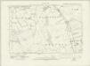
Northumberland nXXVII.NE - OS Six-Inch Map
1 : 10560 Topographic maps Ordnance Survey Ordnance Survey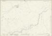
Northumberland (New Series) XXI.10 (includes: Ilderton; North Middleton; South Middleton) - 25 Inch Map
1 : 2500 Topographic maps Ordnance Survey Ordnance Survey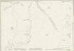
Northumberland (New Series) XXI.14 (includes: Ilderton; South Middleton) - 25 Inch Map
1 : 2500 Topographic maps Ordnance Survey Ordnance Survey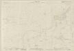
Northumberland (New Series) XXVII.2 (includes: Ilderton; Reaveley; Roddam) - 25 Inch Map
1 : 2500 Topographic maps Ordnance Survey Ordnance Survey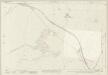
Northumberland (New Series) XXI.11 (includes: East Lilburn; Ilderton; Plea Piece; Roseden; West Lilburn) - 25 Inch Map
1 : 2500 Topographic maps Ordnance Survey Ordnance Survey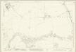
Northumberland (New Series) XXI.15 (includes: Ilderton; Roddam; Roseden; Wooperton) - 25 Inch Map
1 : 2500 Topographic maps Ordnance Survey Ordnance Survey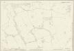
Northumberland (New Series) XXVII.3 (includes: Ilderton; Reaveley; Roddam; Wooperton) - 25 Inch Map
1 : 2500 Topographic maps Ordnance Survey Ordnance Survey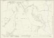
Northumberland (New Series) XXI.12 (includes: East Lilburn; Hepburn; Old Bewick; Roseden) - 25 Inch Map
1 : 2500 Topographic maps Ordnance Survey Ordnance Survey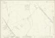
Northumberland (New Series) XXI.16 (includes: East Lilburn; New Bewick; Old Bewick; Roseden; Wooperton) - 25 Inch Map
1 : 2500 Topographic maps Ordnance Survey Ordnance Survey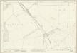
Northumberland (New Series) XXVII.4 (includes: Beanley; Brandon; Hedgeley; New Bewick; Wooperton) - 25 Inch Map
1 : 2500 Topographic maps Ordnance Survey Ordnance Survey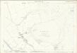
Northumberland (Old Series) XXV.8 (includes: New Bewick; Old Bewick) - 25 Inch Map
1 : 2500 Topographic maps Ordnance Survey Ordnance Survey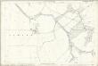
Northumberland (Old Series) XXV.12 (includes: Beanley; Eglingham; Harehope; New Bewick; Old Bewick) - 25 Inch Map
1 : 2500 Topographic maps Ordnance Survey Ordnance Survey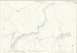
Northumberland (Old Series) XXV.16 (includes: Beanley; Hedgeley; New Bewick) - 25 Inch Map
1 : 2500 Topographic maps Ordnance Survey Ordnance Survey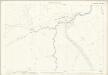
Northumberland (Old Series) XXV.5 (includes: Ilderton; South Middleton) - 25 Inch Map
1 : 2500 Topographic maps Ordnance Survey Ordnance Survey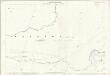
Northumberland (Old Series) XXV.9 (includes: Ilderton; Roddam) - 25 Inch Map
1 : 2500 Topographic maps Ordnance Survey Ordnance Survey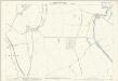
Northumberland (Old Series) XXV.7 (includes: East Lilburn; New Bewick; Old Bewick; Roseden; Wooperton) - 25 Inch Map
1 : 2500 Topographic maps Ordnance Survey Ordnance Survey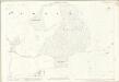
Northumberland (Old Series) XXV.4 (includes: Hepburn; Old Bewick) - 25 Inch Map
1 : 2500 Topographic maps Ordnance Survey Ordnance Survey
Northumberland (Old Series) XXV.13 (includes: Ilderton; Reaveley; Roddam) - 25 Inch Map
1 : 2500 Topographic maps Ordnance Survey Ordnance Survey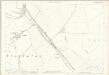
Northumberland (Old Series) XXV.11 (includes: Beanley; New Bewick; Roseden; Wooperton) - 25 Inch Map
1 : 2500 Topographic maps Ordnance Survey Ordnance Survey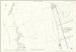
Northumberland (Old Series) XXV.15 (includes: Beanley; Brandon; Hedgeley; New Bewick; Reaveley; Wooperton) - 25 Inch Map
1 : 2500 Topographic maps Ordnance Survey Ordnance Survey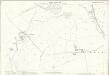
Northumberland (Old Series) XXV.6 (includes: East Lilburn; Ilderton; Plea Piece; Roseden; West Lilburn) - 25 Inch Map
1 : 2500 Topographic maps Ordnance Survey Ordnance Survey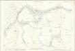
Northumberland (Old Series) XXV.10 (includes: Ilderton; Roddam; Roseden; Wooperton) - 25 Inch Map
1 : 2500 Topographic maps Ordnance Survey Ordnance Survey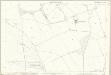
Northumberland (Old Series) XXV.14 (includes: Brandon; Reaveley; Roddam; Wooperton) - 25 Inch Map
1 : 2500 Topographic maps Ordnance Survey Ordnance Survey


