Maps of East Riding of Yorkshire
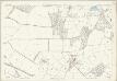
Yorkshire 158 - OS Six-Inch Map
1 : 10560 Topographic maps Ordnance Survey Ordnance Survey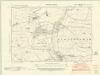
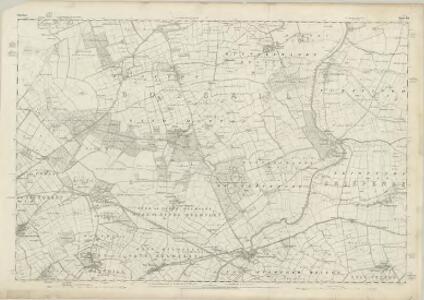
Yorkshire CLVIII.NE - OS Six-Inch Map
1 : 10560 Topographic maps Ordnance Survey Ordnance Survey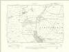
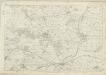
Yorkshire CLVIII.NE - OS Six-Inch Map
1 : 10560 Topographic maps Ordnance Survey Ordnance Survey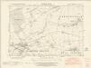
Yorkshire CLVIII.SE - OS Six-Inch Map
1 : 10560 Topographic maps Ordnance Survey Ordnance Survey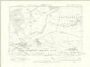
Yorkshire CLVIII.SE - OS Six-Inch Map
1 : 10560 Topographic maps Ordnance Survey Ordnance Survey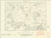
Yorkshire CLVIII.NW - OS Six-Inch Map
1 : 10560 Topographic maps Ordnance Survey Ordnance Survey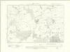
Yorkshire CLVIII.NW - OS Six-Inch Map
1 : 10560 Topographic maps Ordnance Survey Ordnance Survey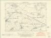
Yorkshire CLVIII.SW - OS Six-Inch Map
1 : 10560 Topographic maps Ordnance Survey Ordnance Survey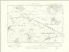
Yorkshire CLVIII.SW - OS Six-Inch Map
1 : 10560 Topographic maps Ordnance Survey Ordnance Survey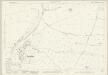
Yorkshire CLVIII.4 (includes: Bossall With Buttercrambe; Howsham; Scrayingham) - 25 Inch Map
1 : 2500 Topographic maps Ordnance Survey Ordnance Survey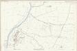
Yorkshire CLVIII.4 (includes: Bossall With Buttercrambe; Howsham; Scrayingham) - 25 Inch Map
1 : 2500 Topographic maps Ordnance Survey Ordnance Survey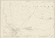
Yorkshire CLVIII.8 (includes: Bossall With Buttercrambe; Scrayingham; Skirpenbeck) - 25 Inch Map
1 : 2500 Topographic maps Ordnance Survey Ordnance Survey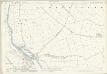
Yorkshire CLVIII.8 (includes: Bossall With Buttercrambe; Scrayingham; Skirpenbeck) - 25 Inch Map
1 : 2500 Topographic maps Ordnance Survey Ordnance Survey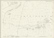
Yorkshire CLVIII.12 (includes: Bossall With Buttercrambe; Skirpenbeck) - 25 Inch Map
1 : 2500 Topographic maps Ordnance Survey Ordnance Survey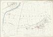
Yorkshire CLVIII.12 (includes: Bossall With Buttercrambe; Skirpenbeck) - 25 Inch Map
1 : 2500 Topographic maps Ordnance Survey Ordnance Survey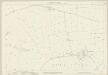
Yorkshire CLVIII.16 (includes: Bishop Wilton; Full Sutton; Skirpenbeck; Stamford Bridge) - 25 Inch Map
1 : 2500 Topographic maps Ordnance Survey Ordnance Survey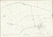
Yorkshire CLVIII.16 (includes: Bishop Wilton; Full Sutton; Skirpenbeck; Stamford Bridge) - 25 Inch Map
1 : 2500 Topographic maps Ordnance Survey Ordnance Survey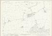
Yorkshire CLVIII.3 (includes: Bossall With Buttercrambe; Claxton; Harton; Sand Hutton) - 25 Inch Map
1 : 2500 Topographic maps Ordnance Survey Ordnance Survey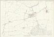
Yorkshire CLVIII.3 (includes: Bossall With Buttercrambe; Claxton; Harton; Sand Hutton) - 25 Inch Map
1 : 2500 Topographic maps Ordnance Survey Ordnance Survey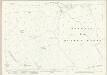
Yorkshire CLVIII.7 (includes: Bossall With Buttercrambe; Sand Hutton) - 25 Inch Map
1 : 2500 Topographic maps Ordnance Survey Ordnance Survey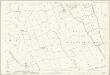
Yorkshire CLVIII.7 (includes: Bossall With Buttercrambe; Sand Hutton) - 25 Inch Map
1 : 2500 Topographic maps Ordnance Survey Ordnance Survey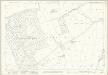
Yorkshire CLVIII.11 (includes: Bossall With Buttercrambe; Sand Hutton; Skirpenbeck; Upper Helmsley) - 25 Inch Map
1 : 2500 Topographic maps Ordnance Survey Ordnance Survey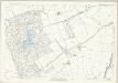
Yorkshire CLVIII.11 (includes: Bossall With Buttercrambe; Sand Hutton; Skirpenbeck; Upper Helmsley) - 25 Inch Map
1 : 2500 Topographic maps Ordnance Survey Ordnance Survey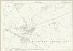
Yorkshire CLVIII.15 (includes: Bossall With Buttercrambe; Catton; Gate Helmsley; Kexby; Skirpenbeck; Stamford Bridge; Upper Helmsley) - 25 Inch Map
1 : 2500 Topographic maps Ordnance Survey Ordnance Survey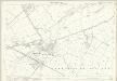
Yorkshire CLVIII.15 (includes: Bossall With Buttercrambe; Catton; Gate Helmsley; Kexby; Skirpenbeck; Stamford Bridge; Upper Helmsley) - 25 Inch Map
1 : 2500 Topographic maps Ordnance Survey Ordnance Survey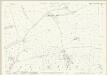
Yorkshire CLVIII.2 (includes: Claxton; Harton; Sand Hutton) - 25 Inch Map
1 : 2500 Topographic maps Ordnance Survey Ordnance Survey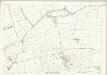
Yorkshire CLVIII.2 (includes: Claxton; Harton; Sand Hutton) - 25 Inch Map
1 : 2500 Topographic maps Ordnance Survey Ordnance Survey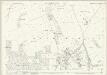
Yorkshire CLVIII.6 (includes: Claxton; Sand Hutton) - 25 Inch Map
1 : 2500 Topographic maps Ordnance Survey Ordnance Survey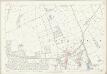
Yorkshire CLVIII.6 (includes: Claxton; Sand Hutton) - 25 Inch Map
1 : 2500 Topographic maps Ordnance Survey Ordnance Survey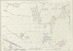
Yorkshire CLVIII.10 (includes: Bossall With Buttercrambe; Sand Hutton; Upper Helmsley; Warthill) - 25 Inch Map
1 : 2500 Topographic maps Ordnance Survey Ordnance Survey