Maps of Bridgend
Glamorgan XLIV - OS Six-Inch Map
1 : 10560 Topographic maps Ordnance Survey Ordnance Survey
Glamorgan XLIV - OS Six-Inch Map
1 : 10560 Topographic maps Ordnance Survey Ordnance Survey
Glamorgan XLIV - OS Six-Inch Map
1 : 10560 Topographic maps Ordnance Survey Ordnance Survey
Glamorgan XLIV - OS Six-Inch Map
1 : 10560 Topographic maps Ordnance Survey Ordnance Survey
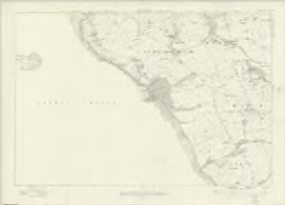
Glamorgan XLIV.NW - OS Six-Inch Map
1 : 10560 Topographic maps Ordnance Survey Ordnance Survey
Glamorgan XLIV.SW & SE - OS Six-Inch Map
1 : 10560 Topographic maps Ordnance Survey Ordnance Survey
Glamorgan XLIV.NE - OS Six-Inch Map
1 : 10560 Topographic maps Ordnance Survey Ordnance Survey
Glamorgan XLIV.10 & 11 (includes: St Brides Major; Wick; Yr As Fawr) - 25 Inch Map
1 : 2500 Topographic maps Ordnance Survey Ordnance Survey
Glamorgan XLIV.1 (includes: Merthyr Mawr; St Brides Major) - 25 Inch Map
1 : 2500 Topographic maps Ordnance Survey Ordnance Survey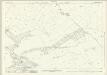
Glamorgan XLIV.7 (includes: St Brides Major) - 25 Inch Map
1 : 2500 Topographic maps Ordnance Survey Ordnance Survey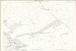
Glamorgan XLIV.7 (includes: St Brides Major) - 25 Inch Map
1 : 2500 Topographic maps Ordnance Survey Ordnance Survey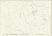
Glamorgan XLIV.8 (includes: St and rews Minor; St Brides Major; Wick) - 25 Inch Map
1 : 2500 Topographic maps Ordnance Survey Ordnance Survey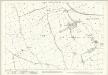
Glamorgan XLIV.8 (includes: St and rews Minor; St Brides Major; Wick) - 25 Inch Map
1 : 2500 Topographic maps Ordnance Survey Ordnance Survey
Glamorgan XLIV.8 (includes: St and rews Minor; St Brides Major; Wick) - 25 Inch Map
1 : 2500 Topographic maps Ordnance Survey Ordnance Survey
Glamorgan XLIV.10 & 11 (includes: St Brides Major; Wick; Yr As Fawr) - 25 Inch Map
1 : 2500 Topographic maps Ordnance Survey Ordnance Survey
Glamorgan XLIV.12 (includes: Llandw; St Brides Major; Wick; Yr As Fawr) - 25 Inch Map
1 : 2500 Topographic maps Ordnance Survey Ordnance Survey
Glamorgan XLIV.12 (includes: Llandw; St Brides Major; Wick; Yr As Fawr) - 25 Inch Map
1 : 2500 Topographic maps Ordnance Survey Ordnance Survey
Glamorgan XLIV.16 (includes: Marcroes; Wick; Yr As Fawr) - 25 Inch Map
1 : 2500 Topographic maps Ordnance Survey Ordnance Survey
Glamorgan XLIV.16 (includes: Marcroes; Wick; Yr As Fawr) - 25 Inch Map
1 : 2500 Topographic maps Ordnance Survey Ordnance Survey
Glamorgan XLIV.3 (includes: Ewenni; St Brides Major) - 25 Inch Map
1 : 2500 Topographic maps Ordnance Survey Ordnance Survey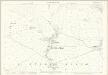
Glamorgan XLIV.3 (includes: Ewenni; St Brides Major) - 25 Inch Map
1 : 2500 Topographic maps Ordnance Survey Ordnance Survey
Glamorgan XLIV.4 (includes: Colwinston; Ewenni; St Brides Major) - 25 Inch Map
1 : 2500 Topographic maps Ordnance Survey Ordnance Survey
Glamorgan XLIV.4 (includes: Colwinston; Ewenni; St Brides Major) - 25 Inch Map
1 : 2500 Topographic maps Ordnance Survey Ordnance Survey
Pontypridd (Hills) - OS One-Inch Revised New Series
1 : 63360 Topographic maps Ordnance Survey Ordnance Survey
Pontypridd (Outline) - OS One-Inch Revised New Series
1 : 63360 Topographic maps Ordnance Survey Ordnance Survey
SS97 - OS 1:25,000 Provisional Series Map
1 : 25000 Topographic maps Ordnance Survey Ordnance Survey
Bridgend
1 : 31680 Thomas Budgen, who worked on the majority of the Welsh plans, is probably the author of this drawing of part of Glamorgan. Following military convention, Mynydd Maendy, Mynydd Llangeinwyr and other reliefs to the north of Bridgens are represented by dense hachuring (interlining)graduating to lighter bands towards the summits. Commons, broken mountainland and upland moors are represented by open dotting. In the lower part of the sheet, field boundaries indicate agricultural land. Budgen, Thomas
Glamorganensis comitatvs; vulgo Glamorgan Shire
1 Karte : Kupferdruck ; 37 x 49 cm Blaeu Joan Blaeu
Cary's Improved Map of England and Wales
Cary, George, & Cary, John London : G. & J. Cary