Maps of Northumberland
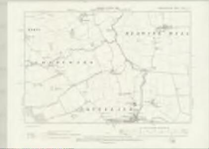
Northumberland LXXIX.SE - OS Six-Inch Map
1 : 10560 Topographic maps Ordnance Survey Ordnance Survey
Northumberland (Old Series) LXXIX.12 (includes: Berwick Hill; Coldcoats; Kirkley; Ponteland) - 25 Inch Map
1 : 2500 Topographic maps Ordnance Survey Ordnance Survey
Northumberland (Old Series) LXXIX.16 (includes: Berwick Hill; Little Callerton; Ponteland; Prestwick) - 25 Inch Map
1 : 2500 Topographic maps Ordnance Survey Ordnance Survey
Northumberland (Old Series) LXXIX.11 (includes: Coldcoats; Higham Dykes; Kirkley; Ponteland) - 25 Inch Map
1 : 2500 Topographic maps Ordnance Survey Ordnance Survey
Northumberland (Old Series) LXXIX.15 (includes: Coldcoats; Milbourne; North Dissington; Ponteland) - 25 Inch Map
1 : 2500 Topographic maps Ordnance Survey Ordnance Survey
Northumberland (New Series) LXXXIV.4 (includes: Berwick Hill; Coldcoats; Higham Dykes; Ponteland) - 25 Inch Map
1 : 2500 Topographic maps Ordnance Survey Ordnance Survey
Northumberland (New Series) LXXXV.1 (includes: Berwick Hill; Horton Grange; Ponteland; Prestwick) - 25 Inch Map
1 : 2500 Topographic maps Ordnance Survey Ordnance Survey
Northumberland (New Series) LXXXIV.8 (includes: Coldcoats; Little Callerton; North Dissington; Ponteland; South Dissington) - 25 Inch Map
1 : 2500 Topographic maps Ordnance Survey Ordnance Survey
Northumberland LXXIX - OS Six-Inch Map
1 : 10560 Topographic maps Ordnance Survey Ordnance Survey
Northumberland nLXXXV.NW - OS Six-Inch Map
1 : 10560 Topographic maps Ordnance Survey Ordnance Survey
Northumberland nLXXXV.NW - OS Six-Inch Map
1 : 10560 Topographic maps Ordnance Survey Ordnance Survey
Northumberland (New Series) LXXXV.5 (includes: Dinnington; High Callerton; Horton Grange; Little Callerton; Ponteland; Prestwick) - 25 Inch Map
1 : 2500 Topographic maps Ordnance Survey Ordnance Survey
Northumberland (New Series) LXXVI.16 (includes: Berwick Hill; Coldcoats; Higham Dykes; Kirkley) - 25 Inch Map
1 : 2500 Topographic maps Ordnance Survey Ordnance Survey
Northumberland (New Series) LXXVII.13 (includes: Berwick Hill; Horton Grange; Kirkley) - 25 Inch Map
1 : 2500 Topographic maps Ordnance Survey Ordnance Survey
NZ17 - OS 1:25,000 Provisional Series Map
1 : 25000 Topographic maps Ordnance Survey Ordnance Survey
Northumberland nLXXXIV - OS Six-Inch Map
1 : 10560 Topographic maps Ordnance Survey Ordnance Survey
Northumberland nLXXXV - OS Six-Inch Map
1 : 10560 Topographic maps Ordnance Survey Ordnance Survey
Northumberland nLXXVII.SW - OS Six-Inch Map
1 : 10560 Topographic maps Ordnance Survey Ordnance Survey
Northumberland (New Series) LXXXIV.3 (includes: Coldcoats; Higham Dykes; Milbourne Grange; Milbourne) - 25 Inch Map
1 : 2500 Topographic maps Ordnance Survey Ordnance Survey
Northumberland (New Series) LXXXIV.7 (includes: Coldcoats; Milbourne; North Dissington; Ponteland; South Dissington) - 25 Inch Map
1 : 2500 Topographic maps Ordnance Survey Ordnance Survey
Northumberland (New Series) LXXVI.15 (includes: Higham Dykes; Kirkley; Milbourne Grange; Milbourne; Newham) - 25 Inch Map
1 : 2500 Topographic maps Ordnance Survey Ordnance Survey
Morpeth (Hills) - OS One-Inch Revised New Series
1 : 63360 Topographic maps Ordnance Survey Ordnance Survey
Morpeth (Outline) - OS One-Inch Revised New Series
1 : 63360 Topographic maps Ordnance Survey Ordnance Survey
Newcastle Upon Tyne - OS One-Inch Map
1 : 63360 Topographic maps Ordnance Survey Ordnance Survey
An accurate map of the county palatine of Durham
1 Karte : Kupferdruck ; 50 x 66 cm Kitchin; Hinton printed for J. Hinton at the Kings Arms in St. Pauls Church Yard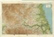
Northumberland, South, Sheet 2 - Bartholomew's "Half Inch to the Mile Maps" of England & Wales
1 : 126720 Topographic maps Bartholomew, John George John Bartholomew & Co
Episcopatvs Dvnelmensis vulgo the bishoprike of Dvrham
1 Karte : Kupferdruck ; 36 x 48 cm Blaeu Joan Blaeu
EPISCOPATVS | DVNELMENSIS. | Vulgo | The Bishoprike of | DVRHAM.
[Amsterdam : Joan Blaeu]
Episcopatus Dunelmensis vulgo the Bishoprike of Durham
1 : 200000 Amstelodami : apud Joannem Janssonium