Maps of Kreis Siegen-Wittgenstein

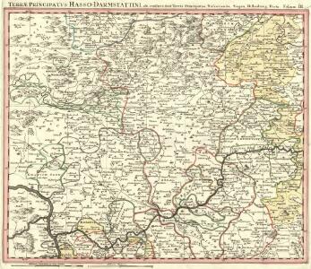
Delineatio Geographica generalis comprehendens VI. Foliis Singulos Principatvs Comitatvs Ditiones Dynastias omnes quotquot Imperio Serenissimi Principis Landgrafii Hasso-Darmstadiensis subsunt :
1 : 180000 Mollova mapová sbírka Bronner, Christian Maximilian Homann, Johann Baptista - dědici
Meßtischblatt 2980 : Eibelshausen, 1891
1 : 250000 Eibelshausen. - Aufn. 1889. - 1:25000. - [Berlin]: Kgl. Preuss. Landesaufnahme, 1891. - 1 Kt.
Meßtischblatt 279 : Bergebersbach, 1899
1 : 250000 Bergebersbach. - Aufn. 1897. - 1:25000. - [Berlin]: Kgl. Preuss. Landesaufnahme, 1899. - 1 Kt.
Meßtischblatt 1 : Rittershausen, 1877
1 : 250000 Rittershausen. - Aufn. 1868. - 1:25000. - [Berlin]: Kgl. Preuss. Landesaufnahme, 1877. - 1 Kt.
Meßtischblatt 2977 : Freudenberg, 1899
1 : 250000 Freudenberg. - Aufn. 1897, hrsg. 1899. - 1:25000. - [Berlin]: Kgl. Preuss. Landesaufnahme, 1899. - 1 Kt.
Meßtischblatt 2978 : Siegen, 1899
1 : 250000 Siegen. - Aufn. 1897. - 1:25000. - [Berlin]: Kgl. Preuss. Landesaufnahme, 1899. - 1 Kt.
Meßtischblatt 2976 : Morsbach, 1896
1 : 250000 Morsbach. - Aufn. 1894. - 1:25000. - [Berlin]: Kgl. Preuss. Landesaufnahme, 1896. - 1 Kt.
Meßtischblatt 5016 : Laasphe, 1945
1 : 250000 Laasphe. - Hrsg. 1908, einzelne Nachtr. 1937. - 1:25000. - [Berlin]: Reichsamt für Landesaufnahme, 1945. - 1 Kt.
Meßtischblatt 2916 : Erndtebrück, 1899
1 : 250000 Erndtebrück. - Aufn. 1897. - 1:25000. - [Berlin]: Reichsamt für Landesaufnahme, 1899. - 1 Kt.
Meßtischblatt 2914 : Wenden, 1898
1 : 250000 Wenden. - Aufn. 1897. - 1:25000. - [Berlin]: Reichsamt für Landesaufnahme, 1898. - 1 Kt.
Meßtischblatt 2915 : Hilchenbach, 1899
1 : 250000 Hilchenbach. - Aufn. 1897. - 1:25000. - [Berlin]: Reichsamt für Landesaufnahme, 1899. - 1 Kt.
Meßtischblatt 2912 : Eckenhagen, 1896
1 : 250000 Eckenhagen. - Aufn. 1894. - 1:25000. - [Berlin]: Reichsamt für Landesaufnahme, 1896. - 1 Kt.
Meßtischblatt 2975 : Waldbröl, 1896
1 : 250000 Waldbröl. - Aufn. 1894. - 1:25000. - [Berlin]: Kgl. Preuss. Landesaufnahme, 1896. - 1 Kt.
Meßtischblatt 2912 : Wiehl, 1896
1 : 250000 Wiehl. - Aufn. 1894. - 1:25000. - [Berlin]: Reichsamt für Landesaufnahme, 1896. - 1 Kt.
Meßtischblatt 3043 : Oberscheld, 1911
1 : 250000 Oberscheld. - Aufn. 1889, hrsg. 1891, bericht. 1911. - 1:25000. - [Berlin]: Kgl. Preuss. Landesaufnahme, 1911. - 1 Kt.
Meßtischblatt 3043 : Ober- Scheld, 1891
1 : 250000 Ober- Scheld. - Aufn. 1889. - 1:25000. - [Berlin]: Kgl. Preuss. Landesaufnahme, 1891. - 1 Kt.
Meßtischblatt [5216 = 3043 =] 7 : Tringenstein, 1877
1 : 250000 Tringenstein. - Aufn. 1868. - 1:25000. - [Berlin]: Kgl. Preuss. Ministerium f. Handel, 1877. - 1 Kt.
Meßtischblatt 3042 : Dillenburg, 1915
1 : 250000 Dillenburg. - Aufn. 1898, hrsg. 1900, Aufl.-dr. 1915. - 1:25000. - [Berlin]: Reichsamt für Landesaufnahme, 1915. - 1 Kt.
Meßtischblatt 3042 : Dillenburg, 1900
1 : 250000 Dillenburg. - Aufn. 1868. - 1:25000. - [Berlin]: Kgl. Preuss. Landesaufnahme, 1900. - 1 Kt.
Meßtischblatt [5215 = 3042 =] 6 : Dillenburg, 1877
1 : 250000 Dillenburg. - Aufn. 1868. - 1:25000. - [Berlin]: Kgl. Preuss. Ministerium f. Handel, 1877. - 1 Kt.
Meßtischblatt 5 : Wildenstein, 1877
1 : 250000 Wildenstein. - Aufn. 1868. - 1:25000. - [Berlin]: Kgl. Preuss. Ministerium f. Handel, 1877. - 1 Kt.
Meßtischblatt 3040 : Betzdorf, 1901
1 : 250000 Betzdorf. - Aufn. 1897/99. - 1:25000. - [Berlin]: Reichsamt für Landesaufnahme, 1901. - 1 Kt.
Meßtischblatt 4 : Langenbach, 1877
1 : 250000 Langenbach. - Aufn. 1868. - 1:25000. - [Berlin]: Kgl. Preuss. Ministerium f. Handel, 1877. - 1 Kt.
Meßtischblatt 3039 : Heimborn, 1877
1 : 250000 Heimborn. - Aufn. 1868. - 1:25000. - [Berlin]: Kgl. Preuss. Landesaufnahme, 1877. - 1 Kt.
Meßtischblatt 3038 : Weyerbusch, 1901
1 : 250000 Weyerbusch. - Aufn. 1894/99, hrsg. 1901. - 1:25000. - [Berlin]: Kgl. Preuss. Landesaufnahme, 1901. - 1 Kt.
Wetzlar 85, uit: Special-Karte von Mittel-Europa / nach amtlichen Quellen bearbeitet von W. Liebenow
1 : 300000 titelvariant: W. Liebenow's Mittel-Europa; Annotatie: Titel boven de bladen: W. Liebenow's Mittel-Europa Johannes Wilhelm Liebenow 1822-1897 Frankfurt a. M. : Ludwig Ravenstein
Wetzlar 85, uit: [W. Liebenow's Special-Karte von Mittel-Europa]
1 : 300000 titelvariant: W. Liebenow's Mittel-Europa; Annotatie: Titel boven de bladen: W. Liebenow's Mittel-Europa Johannes Wilhelm Liebenow 1822-1897 Hannover : Hermann Oppermann
124. Siegen, uit: Topographische Uebersichtskarte des Deutschen Reiches / herausgegeben v. d. Kartogr. Abt. d. Königl. Preuß. Landesaufnahme
1 : 200000 titelvariant: Topogr. Übersichtskarte des Deutschen Reiches; Annotatie: Titel boven bladen ook: Topogr. Übersichtskarte des Deutschen Reiches; Annotatie geografische gegevens: Op elk blad twee maatstokken: 10 Kilometer = 5,5 cm; 1 geogr. Meile = 3,6 cm; Legenda onder op elk blad Königlich Preußische Landesaufnahme. Kartographische Abtheilung [S.l : Königlich Preußische Landesaufnahme, Kartographische Abtheilung]
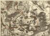
Neue Topographische Carte Der Sieg und Agger von ihrem Ursprunge bis zu ihrem Einflus in den Rhein mit Bemerkung der in dieser Gegend vorgefallenen Kriegsbegebenheiten von 1795 und 1796
Brand, Peter; Schalck, Anna Maria; Coentgen, Georg Joseph Brand