Maps of Tatenberg

Tabula ichnographica Cellae ad Alleram Principum Luneburgensium quondam sedis calamo
1 : 2100 Mollova mapová sbírka Seutter, Matthäus Seutter, Matthäus
209. Amelinghausen. (Germany)
1 : 100000 Reichsamt fur Landesaufnahme
Entwurf des generalplanes für die stadtweiterung. Blatt 1
1 : 20000 Meyer, Andreas, fl. 1896 Photolithographie v. Strumper & Co.
Germany [Town plans of], Hamburg
Town plans of Germany, GSGS 4480. Great Britain. War Office. [London] : War Office
Meßtischblatt 1673 : Sülze, 1936
1 : 250000 Sülze. - Hrsg. 1901, einz. Nachtr. 1931, gedr. [19]36. - 1:25000. - [Berlin]: Reichsamt für Landesaufnahme, 1936. - 1 Kt.
Messtischblatt 1603 : Hermannsburg, 1901 Hermannsburg
1 : 250000 Hermannsburg. - Aufn. 1899. - 1:25000. - [Berlin]: Reichsamt für Landesaufnahme, 1901. - 1 Kt.
Meßtischblatt Munster
1 : 250000 Munster. - Aufn. 1899, bericht. 1920. - 1:25000. - [Berlin]: Reichsamt für Landesaufnahme, 1920. - 1 Kt.
Meßtischblatt 1459 : Breloh, 1926
1 : 250000 Breloh. - Aufn. 1899, bericht. 1926. - 1:25000. - [Berlin]: Reichsamt für Landesaufnahme, 1926. - 1 Kt.
Meßtischblatt 1379 : Evendorf, 1901
1 : 250000 Evendorf. - Aufn. 1899. - 1:25000. - [Berlin]: Reichsamt für Landesaufnahme, 1901. - 1 Kt.
Meßtischblatt 1298 : Garlstorf, 1901
1 : 250000 Garlstorf. - Aufn. 1878/99, hrsg. 1901. - 1:25000. - [Berlin]: Reichsamt für Landesaufnahme, 1901. - 1 Kt.
Meßtischblatt 1213 : Stelle, 1917
1 : 250000 Stelle. - Aufn. 1878, hrsg. 1880, Aufl.-Dr. 1917. - 1:25000. - [Berlin]: Reichsamt für Landesaufnahme, 1917. - 1 Kt.
Meßtischblatt 1122 : Allermöhe, 1933
1 : 250000 Allermöhe. - Hrsg. 1880/81, bericht. 1927, gedr. [19]33. - 1:25000. - [Berlin]: Reichsamt für Landesaufnahme, 1933. - 1 Kt.
Meßtischblatt 1030 : Wandsbek, 1927
1 : 250000 Wandsbek. - Aufn. 1878, bericht. 1927. - 1:25000. - [Berlin]: Reichsamt für Landesaufnahme, 1927. - 1 Kt.
Meßtischblatt 1030 : Wandsbek, 1917
1 : 250000 Wandsbek. - Aufn. 1878, hrsg. 1881, Auflagedr. 1917. - 1:25000. - [Berlin]: Reichsamt für Landesaufnahme, 1917. - 1 Kt.
Germany 1:25,000, Garlstorf
Germany 1:25,000 , Series GSGS 4414. Great Britain. War Office. [London] : War Office
Plan zur Veranschaulichung der Wasserversorgung Hamburg's, mit der Situation der projectirten Filtrations Anlage
1 : 20000 Strumper & Co.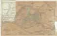
Plan von Hamburg mit seinen Vorstädten
1 : 12600 Hamburk (Německo) Grieben, Th. Th. Grieben
Plan von Hamburg
Hamburk (Německo) Georg Vigand's Verlag
Grosser Plan von Hamburg, Altona-Ottensen und Wandsbek
1 : 14000 Verl.-Anst. (vormals J. Richter)
Meßtischblatt 1745 : Celle, 1931
1 : 250000 Celle. - Hrsg. 1900, bericht. 1931. - 1:25000. - [Berlin]: Reichsamt für Landesaufnahme, 1931. - 1 Kt.
H. Carly's Bebauungs-Plan von Hamburg und sämtlichen Hamburgischen Vororten : nebst Plan von Altona-Ottensen, Wandsbeck und Umgebung sowie Plan von Hagenbecks Tierpark
Carly, H Druck und Verlag H. Carly (Inh. Oscar und Robert Enoch)
Plan zur Veranschaulichung der Sielsysteme der Stadt Hamburg
1 : 20000 Strumper & Co.
Prospect und Grundris der keiserl. freyen Reichs und Ansee Stadt Hamburg, samt ihrer Gegend
1 : 40000 Hamburk (Německo) Homann, Johann Baptist Ioh. Bapt. Homann
Prospect und Grundris der keiserl. freyen Reichs und Ansee Stadt Hamburg, samt ihrer Gegend
1 : 40700 Hamburk (Německo) Homann, Johann Baptist Ioh. Bapt. Homann
Meßtischblatt 934 : Bergstedt, 1931
1 : 250000 Bergstedt. - Hrsg. 1880, bericht. 1927, einz. Nachtr. 1931. - 1:25000. - [Berlin]: Reichsamt für Landesaufnahme, 1931. - 1 Kt.
[Recto], uit: Plan von Hamburg
1 : 20000 Hamburg : Fremdenverkehrsverein Hamburg [etc.]
[Recto], uit: Plan von Hamburg
1 : 10000 [Hamburg : Verein zur Förderung des Fremdenverkehrs]
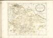
Ducatus Lunenburgensis in omnes ejusdem subjacentes praefecturas Nova descriptio
1 : 870000 Mollova mapová sbírka Danckerts, Justus Danckerts, Justus
Nova et accurata descriptio ducatus Bremae et Ferdae cum maxima parte finitimi ducatus Stormariensis et comitatus Oldenburgici, itemque fluminum Albis et Visurgis
1 : 336000 Brémy (Německo) Seutter, Matthäus sumptibus Matthaei Seutteri