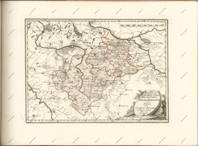
Maps of Masovian

[Polen]
1 : 800000 Polsko S. Hirzel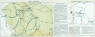
Nr. 13. Einfälle in Russisch-Polen
Polen Weltkrieg <1914-1918>
Zweite Offensive in Polen
1 : 4000000 Polen Feldzug, Weltkrieg <1914-1918>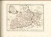

Bez titulu: Přehledná mapa střední Evropy

Warschau, Lublin, Modlin (Nowogeorgiewsk)
1 : 750000 Lublin (Polsko : oblast) Karl, E. K. u. k. Militärgeographisches Institut
Warschau, Lublin, Nowo-Georgiewsk
1 : 750000 Lublin (Polsko : oblast) K. k. militär-geographisches Institut
Übersichtskarte von Mittel - Europa

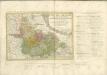
Posen, Glogau, Schweidnitz, Oppeln, Kalisz
1 : 750000 Głogów (Polsko : oblast) Geng, K. K. u. k. Militärgeographisches Institut
Posen, Glogau, Schweidnitz, Oppeln, Kalisz
1 : 750000 Głogów (Polsko : oblast) K. k. militär-geographisches Institut
Sect. 16: Posen, uit: Geologische Karte des Deutschen Reichs in 27 Blaettern / [von] Richard Lepsius ; Red. von C. Vogel
1 : 500000 Annotatie: Blad 18 ontbreekt; Een aantal bladen op linnen; Een aantal bladen gereviseerd 1913-1914; Annotatie geografische gegevens: Met schaalstokken o.a. in kilometers; Legenda Carl Vogel 1828-1897 Gotha : Justus Perthes
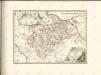
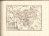
General-Carte von Westgallizien
1 : 291000 Polsko jihovýchodní Benedicti, Lucas
Militair- Commerzial- und Post-Strassen von Dresden nach Warschau
Drážďany (Německo)
Militair- Commerzial- und Post-Strassen von Dresden nach Warschau
Drážďany (Německo)
West-Galizien
Halič (Polsko a Ukrajina) Metzburg, Georg Ignaz von im Verlage des Kunst und Industrie Comptoirs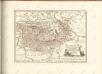


Dvcatvs Silesiae tabvla geographica prima, inferiorem eivs partem, seu novem principatvs, quorum insignia hic adjecta sunt, secundum statum recentissimum complectens
1 : 575000 Dolní Slezsko Hase, Johann Matthias Homannianos Heredes
Dvcatvs Silesiae tabvla geographica prima, inferiorem eivs partem, seu novem principatvs, quorum insignia hic adjecta sunt, secundum statum recentissimum complectens
1 : 575000 Dolní Slezsko Hase, Johann Matthias Homannianos Heredes
Dvcatvs Silesiae tabvla geographica prima, inferiorem eivs partem, seu novem principatvs, quorum insignia hic adjecta sunt, secundum statum recentissimum complectens
1 : 580000 Dolní Slezsko Hase, Johann Matthias curis Homann. Heredum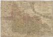
Dvcatvs Silesiae tabvla geographica prima, inferiorem eivs partem seu novem principatvs quorum insignia hic adjecta sunt, secundum statum recentissimum complectens
1 : 580000 Dolní Slezsko Hase, Johann Matthias curis Homann. Heredum
DVCATVS SILESIAE TABVLA GEOGRAPHICA PRIMA, INFERIOREM EIVS PARTEM, seu NOVEM PRINCIPATVS
1 : 600000 Dolní Slezsko Hase, Johann Matthias edita curis Homann. Heredum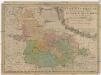
Dvcatvs Silesiae Tabvla Geographica Prima, inferiorem eivs partem, seu novem principatvs, quorum insignia hic adjecta sunt, secundum statum recentissimum complectens
1 : 580000 Dolní Slezsko Hase, Johann Matthias curis Homann. Heredum
DVCATVS SILESIAE TABVLA GEOGRAPHICA PRIMA, INFERIOREM EIVS PARTEM, seu NOVEM PRINCIPATVS
1 : 600000 Dolní Slezsko Hase, Johann Matthias edita curis Homann. Heredum
Dvcatvs Silesiae tabvla geographica prima, inferiorem eivs partem, seu novem principatvs, quorum insignia hic adjecta sunt, secundum statum recentissimum complectens
1 : 580000 Dolní Slezsko Hase, Johann Matthias curis Homann. Heredum
Dvcatvs Silesiae tabvla geographica prima, inferiorem eivs partem, seu novem principatvs, quorum insignia hic adjecta sunt, secundum statum recentissimum complectens
1 : 580000 Dolní Slezsko Hase, Johann Matthias curis Homann. Heredum