Maps of British Columbia


Facsimile: Arrowsmith's North America (northwestern portion).
1 : 7050000 Arrowsmith
Facsimile: U.S. Coast Survey Northwestern America (portion).
1 : 5000000 U.S. Coast Survey
Facsimile: Faden's Map North America (portion).
1 : 7280000 Faden, William, 1750?-1836
Facsimile: Canada (portion).
1 : 12400000 Johnston, J.
British Columbia
1 : 2450000
Facsimile: Arrowsmith's North America (portion).
1 : 4300000 Arrowsmith, Aaron
Facsimile: Pacific Ocean. Cook River to Gulf of California. British Admiralty Chart (portion).
1 : 4840000 British Admiralty
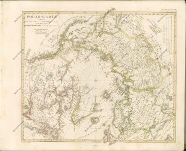
Nordamerika [Nebenkarte]
Nordamerika Alaska
Facsimile: British Columbia (portion).
1 : 5900000 Alaskan Boundary Tribunal
Facsimile: Map of the Province of British Columbia.
1 : 4539000 Mohun, Edward
Facsimile: Official British Columbia Map.
1 : 4500000 Selwyn, Alfred R.C.
Limits of forest trees
1 : 12500000 Kanada
Facsimile: Imray's North Pacific (portion).
Imray, James
Facsimile: Part of Map of British North America. Arrowsmith.
1 : 9750000 Arrowsmith, John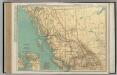
British Columbia.
1 : 2851000 Rand McNally and Company
British Columbia.
1 : 2408000 Rand McNally and Company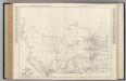
Alberta. British Columbia.
Rand McNally and Company
Facsimile: Western Canada (portion).
1 : 7600000 Olgilvie, Wm.
Facsimile: Pacific Ocean Eastern Part (portion), Cape Corrientes, Mexico to Kodiak Island..
1 : 4970000 (Canadian?) Hydrographic Office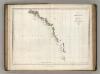
Chart of Part of the North West Coast of America.
1 : 2250000 La Perouse, Jean-Francois de Galaup, comte de, 1741-1788
Facsimile: Dawson's Canadian Map, 1887.
1 : 1900000 Dawson
Facsimile: British Columbia and Northwest Territory (portion).
1 : 5100000 Edward Stanford
Facsimile: U.S. Coast Survey Southeastern Alaska (portion).
1 : 2350000 Emmons, G.T.
Facsimile: U.S. Coast Survey Southeastern Alaska (portion).
1 : 2350000 U.S. Coast and Geodetic Survey
Facsimile: Western Canada (portion).
1 : 5900000 Johnston, T.B.
Facsimile: Southeastern Alaska with Four Boundary Lines.
1 : 2350000 U.S. Coast and Geodetic Survey
Facsimile: Southeastern Alaska.
1 : 2350000 U.S. Coast and Geodetic Survey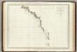
Cote N.O. de l'Amerique. 1.
1 : 3100000 La Perouse, Jean-Francois de Galaup, comte de, 1741-1788