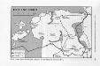
Maps of Baltic Plains


Livoniae et Curlandiae ducatus cum insulis adjacentib. mappa geographica
1 : 1900000 Estonsko Seutter, Matthäus Drentwett, Abraham per Matthaeum Seutter

DVCATVVM LIVONIAE et CVRLANDIAE cum vicinis Insulis Nova Exhibitio Geographica
1 : 917000 Estonsko Homann, Johann Baptist Ioh. Baptista Homanno
Dvcatvvm Livoniae et Cvrlandiae cum vicinis insulis nova exhibitio geographica
1 : 895000 Estonsko Homann, Johann Baptist Ioh. Baptista Homanno
Esthland, Livland, Kurland vom Frieden von Stenby 1238 bis zur Abtretung des Dänischen Theils von Esthland an den Deutschen Orden 1346
1 : 6000000 Baltikum
Topographische Charte von Liw-Laett u. Eestland zu Anfang des 13ten Jahrhunderts
Estonsko
Esthland, Livland, Kurland zur Zeit des Schwertordens 1201 - 1237
1 : 5000000 Baltikum Schwertbrüderorden
Esthland, Livland, Kurland 1480 bis 1682
1 : 6000000 Baltikum
Esthland, Livland, Kurland in den Jahren 1346 bis 1480
1 : 6000000 Baltikum
Esthland, Livland, Kurland nach ihren kirchlichen Verhältnissen im Mittelalter
1 : 6000000 Baltikum Kirchengeschichte
Estland, Lettland und Nordwestrußland
1 : 2500000 Estland, Lettland
Dvcatvvm Livoniæ et Cvrlandiæ cum vicinis insulis nova exhibitio geographica
1 Karte : Kupferdruck ; 47 x 56 cm Homann Johann Baptist Homann
Dvcatvvm Livoniæ et Cvrlandiæ cum vicinis insulis nova exhibitio geographica / editore Ioh. Baptis
1 : 910000 1 Karte : Kupferdruck ; 47 x 57 cm Homann, Johann Baptist [Johann Baptist Homann]
Tabula ducatuum Livoniae et Curlandiae
1 : 1000000 recentior incisa editaque per Gerardum Valck [Amsterdam] : per Gerardum Valck
Livonia vulgo Lÿefland
1 : 2200000 Mollova mapová sbírka Merian, Matthäus Merian, Matthäus - dědici
Ducatuum Livoniae et Curlandiae novissima tabula in quibus sunt Estonia Litlandia et aliae minores provinciae
1 : 970000 1 Karte : Kupferdruck ; 47 x 56 cm Danckerts, Justus [Danckerts]
Skizze des Vormarsches der 8. Armee in Livland und Estland
1 : 1050000 Baltikum Weltkrieg <1914-1918> Verl. Gerhard Stalling, Oldenburg
Übersichtskarte von Liv-, Est- und Kurland
1 : 1000000 Baltikum Weltkrieg <1914-1918> Verl. Gerhard Stalling, Oldenburg
Estland-Letland-Litauen
1 : 2200000 Den Haag : Kompas
Das Deutschtum II. 1.
Baltikum Ethnische Gruppe, Deutsche

Die Russischen Ost-See-Provinzen Livland Ehstland und Kurland
Grosser Hand-Atlas über alle Theile der Erde in 170 Karten Meyer, J. Verlag des Bibliographischen Instituts
Livonia
1 Karte : Kupferdruck ; 35 x 46 cm Mercator; Hondius sumptibus Henrici Hondij
Von Riga nach St. Petersburg
1 : 2600000 Baltikum
Russia Part lII.
1 : 1770000 Society for the Diffusion of Useful Knowledge (Great Britain)
Ost-See Provinzen.
1 : 1370000 Grassl, J. (Joseph)
Lettland
1 : 420000 Lotyšsko Endzelin, J. Karthographischen Institut A. Ošinš & P. Mantnieks
Latvija
1 : 300000 Lotyšsko Olava fonda izdevums