Maps of Záběhlice

Orientační plán hlavního města Prahy s okolím
1 : 5000
Výškopisný plán hlavního města Prahy s okolím

Zabiehlitz - c9001-1-001 - Kaiserpflichtexemplar der Landkarten des stabilen Katasters
1 : 2880
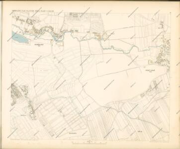
Zabiehlitz - c9001-1-002 - Kaiserpflichtexemplar der Landkarten des stabilen Katasters
1 : 2880
Zabiehlitz - c9001-1-005 - Kaiserpflichtexemplar der Landkarten des stabilen Katasters
1 : 2880
Zabiehlitz - c9001-1-004 - Kaiserpflichtexemplar der Landkarten des stabilen Katasters
1 : 2880
Zabiehlitz - c9001-1-003 - Kaiserpflichtexemplar der Landkarten des stabilen Katasters
1 : 2880
Auto-Praha : automobilní plán Velké Prahy a příručka pro automobilisty
1 : 50000
Orientační plán Prahy a obcí sousedních List 23.

Orientační plán král. Hl. města Prahy

Chodow - c2555-1-003 - Kaiserpflichtexemplar der Landkarten des stabilen Katasters
1 : 2880
Chodow - c2555-1-002 - Kaiserpflichtexemplar der Landkarten des stabilen Katasters
1 : 2880
Chodow - c2555-1-004 - Kaiserpflichtexemplar der Landkarten des stabilen Katasters
1 : 2880
Chodow - c2555-1-001 - Kaiserpflichtexemplar der Landkarten des stabilen Katasters
1 : 2880
Forstkarte der zum Universiteets-Gute Michle und Maleschitz gehörigen Waldstrecke Brzezina
1 : 2700 Praha (Česko) Oppel, Wenzl
Orientierungsplan der Hauptstadt Prag
Jiřík, Rudolf
Hostiwarz (Hostiwarze) - c2250-1-004 - Kaiserpflichtexemplar der Landkarten des stabilen Katasters
1 : 2880
Hostiwarz (Hostiwarze) - c2250-1-005 - Kaiserpflichtexemplar der Landkarten des stabilen Katasters
1 : 2880
Hostiwarz (Hostiwarze) - c2250-1-003 - Kaiserpflichtexemplar der Landkarten des stabilen Katasters
1 : 2880
Hostiwarz (Hostiwarze) - c2250-1-006 - Kaiserpflichtexemplar der Landkarten des stabilen Katasters
1 : 2880
Hostiwarz (Hostiwarze) - c2250-1-001 - Kaiserpflichtexemplar der Landkarten des stabilen Katasters
1 : 2880
Hostiwarz (Hostiwarze) - c2250-1-002 - Kaiserpflichtexemplar der Landkarten des stabilen Katasters
1 : 2880
Jižní Město. - Litochleby Orientační plán 3. souboru
1 : 2500
Mapa katastrálních obcí
1 : 14400 Nusle (Praha, Česko) Herold, Theofil
Orientační plán Hlavního města Prahy

Umgebung von Prag

Umgebung von Prag IV.

Veřejné dopravní prostředky hlavního města Prahy

Orientační plán hlavního města Prahy
Praha (Česko) Brož, Josef Stein, Carl Průmyslová tiskárna