Maps of Papua

Kaart van Nederlandsch Nieuw-Guinea en omliggende eilanden / Topographisch Bureau
Topographisch Bureau Batavia Batavia : Topographisch Bureau
Západní Irian

Nederlandsch-Nieuw-Guinee
Topographische Inrichting Batavia Batavia : Top[ographische] Inr[ichting]
Nederlands Nieuw-Guinea / [Netherlands Topographic Service]
Netherlands Topographic Service Delft [Delft : Netherlands Topographic Service]
Overzichtskaart van de Residentie Amboina en de Afdeeling Noord-Nieuw Guinea / samengesteld door het Encyclopaedisch Bureau [in] 1915
Encyclopaedisch Bureau Batavia Batavia : G. Kolff & Co.
Kaart van een gedeelte der zuid en zuidwest kust van Nieuw-Guinea : volgens de opnemingen gedaan door Zr. Ms. schepen Dourga, Triton, Sireen en Postillon tusschen de jaren 1826 en 1835 / zamengesteld door Salomon Müller
[S.l. : s.n.]
Kaart van Nederlandsch Nieuw Guinea en de Papoesche Eilanden
[S.l. : s.n.]
De Molukken of Specerij-Eilanden / gelith. door E. de Geest
Seyffardts Boekhandel Amsterdam Amsterdam : Seyffardts Boekhandel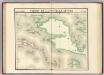
Partie, Nouvelle Guinee. Oceanique no. 22.
1 : 1641836 Vandermaelen, Philippe, 1795-1869
Geologische overzichtskaart van den Nederlandsch Oost-Indischen Archipel : Vogelkop / bewerkt door J. Zwierzycki
Landsdrukkerij Weltevreden (Batavia) [Weltevreden (Batavia) : Landsdrukkerij]
Aroe-Eilanden / samengesteld en gedrukt bij den Topografischen Dienst
Topografische Dienst Batavia Batavia : Topografische Dienst
Aroe Eilanden / U.S. Army Map Service
U.S. Army Map Service Washington D.C. Washington D.C. : U.S. Army Map Service
Geelvink-baai / samengesteld en gedrukt bij den Topografischen Dienst
Topografische Dienst Batavia Batavia : Topografische Dienst
Geelvinkbaai / U.S. Army Map Service
U.S. Army Map Service Washington D.C. Washington D.C. : U.S. Army Map Service
Bladwijzer van Eilanden Biak-Japen en Kuststrook Verkam-Hollandia
[S.l. : s.n.]
Geologische overzichtskaart van den Nederlandsch Oost-Indischen Archipel : Aroe-, Kei- en Tenimbereilanden / bewerkt door J. Zwierzycki
Landsdrukkerij Weltevreden (Batavia) [Weltevreden (Batavia) : Landsdrukkerij]
Schetskaartje van een gedeelte der Westkust van Nieuw Guinea / door W.F. Versteeg
Nederlandsch Aardrijkskundig Genootschap Amsterdam Amsterdam : C.L. Brinkman
[Deel van de onderafdeling Fak-Fak met zuidelijk deel van de Vogelkop] / prepared under the direction of the Chief Engineer by Base Map Plant U.S. Army
Corps of Engineers U.S. Army War Department Washington D.C. [Washington D.C.] : Corps of Engineers U.S. Army, War Department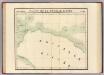
Partie, Nouvelle Guinee. Oceanique no. 23.
1 : 1641836 Vandermaelen, Philippe, 1795-1869
Bladwijzer van de Radja Ampat Groep
[S.l. : s.n.]
MacCluer-Golf
[S.l. : s.n.]
Geelvink Baai
[S.l. : s.n.]
Vogelkop
[S.l. : s.n.
Vogelkop
[S.l. : s.n.
Vogelkop
[S.l. : s.n.
Schetskaart van het Bomberai-Gebied
[Hollandia] : Kadaster en Katering
[Tanimbar]
[S.l. : s.n]
Noord-Jamdena / samengesteld door den Topografische Dienst (Kart[ografische] Afd[eling]) naar diverse gegevens
Topografische Dienst Batavia Batavia : Reproductieberijf Topografische Dienst
Bladwijzer van eilanden rondom Nieuw-Guinea
[S.l. : s.n.]


