Maps of Mojokerto

Kaart der landbouw-ondernemingen in Oost-Java : (Soerabaja, Kediri, Pasoeroean, Probolinggo en Besoeki) / bewerkt naar de oorspronkelijke teekeningen van den heer H.Ph.Th. Witkamp ; uitgave van J.H. de Bussy Amsterdam, 1892
Amsterdam : J.H. de Bussy
Kaart van Oost-Java : Derde militaire afdeeling / [door J.W Stemfoort en J.J. ten Siethoff ; gereproduceerd op last van het Departement van Koloniën, aan de Topographische Inrichting te 's-Gravenhage, onder leiding van den Directeur C.A. Eckstein]
Ministerie van Koloniën Den Haag s-Gravenhage : Departement van Koloniën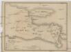
Vulkan Karte von Ost Java
1 : 1300000 Jáva (Indonésie)
Ost-Java
1 : 1000000 Schulze, F. [s.n.]
Oost Java = East Java / Reproductiebedrijf Top[ografische] Dienst, Batavia
Topografische Dienst Batavia Batavia : Officieële Vereeniging voor Toeristenverkeer in Nederlandsch Indië
Overzichtskaart van de Residentie Pasoeroean / Topographische Inrichting
Topographische Inrichting Batavia Batavia : Topographische Inrichting
Kaart der Residentiën Pasoeroean en Probolinggo / Topographisch Bureau te Batavia, November 1885
Topographisch Bureau Batavia Batavia : Topographisch Bureau
Kaart van de Residentie Kediri : opgenomen ingevolge Gouvernements besluit d.d. 6 juli nr.8 in de jaren 1869 t/m 1875 / Topographisch Bureau, Batavia
Topographisch Bureau Batavia Batavia : Topogr[aphisch] Bureau
Kaart van de Residentie Kediri / Topographisch Bureau te Batavia, 1891
Topographisch Bureau Batavia Batavia : Topographisch Bureau
Overzichtskaart van de Residentie Besoeki / Topographisch Bureau
Topographisch Bureau Batavia Batavia : Topographisch Bureau
Kaart der Residentie Besoeki / Topographisch Bureau te Batavia, april 1887
Topographisch Bureau Batavia Batavia : Topographisch Bureau
Overzichtskaart van de residentie Madioen / Topografische Inrichting
Topografische Inrichting Batavia Batavia : Topografische Inrichting
Kaart van de Residentie Soerabaja / Topographisch Bureau
Topographisch Bureau Batavia Batavia : Topographisch Bureau
Kaart van de Residentie Pasoeroean : opgenomen ingevolge Gouvernements Besluit d.d. 6 juli 1866 nr. 8 in de jaren 1874 t/m 1879 / Topographisch Bureau van de Generale Staf, Batavia
Topographisch Bureau van de Generale Staf Batavia [Batavia : Topographisch Bureau van de Generale Staf]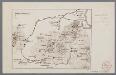
[Oudheden op Oost Java]
1 : 500000 Annotatie: Concept voor atlas van C. Lekkerkerker? [S.l. : s.n.]
Bondowoso / prepared under the direction of the Chief of Engineers, U.S. Army by the Army Map Service
Army Map Service Washington D.C. Washington D.C. : Army Map Service
Tengger-Semeroe-Kawi-Ardjoena / Topographical Service
Topographical Service Batavia Batavia : Topographical Service
Pasoeroean / prepared under the direction of the Chief of Engineers, U.S. Army by the Army Map Service
Army Map Service Washington D.C. Washington D.C. : Army Map Service
[Pasuruan]
1 : 200000 Joh. C. Stemler Cz.
[Probolinggo]
1 : 200000 Joh. C. Stemler Cz.
Kaart van de Residentie Probolingo op de schaal van 1:20.000 : opgenomen ingevolge Gouv[ernements] Besluit dd. 6 juli 1866 nr. 8 in de jaren 1875 t/m 1880 / Topographisch Bureau van den Generalen Staf, Batavia
Topographisch Bureau van den Generalen Staf Batavia [Batavia : Topographisch Bureau van den Generalen Staf]
Statistieke Overzichtskaart van het Zuid-Oostelijke gedeelte der Residentie Besoeki
['s-Gravenhage : Algemeene Landsdrukkerij]
Overzichtskaart rayon Kediri fabrieken
Soerabaja : [s.n.]
Oost Java Stoomtram Maatschappij : algemeene overzichtskaart / Oost Java Stoomtram Maatschappij, mei 1902
Oost Java Stoomtram Maatschappij [Soerabaja] : Oost Java Stoomtram Maatschappij
Oost Java Stoomtram Maatschappij : algemeene overzichtskaart / Oost Java Stoomtram Maatschappij
Oost Java Stoomtram Maatschappij [Soerabaja] : Oost Java Stoomtram Maatschappij
Overzichtskaart der spoor- en tramwegen in de omstreken van Modjokerto
[S.l.] : [s.n.]
Watervoorziening der stad Soerabaja : nieuw voorlopig ontwerp voor aanvoer van water uit de Kasribronnen
[S.l. : s.n.]
Madioen / prepared under the direction of the Chief of Engineers, U.S. Army by the Army Map Service
Army Map Service Washington D.C. Washington D.C. : Army Map Service
Overzichtskaart van de Residentie Soerabaja / Top[ographische] Inr[ichting]
Topographische Inrichting Batavia Batavia : Top[ographische] Inr[ichting]


