Maps of Bantul Regency

Platte grond van de hoofdplaats Jogjakarta : omstreeks 1830
[Batavia : Landsdrukkerij]
Situatie der Ommestreeken van Djocjakarta

Kaart Kraton Jogja

Kraton van Jogja

Plattegrond van den ganschen Benteng Kraton te Jogjakarta in zijn vollen omvang

Plattegrond van het noordelijk deel van het middenvak van de Kraton [van Djokjakarta]

Platte grond van de hoofdplaats Jogjakarta

Plattegrond van de Benteng Kraton en van de verdere Kota Jogjakarta

Vertooningh van de Provinciale Hofplaats van den Soesoehoenan Ingalaga genaamt Mataram of de Hoofdstad sijns Rijks rontom in plaats van muuren beslooten
Den Haag : Lankhout
Jogjakarta / published by Survey Production Centre S[outh] E[ast] Asia ; printed from Kodalines by 71 Rep[roduction] Sec[tion] R.E., June 1946
Survey Production Centre South East Asia [S.l.] : Survey Production Centre S[outh] E[ast] Asia
Kaart van de Hoofdplaats Djokjakarta en omstreken / Topogr[aphisch] Bur[eau]
Topographisch Bureau Batavia [Batavia] : Topogr[aphisch] Bur[eau]
Kaart van de afdeeling Mataram (Residentie Jogjakarta)

Residentie Jogjakarta

[Yogyakarta]
1 : 200000 Joh. C. Stemler Cz.
Overzichtskaart van de Residentie Djokjakarta / Topographische Inrichting
Topographische Inrichting Batavia Batavia : Topographische Inrichting
Jogjakarta / prepared under the direction of the Chief of Engineers, U.S. Army by the Army Map Service
Army Map Service Washington D.C. Washington D.C. : Army Map Service
Kaart van den spoorweg van Samarang naar de Vorstenlanden
Lang, Carl Semarang Samarang : [s.n.]
Overzichtskaart van de residentie Kÿæedoe / Topografische Inrichting
Topografische Inrichting Batavia Batavia : Topografische Inrichting
Zendin[g]s-terrein-gouv. Soerakarta van de Gereem. [sic] Kerken in Zuid-Holland ten Noorden
1 : 100000 Annotatie: Linksboven: schetskaart; Titel van de kaart in potlood; Annotatie geografische gegevens: Inzet: Java. - 1.5.000.000. - Toont locatie van de hoofdkaart [S.l. : s.n.]
Kaart van de Residentie Samarang = Gambaripoen siti ing Karesidenan Samarang / door H.Ph.Th. Witkamp = jasanipoen toewan H.Ph.Th. Witkamp ; Abdullah Mohamed Hamerodin del. ; R. Roobol en L.G. Kierdorff grav[ure], Maart 1886
Koninklijk Nederlandsch Aardrijkskundig Genootschap Amsterdam Leiden : E.J. Brill
Midden-Java = Middle Java / Reproductiebedrijf Top[ografische] Dienst, Batavia
Topografische Dienst Batavia Batavia : Officieële Vereeniging voor Toeristenverkeer in Nederlandsch Indië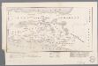
[Zendingskaart van Midden-Java]
1 : 750000 Annotatie: Uit: Sadrach's kring / L. Adriaanse. - Leiden : Donner, 1899 [Leiden : Donner]
Westelijk-gedeelte van het oorlogstooneel van den Java-Oorlog 1825-1830 / ontworpen door den Kapitein der Infanterie P.J.F. Louw
[Batavia : Landsdrukkerij]
Schetskaart der expeditie van Anthonio Hurdt in Java's binnenland
['s-Gravenhage : Martinus Nijhoff]
Semanoe / Survey of India
Survey of India [S.l.] : Survey of India
Semarang / Survey of India
Survey of India [S.l.] : Survey of India
Java
['s-Gravenhage : Martinus Nijhoff]
Kaart van een gedeelte van het Eiland Java : uitgemaakt hebbende het tooneel van den oorlog van 1825-1830 / door L.M. Lange. Majoor bij het Nederl[andsch] Ind[isch] Leger, Ridder der Militaire Willems Orde ; geteekend en op 61/4 verkleind door H. Hama, Gead. Landmeter

4. Midden Java, uit: Atlas van Nederlandsch Oost-Indië / samengest. door Topographisch Bureau te Batavia van 1897-1904
Annotatie: Omgewerkte versie van: Atlas der Nederlandsche bezittingen in Oost-Indië / naar de nieuste bronnen samengest. door J.W. Stemfoort en J.J. ten Siethoff. - 's-Gravenhage : Topographische Inrichting, [ca. 1885] Topographisch Bureau, Batavia 's-Gravenhage : Topographische Inrichting


