Maps of Pekanbaru

Pakanbaroe / published by War Office = uitgegeven door War Office ; revised and photolithographed by War Office
War Office Washington D.C. [Washington D.C.] : War Office
[Kotabatak] / opgenomen door den Topografischen Dienst in 1929-1931
Topografische Dienst Batavia Batavia : Reproductiebedrijf Topografische Dienst
[Segoempal] / opgenomen door den Topografischen Dienst in 1928-1930
Topografische Dienst Batavia Batavia : Reproductiebedrijf Topografische Dienst
[Pakanbaroe] / opgenomen door den Topografischen Dienst in 1927-1929
Topografische Dienst Batavia Batavia : Reproductiebedrijf Topografische Dienst
[Goenoengsahilan] / opgenomen door den Topografischen Dienst in 1927-1929
Topografische Dienst Batavia Batavia : Reproductiebedrijf Topografische Dienst
[Gasip] / opgenomen door den Topografischen Dienst in 1929-1930
Topografische Dienst Batavia Batavia : Reproductiebedrijf Topografische Dienst
[Langgam] / opgenomen door den Topografischen Dienst in 1930-1931
Topografische Dienst Batavia Batavia : Reproductiebedrijf Topografische Dienst
[Siak Sri Indrapoera] / opgenomen door den Topografischen Dienst in 1929-1930
Topografische Dienst Batavia Batavia : Reproductiebedrijf Topografische Dienst
[Doendang] / opgenomen door den Topografischen Dienst in 1930-1932
Topografische Dienst Batavia Batavia : Reproductiebedrijf Topografische Dienst
Kaart van een gedeelte der Siak-Rivier
Nederlandsch Aardrijkskundig Genootschap Amsterdam Amsterdam : C.L. Brinkman
[Pakanbaroe]
Topografische Dienst Batavia Batavia : Reproductiebedrijf Topografische Dienst
[Bangkinang] / opgenomen door den Topografischen Dienst in 1926-1928
Topografische Dienst Batavia Batavia : Reproductiebedrijf Topografische Dienst
[Sikidjang] / opgenomen door den Topografischen Dienst in 1929-1930
Topografische Dienst Batavia Batavia : Reproductiebedrijf Topografische Dienst
[Koeak] / opgenomen door den Topografischen Dienst in 1926-1929
Topografische Dienst Batavia Batavia : Reproductiebedrijf Topografische Dienst
Pakanbaroe / Survey of India
Survey of India [S.l.] : Survey of India
[Pakanbaroe]
Topografische Dienst Batavia Batavia : Reproductiebedrijf Topografische Dienst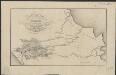
Figurative kaart van een gedeelte van Sumatra voornamelijk aantoonende de wegen en rivieren, welke uit de Padangsche binnenlanden naar de oostkust afloopen
1 : 1360000 opgenomen door S. Muller en H. Hellbach steendr. van H.J. Backer Amsterdam : Beyerinck
Het Minangkabausche land (Alam Minangkabau)
[S.l. : s.n.]
Etappekaart Sumatra's W[es]t Kust

9. Gouvernement Sumatra's Westkust, uit: Atlas van Nederlandsch Oost-Indië / samengest. door Topographisch Bureau te Batavia van 1897-1904
Annotatie: Omgewerkte versie van: Atlas der Nederlandsche bezittingen in Oost-Indië / naar de nieuste bronnen samengest. door J.W. Stemfoort en J.J. ten Siethoff. - 's-Gravenhage : Topographische Inrichting, [ca. 1885] Topographisch Bureau, Batavia 's-Gravenhage : Topographische Inrichting
Gouvernement Sumatra's Westkust / Topographische Inrichting
Topographische Inrichting [Batavia] : Topographische Inrichting
Kaart van een gedeelte van Sumatra's Oostkust
Aardrijkskundig Genootschap Amsterdam Amsterdam : C.L. Brinkman
Bladwijzer der Topographische Kaart van de Padangsche Beneden- en Bovenlanden
Topographisch Bureau Batavia Batavia : Topographisch Bureau
Schetskaart van het stroomgebied der Indragiri-rivier en aangrenzende landstreken / Topographische Inrichting
Topographische Inrichting Batavia Batavia : Topographische Inrichting
Kaart tot afstandswijzer van het Gouvernement Sumatra's Westkust / Topographische Inrichting
Topographische Inrichting Batavia Batavia : Topographische Inrichting
Schetskaart van het Soetanaat Indragiri / [bewerkt door het Encyclopaedisch Bureau]
Encyclopaedisch Bureau Batavia ['s-Gravenhage : N.V. Electrische Drukkerij 'Luctor et Emergo'
Routekaart Medan - Pakanbaroe
[S.l. : s.n.
Routekaart Pakanbaroe - Batavia
[S.l. : s.n.
North Sumatra : Tactical Pilotage Chart
[London] : Ministry of Defence United Kingdom


