Maps of Kongsvinger

Spesielle kart 103-11: Flötningskart over Glommens vassdrag
1 : 1000 Einar Sigurd Ween
Spesielle kart 20-2: Lillestrøm-Kongsvinger-Charlottenberg
1 : 400000 Albert Cammermeyer Forlag
Kartblad 45: Wej-Cart over det Wingerske lette Infanterie Compagnies District

Kartblad 46: Wej-Cart over det Soleurske Compagnies District
Leegaard
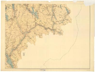
20B Kongsvinger
1 : 100000 H. Hagen | Torgrim Lundtvedt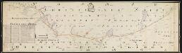
NRA GA 3
Thodal | Friedenreich | Hejde | Marelius | Holm | Ratkind
Trigonometrisk grunnlag, vedlegg 56
1 : 50000
Trigonometrisk grunnlag, vedlegg 17: Fundament Mensul for Quadrat-Milen No 91
1 : 20000 Hans Nicolai Archtander | Niels Andreas Wibe
Portefølje nr 33
1 : 100000
Portefølje nr 33
1 : 100000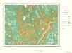
Geologisk kart 10 Nannestad
1 : 100000
Kartblad 44: Vej-Cart over det Oudahlske lette Infanterie Compagnies District

Geologisk kart 39: Den Geologiske Undersøgelse, Nannestad
1 : 100000 Norges geologiske undersøkelse
20A Nannestad
1 : 100000 Johan Ferdinand Nordmann | Ole Engh
20A Nannestad
1 : 100000 Johan Ferdinand Normann | Carl Christian Olberg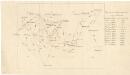
Trigonometrisk grunnlag, vedlegg 59
1 : 50000
20B Kongsvinger
1 : 100000
20B Kongsvinger
1 : 100000
20B Kongsvinger
1 : 100000
Kartblad 43: Wej-Cart over det Næsiske lette Infanterie Compagnies District

Trigonometrisk grunnlag, vedlegg 22: Kvadratmilien No 97, kvadratmilen No 58
1 : 10000
Spesielle kart 104-1: Kart over Fredrikshaldsvassdraget med Mangenvassdraget
1 : 50000 Finn Qvale
2115-3 Austmarka
1 : 50000 Norges Geografiske Oppmåling
2015-3 Ström
1 : 50000 Statens kartverk
2015-2 Kongsvinger
1 : 50000 Statens kartverk
Trigonometrisk grunnlag, vedlegg 15: Fundament Mensul for Sammenbindelsen af de gamle Operationer
1 : 50000 Hans Lemich Juell | Johan Henrik Ramm
2015-3 Strøm
1 : 50000
2115-3 Austmarka
1 : 50000 Norges Geografiske Oppmåling
2015-2 Kongsvinger
1 : 50000 Norges Geografiske Oppmåling