Maps of Meråker

47D 11
1 : 50000 Thorvald Johan Randin Johannesen
1722-2 Feren
1 : 50000 Statens kartverk
1722-2 Feren
1 : 50000 Statens kartverk
1722-2 Færen
1 : 50000 Norges Geografiske Oppmåling
1722-2 Feren
1 : 50000 Norges Geografiske Oppmåling
1722-2 Feren
1 : 50000 Statens kartverk
1822-3 Bellingen
1 : 50000 Statens kartverk
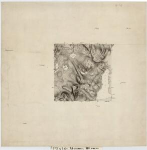
Trigonometrisk grunnlag, vedlegg 9: Fundament Mensul for Quadrat Miilene No 4 og 5
1 : 20000 Ditlef Wibe | Niels Andreas Wibe
1822-3 Bellingen
1 : 50000 Norges Geografiske Oppmåling
Mil nr 457
1 : 10000
Mil nr 458
1 : 10000
50B-4-vest
1 : 10000 Ditlev Wibe
50B-3-øst
1 : 10000 Ditlev Wibe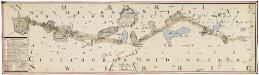
NRA GA 10
Ratkind | Thodal | Hiarne | Krogh | Marelius | Holm
47D Meraker
1 : 100000 Torgrim Lundtvedt | Johan Nordhagen
47D Meraker
1 : 100000 Torgrim Lundtvedt | Johan Nordhagen
47D Meraaker
1 : 100000
50B 3; 50B 4
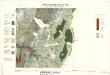
1 : 50000 Thorvald Johan Randin Johannesen
47D Meraaker
1 : 100000 C. Pedersen | Torgrim Lundtvedt
47D Meraaker
1 : 100000 Torgrim Lundtvedt | C. Pedersen
47D Meraaker
1 : 100000
47D Meraaker
1 : 100000 C. Pedersen | Torgrim Lundtvedt
47D 3; 47D 7
1 : 50000 Hans Gjestvang
1822-3 Billingen
1 : 50000 Norges Geografiske Oppmåling
1822-3 Bellingen
1 : 50000 Statens kartverk
47D 9; 47D 10
1 : 50000 Wilhelm Sørensen
1822-3 Storbellingen
1 : 50000 Statens kartverk
47D Meraaker
1 : 100000 C. Pedersen | Torgrim Lundtvedt
Kartblad 79: Carta ower Werdahlske Hr. Capitaine Boyes Compagnies District
Klüwer | Nicolaus Meyer