Maps of Stryn

35B 1; 35B 5
1 : 50000 Christian Due
1318-4 Hornindal
1 : 50000 Statens kartverk
1318-1 Stryn
1 : 50000 Statens kartverk
1318-4 Hornindal
1 : 50000 Norges Geografiske Oppmåling
1318-4 Hornindal
1 : 50000 Statens kartverk
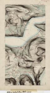
LE NÉVÉ DE JUSTEDAL ET SES ALENTOURS
M. Lyng's lith. Anst. Christiania
29D 1; 29D 5; 29D 6; 29D 9; 29D 10; 29D 11
1 : 100000 Karsten Lorange
35A 3; 35A 4; 35A 7; 35A 8
1 : 50000 E. Lund
1318-3 Breim
1 : 50000 Statens kartverk
1318-3 Breim
1 : 50000 Statens kartverk
35B 2; 35B 6; 35B 7
1 : 50000 Christian Due
1318-1 Stryn
1 : 50000 Norges Geografiske Oppmåling
1318-1 Stryn
1 : 50000 Statens kartverk
1318-1 Stryn
1 : 50000 Norges Geografiske Oppmåling
1318-1 Stryn
1 : 50000 Statens kartverk
1318-3 Breim
1 : 50000 Norges Geografiske Oppmåling
35A 12; 35B 9; 35C 4
1 : 50000 Frithjof Jacobsen
1318-2 Briksdalsbreen
1 : 50000 Statens kartverk
1318-3 Byrkjelo
1 : 50000 Statens kartverk
1318-2 Briksdalsbreen
1 : 50000 Statens kartverk
1318-2 Briksdalsbreen
1 : 50000 Norges Geografiske Oppmåling
29C 12
1 : 50000 Henrik Lund
1318-2 Briksdalsbreen
1 : 50000 Statens kartverk
35B 10
1 : 50000 Frithjof Jacobsen
Jostedalsbræen med tilgrænsende strøk

Trigonometrisk grunnlag, vedlegg 68-8
1 : 250000
Årdal
1 : 250000 Army map service
Kartblad 122: Situasion af de Bergenhuusske Regimenters Grændser udi Indre Sogn saaledes som samme vilde blive efter den af det Første Bergenhuusiske Regiment udkastede Plan

Spesielle kart: Tyngdeanomalikart, Ã...rdal
1 : 250000 NGO