Maps of Røyken

14D 3 nv
1 : 20000 Due
14D 3
1 : 20000 Due | Bull
14D 2 sø; 14D 3 nv og sv
1 : 25000 Ødegaard
14D 8
1 : 25000 Thorolf Ingar Ween
14D 2 nord; 14D 6 sør
1 : 25000 Johannes Solem
14D 7 sv
1 : 25000 Johannes Solem
Mil nr 53
1 : 10000 Johan Henrich Ramm | Hans Lemmich Juell
14B 11; 14D 3
1 : 50000
1814-1 Asker
1 : 50000 Statens kartverk
1814-1 Asker
1 : 50000 Statens kartverk
Kartblad 29: Militært Cart over det Askerske Compagnie District
M. Grønvold
Kartblad 26- Det Huurumske Compagnie District; versjon 1

Kartblad 26-2: Det Huurumske Compagnie District; versjon 2

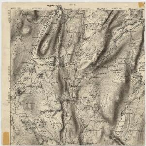
Geologisk kart 1 Den geologiske undersøgelse, Rektangel 14D Kristiania
1 : 100000 Kjerulf Norges geologiske undersøkelse
14D Oslo
1 : 100000 Johan Gulbrandsen Natrud | Ole Engh
14D Oslo
1 : 100000 E. Heiberg | H. N. Bergh
14D Oslo
1 : 100000 Johan Gulbrandsen Natrud | Ole Engh
14D Oslo
1 : 100000 Johan Gulbrandsen Natrud | Ole Engh
14D Oslo
1 : 100000 Johan Gulbrandsen Natrud | Ole Engh
14D Oslo
1 : 100000 Johan Gulbrandsen Natrud | Ole Engh
Kartblad 25: Cartt over det Lierske Infanterie Compagnies District
Christian Heubsch
Geologiske kart 50: Geologisk kart over Christiania omegn
1 : 100000 Theodor Kjerulf
Kartblad 23: Kart over det Aggerske Compagnie District
Fridrich Helle Grønvold
Geologiske kart 58: Den geologiske Undersøgelse, Kristiania
1 : 100000 J. Natrud | J. Schetelig | W. C. Brøgger Norges geologiske undersøkelse
Geologisk kart 59: Den geologiske Undersøgelse, Kristianiafeltet-Fet
1 : 100000 W. C. Brøgger | J. Schetelig Norges geologiske undersøkelse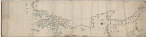
Norge 69: Kristianiafjordens vestre Kyst fra Tønsberg til Drammen
1 : 50000
Portefølje nr 23
1 : 100000
Trigonometrisk grunnlag, vedlegg 60
1 : 50000
Trigonometrisk grunnlag, dublett 60: Kart over trigonometriske punkter foretatt i 1795