Maps of Gjøvik

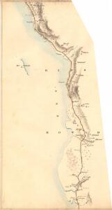
Fra Moelv til Øgarden
1 : 20000 J. H. Reichborn
25D 4
1 : 50000 Hans Christian Smith Due
25D 4
1 : 50000 Hans Christian Smith Due
25D 4
1 : 20000 Jørgen Scielderup Grimseth
Kartblad 4: Kart over Veien fra Eidsvold til Gausdal og til Skydsstationen Holmen i Øyer
J. H. Reichborn
Fra Honne til Fegring
J. H. Reichborn
Fra Øgarden til Unset
J. H. Reichborn
Kartblad nr 2: Kaart over Postveien fra Korsødegaarden til Trondhjem igjennom Gulbrandsdalen over Dovrefjeld
1 : 20000 J. H. Reichborn
25D 3; 25D 4; 25D 7; 25D 8
1 : 50000 Schilling
25D Lillehammer
1 : 100000
1816-1 Gjövik
1 : 50000 Norges Geografiske Oppmåling
1816-1 Gjøvik
1 : 50000 Statens kartverk
25D Lillehammer
1 : 100000
25D Lillehammer
1 : 100000 Johan Ferdinand Normann | Ole Engh
25D Lillehammer
1 : 100000 Johan Ferdinand Normann
Trigonometrisk grunnlag, vedlegg 51
1 : 50000
25D Lillehammer
1 : 100000 Einar Sigurd Ween | Johan Ferdinand Normann
25D Lillehammer
1 : 100000 Johan Ferdinand Normann
1816-1 Gjövik
1 : 50000 Norges Geografiske Oppmåling
Kartblad 5 Vey-Cart over det Nordre Hedemarkiske Capt. Von Weyhes Compagnie District
Johan Henrik Ramm
Kartblad 50: Militairisk Wej-Cart over det Westre Hedemarkske Compagnie District
De Place
1816-1 Gjövik
1 : 50000 Norges Geografiske Oppmåling
1816-1 Gjøvik
1 : 50000 Statens kartverk
1816-1 Gjøvik
1 : 50000 Statens kartverk
1816-1 Gjøvik
1 : 50000 Statens kartverk
1816-1 Gjøvik
1 : 50000 Statens kartverk
1817-2 Lillehammer
1 : 50000 Norges Geografiske Oppmåling
1817-2 Lillehammer
1 : 50000 Statens kartverk
1817-2 Lillehammer
1 : 50000 Statens kartverk