Maps of Namsos

1723-4 Namsos
1 : 50000 Norges Geografiske Oppmåling
1723-4 Namsos
1 : 50000 Statens kartverk
1723-4 Namsos
1 : 50000 Statens kartverk
1723-4 Namsos
1 : 50000 Norges Geografiske Oppmåling
1723-4 Namsos
1 : 50000 Statens kartverk
53A 7; 53A 8
1 : 50000 Gustav Heramd
53A 3; 53A 4
1 : 50000 Abraham Ludvig Amundsen
Kartblad 88: Vejkart over Bedstadens Compagnie District
Christian Klein dy
53A Namsos
1 : 100000 Torgrim Lundtvedt | Nicolai Franck
53A Namsos
1 : 100000
53A Namsos
1 : 100000 Torgrim Lundtvedt | Nicolai Franck
53A Namsos
1 : 100000 Torgrim Lundtvedt | C. Pedersen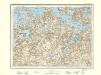
53A Namsos
1 : 100000 C. Pedersen | Torgrim Lundtvedt
50C 11; 50C 12
1 : 50000 Abraham Ludvig Amundsen
53B 1; 53B 2
1 : 50000 Jens Kristian Meinich Bratli | Lang
53A 12
1 : 50000 Thorvald Johan Randin Johannessen
53B 5; 53B 6; 53B 9; 53B 10
1 : 50000 Thomas Hans Knoff
1723-3 Steinkjer
1 : 50000 Statens kartverk
1723-3 Steinkjer
1 : 50000 Statens kartverk
1723-3 Steinkjer
1 : 50000 Statens kartverk
50D 9; 50D 10
1 : 50000 Abraham Ludvig Amundsen
1723-3 Steinkjer
1 : 50000 Norges Geografiske Oppmåling
1723-3 Steinkjer
1 : 50000 Norges Geografiske Oppmåling
Kartblad 87: Det Bedstadske Compagnie Districhte
Andreas Christen Bull
Namsos
1 : 250000
Namsos
1 : 250000
Kartblad 90- Cituations Carte over det Overhaldske Præstegield og Major F. H. Sommerschields Compagnie; versjon 1
Henrich Christopher Sommerschield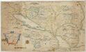
Kartblad 168: Carta over Schieløber-Compagniet og Eendeel af det Første Tronhiemsche Regiement
Christian Wilhelm Klüwer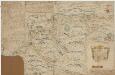
Kartblad 170: Carta over det Snee-Aasensche Hr. Major Klüwer andfortroede Compagnie
Christian Wilhelm Klüwer | Lorentz Diderich Klüwer (d.e.)


