Maps of Bamble

F37
1 : 20000 Axel P. Printz
Museumskart 30: Kaart over Langesunds fjord fra Mundingen og op til Troswig
1 : 20000 Poul de Løvenørn
9A 11
1 : 50000 Thorvald Johan Randin Johannessen
9A 11
1 : 100000 Ramm
Brevik og Stathelle
1 : 50000 Søren Christian Gjessing
Frierfiord
1 : 10000 C. C. Lund
9A11 14b
1 : 3600 Rørdam
9A11 19
1 : 3600 Rørdam
9A11 14a
1 : 3600 Rørdam
9A11 15
1 : 3600 Rørdam
9A11 20
1 : 3600 Rørdam
1713-2 Porsgrunn
1 : 50000 Norges Geografiske Oppmåling
9A 6 (halv) 9A 7 9A 10 9A 11
1 : 50000 C. C. Lund
F37-2, F37-3
1 : 25000 Axel P. Printz
9A 10
1 : 50000 Vilhelm Christian Marius à ̃degaard
Museumskart 39: Situations Kaart over Fiordene fra Langesund til Scheen
1 : 50000
1713-2 Porsgrunn
1 : 50000 Statens kartverk
1713-2 Skien
1 : 50000 Norges Geografiske Oppmåling
1713-2 Porsgrunn
1 : 50000 Statens kartverk
1713-2 Porsgrunn
1 : 50000 Statens kartverk
1713-2 Porsgrunn
1 : 50000 Statens kartverk
Een gedeelte van de kust van Noorweegen tussen t Gat van Longen en de Laerwijkse Swijnen vertoonende Westkil, Langesond en Laarwijk int grood
Norway Gerard van Keulen
Kartblad 148: Wey-Cart over det Bambleske Herr Capitain von Pohlmans anfortroede Compagnie
H. L. Wamberg
Museumskart 16: Kysten utenfor Vestfold og Telemark, sà ̧rlige del
1 : 35000 Jens SÃ ̧rensen
9C Skien
1 : 100000
Museumskart 217-58: Specialkart over Kristianiafjorden fra Tønsberg Tønde til Jomfruland
1 : 50000 A. Dellinger Den Geografiske Opmaaling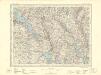
9C Skien
1 : 100000
Trigonometrisk grunnlag, Squelet-Cart 34: En Deel af Laurvigs Grevskab trigonometrisk bestemte Punkter
H. Gløersen | J. J. Broch
9A Kragerø
1 : 100000 Torgrim Lundtvedt | Einar Sigurd Ween


