Maps of Samnanger

B33-3; B33-4
1 : 50000 Thorolf Ingar Ween
B33-3-n/2; B33-9-s/2; B33-4-n/2; B33-10-s/2
1 : 50000 Gunvald Hagene | Andreas Theodor Walle
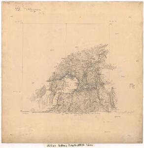
1215-4 Samnanger
1 : 50000 Statens kartverk
B33-2; B33-3
1 : 50000 Andreas Theodor Walle
16D 12; 17C 9; 23A 1
1 : 50000 J. N. Hertzberg | O. Petersen
1215-4 Bruvik
1 : 50000 Norges Geografiske Oppmåling
1215-4 Samnanger
1 : 50000 Statens kartverk
1215-4 Samnanger
1 : 50000 Statens kartverk
1215-4 Samnanger
1 : 50000 Statens kartverk
1215-4 Bruvik
1 : 50000 Norges Geografiske Oppmåling
B34-9; B34-10
1 : 50000 Einar Faller | Hjalmar Skaar | Oscar Thue
16D 4; 16D 7; 16D 8; 16D 11; 16D 12
1 : 50000 Hedvard Carl Scharffenberg
16D 4; 16D 7; 16D 8
1 : 100000 Lund
B34-11
1 : 50000 Oscar Thue
B33-2; B33-3; B33-8; B33-9
1 : 50000 Toralf Øyen
22B 4; 22B 8
1 : 50000 Henriksen
B33-2-n/2
1 : 25000 Kaare Kvisgaard | Andreas Theodor Walle
B34-9
1 : 50000 Toralf Øyen | Trygve Lindseth Værnø
B34-8; B34-9
1 : 50000 Einar Faller
B34-11
1 : 50000 Hjalmar Skaar
B33-2
1 : 25000 Thorleif Barlag
B34-8-n/2
1 : 25000 Thorleif Barlag | Toralf Øyen | August Emil Dessen Tobiesen
Kartblad 129: Situations Cart over det Nordre Sündhordlehnske Compagnie District
Severin Wincentz Segelcke
16D Bergen
1 : 100000 H. C. Wanggård | H. Bergh | E. Heiberg
16D Bergen
1 : 100000 H. Bergh | E. Heiberg | Einar Sigurd Ween
16D Bergen
1 : 100000 Einar Sigurd Ween | H. Bergh | E. Heiberg
16D Bergen
1 : 100000 H. C. Wanggård | E. Heiberg | H. Bergh
Museumskart 217-4 Specialkart over Hardangerfjorden. Vestre del.
1 : 100000 M. T. Kingo | H. N. Bergh | R. M. Petersen Den Geografiske Opmaaling
B33 vest Bergen
1 : 100000