Maps of Maritime Alps

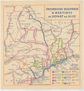
Excursions routières & maritimes au Départ de Nice
Nice Centre d'Excursions
Carte générale du département des Alpes Maritimes
1 : 125000 Alpy francouzské (pohoří) Gavini, M. Conte-Grandchamps, M. E. Andriveau-Goujon
Le Theatre de Bellone :
Mollova mapová sbírka Schenk, Pieter Braakman, Adriaan
Environs de Barcelonette et de Beuil = Environs de Coni, Tende et Albenga
1 : 120000 Mollova mapová sbírka Dheulland, Guillaume Dheulland, Guillaume
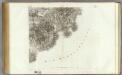
Carte routiere, vélocipédique, kilometrique des Alpes-Maritimes
1 : 100000 Rochemonteix, Adolphe de Erhard Freres
Parte del Piemonte
1 : 230000 Mollova mapová sbírka
Castello di Savorgio
Mollova mapová sbírka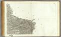
168 Vence.
1 : 86400 Cassini family; Cassini, Cesar-Francois, 1714-1784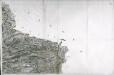
[Vence]
1 Blatt : 56 x 89 cm Aldring s.n.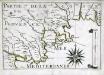
Partie de la coste de Provence
1 Karte : 22 x 33 cm de Fer
Carte de la France... Feuille XXVII - 32
169 Antibes.
1 : 86400 Cassini family; Cassini, Cesar-Francois, 1714-1784
[Antibes]
1 Blatt : 56 x 63 cm s.n.
Carte de la France... Feuille XXVII - 33

Pianta di Villa franca con parte della riviera di Gjenova
Mollova mapová sbírka
Antibes
1 : 5600 Antibes (Francie) Allard, Carel C. Allard
Nice
Afteekening van de baije van Villa Franca en Sospes of S. Vesperis in de Middellandsche Zee, aen de kust van Provence
France Gerard van Keulen
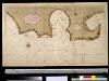
Description dv Cap de la Croix isles St. Margverite et St. Honorat
1 : 10600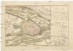
Plan von der Belagerung der Stadt und Festung Cuneo in Piemont welche durch die k.k. Truppen unter Comando sr. fürstlichen Durchlaucht Herrn F.M.L. Fürsten von Lichtenstein belagert worden, wo von 25.ten auf den 26.ten 9.ber Nachts die transcheé eröfnet und den 3.ten December [1]799 die Festung mit Capitulation übergangen
Cuneo (Itálie)
167 Larche.
1 : 86400 Cassini family; Cassini, Cesar-Francois, 1714-1784
[Larche]
1 Blatt : 56 x 29 cm s.n.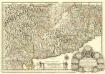
Carte du Piemont et du Monferrat
1 : 350000 Mollova mapová sbírka Placide de Sainte-Hélène
Estats du Duc de Savoye de delà des Alpes et vers l'Italie :
1 : 530000 Mollova mapová sbírka Sanson, Nicolas L'Huilier, Jan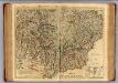
Piemont, Monferrat meridionale.
1 : 275000 L'Isle, Guillaume de, 1675-1726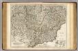
Piemont, Monferrat meridionale.
1 : 275000 L'Isle, Guillaume de, 1675-1726
Partie Meridionale du Piemont et du Monferrat
1 : 270000 Mollova mapová sbírka Delisle, Guillaume Desrosiers, F. L'Isle, Guillaume de
Bez titulu:Itálie