Maps of Zalaszentgróti járás

Sümeg
1 : 75000 Sümeg, Komitat Veszprém
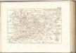
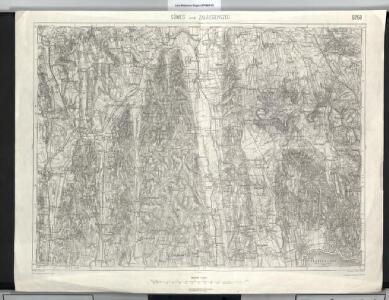
Sumeg und Zala-Egerszeg.
from Spezialkarte der osterreichisch-ungarischen Monarchie.
A szlovének arány és száma Vas megyében 1980-ban
Komitat Vas Slowenen, Siedlung Bottlik, Zsolt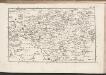
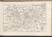
C. Szaladiensis. Tab. II
Ungarn Komitat Zala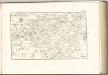

Steinamanger 161, uit: Special-Karte von Mittel-Europa / nach amtlichen Quellen bearbeitet von W. Liebenow
1 : 300000 titelvariant: W. Liebenow's Mittel-Europa; Annotatie: Titel boven de bladen: W. Liebenow's Mittel-Europa Johannes Wilhelm Liebenow 1822-1897 Frankfurt a. M. : Ludwig Ravenstein
Szalader com[it.] Schackmin Cvrassie Regiments
1 : 467000 Balaton-oblast (Maďarsko) Cir, V.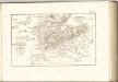
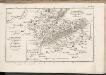
C. Szaladiensis. Tab. III
Ungarn Komitat Zala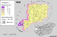
A szlovének arány és száma Vas megyében 1880-ban
Komitat Vas Slowenen, Siedlung Bottlik, Zsolt
Somogy vármegye térképe
1 : 400000 Kaposvár (Maďarsko) Kogutowicz, Manó Magyar Földrajzi Intézet
Vas vármegye
1 : 450000 Kenedics, József Görög, Demeter Görög
Comitatus Castri Ferrei
1 : 110000 Maďarsko Kenedics, Joseph Mansfeld, Johann Ernst
Comitat Somogy
1 : 300000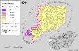
Slowenen im Komitat Vas 1941
Komitat Vas Slowenen, Siedlung Bottlik, Zsolt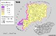
Slowenen im Komitat Vas 1880
Komitat Vas Slowenen, Siedlung Bottlik, Zsolt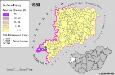
Slowenen im Komitat Vas 1980
Komitat Vas Slowenen, Siedlung Bottlik, Zsolt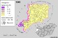
A szlovének arány és száma Vas megyében 1941-ben
Komitat Vas Slowenen, Siedlung Bottlik, Zsolt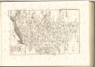

Übersichtskarte zu den Operationen vor u. nach der Schlacht bei Raab
C. Castriferrei
Ungarn Komitat Vas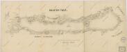
Balaton Tava

Veszprém vármegye térképe
1 : 400000 Veszprém (Maďarsko : oblast) Kogutowicz, Manó Magyar Földrajzi Intézet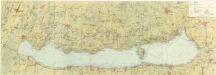
Balaton turistická mapa

Comitat Eisenburg
1 : 290000
Hegyes-Kis-Somlyo.
from Spezialkarte der osterreichisch-ungarischen Monarchie.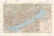
Balaton und Umgebung
1 : 200000 Balaton (Maďarsko : jezero : oblast) M. Kir. Állami Térképészet
Kis-Komarom und Zala-Szt.-Mihaly.
from Spezialkarte der osterreichisch-ungarischen Monarchie.
Nagyvazsony und Badacsonytomaj.
from Spezialkarte der osterreichisch-ungarischen Monarchie.